Browse Our Stories
Thu, Sep 18 2025
The Atlas for Regional Shoreline Adaptation Planning
The Regional Shoreline Adaptation Plan Atlas is a comprehensive resource for understanding and addressing the impacts of sea level rise along shorelines. Learn more about the San Francisco Bay Conservation and Development Commission's new tool to serve the best available science and information to a receptive community of municipal planners.

Mon, Aug 11 - Mon, Aug 25 2025
Help Us Name Our New Stormwater Sampling Machines!
The SFEI stormwater team has developed robot samplers to pump up sips of stormwater runoff during rainstorms so we can test for pollution. Now, it’s prime time to name the 15 new samplers that we’ll deploy in the field across the Bay Area this upcoming wet season.
Fri, Aug 8 2025
Helping California Track and Protect Its Wetlands
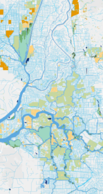
With millions spent on restoration projects across California, how are we able to consistently track the condition of wetlands—or the success of projects meant to protect them? Tools like SFEI’s EcoAtlas, Project Tracker, and CRAM are changing that. By bringing transparency, accountability, and science into the permitting process, these tools help ensure wetlands are not only restored, but truly recovered.
Tue, Aug 5 2025
New Bay PFAS Data Show Reasons for Optimism and Concern
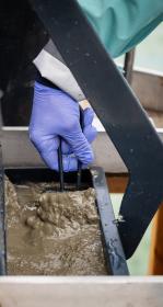
Monitoring for PFAS, or forever chemicals, has come a long way in the 16 years since the Regional Monitoring Program for Water Quality in San Francisco Bay (RMP) first tested water and sediment from the Bay for the toxic compounds. Forever chemicals are toxic and one of the most concerning under-regulated contaminants in San Francisco Bay.
Mon, Jun 30 2025
SFEI Scientist Interviewed on Microplastics for Maven's Notebook
Senior scientist Ezra Miller was interviewed in Maven's Notebook about SFEI's groundbreaking microplastics work. Miller discussed where microplastics in San Francisco Bay come from, the biggest unsolved questions our scientists are working on, and why focusing on sources is the best way to prevent microplastic pollution in the Bay.
Wed, Jun 25 2025
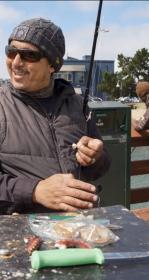
Fishing for "Forever Chemicals" In the Press: SFEI Study in Dozens of Media Outlets
Dozens of media outlets picked up our study that confirmed PFAS (“forever chemicals”) are widespread in ten species of popular fish to eat from San Francisco Bay, especially the South Bay.

Thu, Jun 5 2025
Broader Access to Lake County Tribal Water Quality Data
The Habematolel Pomo of Upper Lake (HPUL) and the Lake County Watershed Protection District (District) approached SFEI with a challenge: how can they submit their years of water quality data in a format compatible with the California Environmental Data Exchange Network (CEDEN)?

Thu, Jun 5 2025
Project Tracker Tidal Wetland Restoration Map
EcoAtlas Project Tracker is a statewide online data entry tool used across the Bay region to track information on wetland restoration, mitigation, and habitat conservation projects. It provides standardized information on the activities involved in restoring habitats. Project Tracker is the most complete database of California wetland restoration projects and a valuable tool for planners and managers.
Thu, Jun 5 2025
San Francisco Baylands Resilience Metrics Mapbook
SFEI’s Baylands and Shoreline Resilience team helps planners, regulatory agencies, community-based organizations, and other stakeholders make informed decisions about where and how to implement nature-based solutions for sea level rise adaptation. The 2019 Adaptation Atlas identified places that are suitable for various types of nature-based solutions, including tidal marshes, mudflats, eelgrass, beaches, and oyster reefs.

Tue, Jun 3 2025
Join SFEI’s Board of Directors
If you’re passionate about connecting data to impact, fostering collaboration, and shaping a resilient future for the region, we’d love to have you on board!

Tue, May 20 2025
"Forever Chemicals" Found In Fish Through Most of Bay
More than a decade of monitoring found that ten species of popular fish to eat from San Francisco Bay may contain dangerous levels of “forever chemicals”—but where they’re caught in the Bay can make a big difference.
Tue, May 6 2025
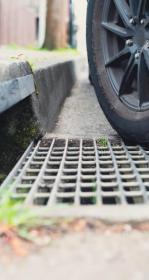
"Unique as Snowflakes": Understanding Tire Particles
Techniques to isolate and identify tire particles will pave the way for better microplastic pollution research and management.
Tue, Apr 22 - Sat, May 31 2025
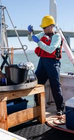
Want to work at SFEI as a Watershed Stewards Corps member?
For the last several years, SFEI has participated in a program that facilitates the training of entry-level professionals for environmental science fields. We encourage you to apply to this special program and contribute to ensure that California is a vibrant place for everyone! Applications to become a Fisheries & Restoration Specialist or Watershed Stewards Program Team Leader are due soon on June 30th.
Tue, Apr 1 2025
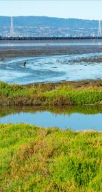
Tracking Tidal Wetland Extent in San Francisco Bay
The Wetlands Regional Monitoring Program updates acreage, highlighting restoration efforts. The WRMP delivers coordinated regional monitoring of the San Francisco Estuary’s wetlands to inform science-based decision-making for wetland restoration and adaptive management and increase the cost-effectiveness of permit-driven monitoring associated with wetland restoration projects. Learn how these new products advance our understanding of tidal wetland monitoring in the Estuary.
Tue, Mar 25 2025
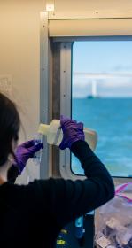
Sampling the Storm: Tracking PCBs in Bay Area Waterways
The Bay's industrial history is preserved in its mud. Buried in the soft, silty clay are legacy contaminants from factories, shipyards, and military activities. These chemicals stick around in the environment long after regulations to limit their production and use were imposed.
Sat, Mar 1 2025
Mapping our Wetlands: Explore the Latest CARI Updates
CARI is a statewide dataset that compiles the most comprehensive wetland mapping available in California. It serves as a valuable resource for coordinating landscape-scale monitoring and assessment across multiple agencies.
Sat, Mar 1 2025
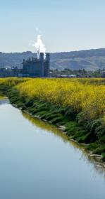
Over a Decade of Science Guiding Nutrient Management Strategy in the Bay
For over a decade, SFEI's Nutrient Management Strategy (NMS) team has equipped decision-makers with the tools to evaluate and respond with targeted interventions, shaping future nutrient management efforts in the Bay. Learn more about this scientific foundation for data-driven management strategies.

Wed, Feb 5 2025
The future of Suisun Marsh depends on understanding its past
SFEI recently completed the Suisun Landscapes project, a multi-million, multi-year effort funded by Delta Stewardship Council and the US Bureau of Reclamation.
Wed, Feb 5 2025
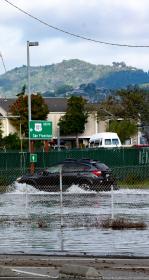
Great Strides for an Oakland Community: Green Stormwater Infrastructure
SFEI collaborated with community partners to generate components for a community plan for green stormwater infrastructure (GSI).

Wed, Feb 5 2025
SFEI is studying dryer emissions to find out if clothing dryers are a significant source of microplastic pollution in the San Francisco Bay. The study will measure the dryer emissions from single-family homes, laundromats, apartment buildings, and other shared laundry facilities.

Tue, Nov 19 2024 - Tue, Feb 25 2025
Out now: 2024 Pulse of the Bay
Contaminants of emerging concern (CECs) take center stage in the 2024 Pulse of the Bay, the signature publication of the Regional Monitoring Program for Water Quality in San Francisco Bay (RMP).
Tue, Nov 19 2024 - Wed, Feb 19 2025
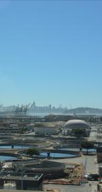
Nature-based solutions for wastewater treatment
High nutrient concentrations can cause increased phytoplankton biomass, low dissolved oxygen, and increased harmful algal blooms and toxins, with detrimental effects on species and ecosystems.

Tue, Nov 19 2024 - Wed, Feb 19 2025
Forever chemicals in household products contribute to Bay pollution
SFEI partnered with Bay Area Clean Water Agencies (BACWA) to implement a collaborative, cost-effective, and innovative investigation of PFAS in municipal wastewater in the San Francisco Bay region.
Mon, Nov 18 2024 - Sat, Jan 25 2025
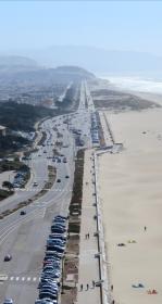
Changing Course on San Francisco’s Great Highway
A fixture of Western San Francisco, the Great Highway is home to a diverse ecosystem of sand dunes, native plants, and wildlife.
Mon, Nov 18 2024 - Fri, Dec 5 2025
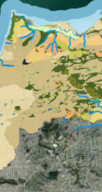
WRMP Webinar Series: Introducing the Baylands Habitat Map 2020!
The San Francisco Estuary Wetlands Regional Monitoring Program (WRMP) held a webinar on October 15, 2024 to introduce the recently released Baylands Habitat Map 2020.
Thu, Aug 22 2024
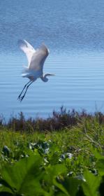
New Baylands Habitat Map Tracks Restoration Progress
The Baylands Habitat Map 2020 is the first complete map of San Francisco Bay wetland and aquatic habitats produced since 2009. It provides updated maps of tidal habitats and diked baylands, expanding our understanding of the full impact of recent habitat change and restoration.
Wed, Aug 7 2024
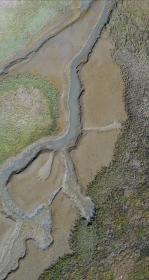
A Drone Upgrade and a New Pilot Propel SFEI’s Efforts
Join us in congratulating SFEI's Associate GIS Specialist, Kat Palermo, for successfully attaining her Part 107 Remote Pilot License from the FAA! She joins GIS Manager, Pete Kauhanen, as a second drone pilot at SFEI.

Wed, Aug 7 2024
Modeling outfall plumes with a web-based, open-source tool
The Software Engineering team has undertaken an effort to migrate an older Pascal codebase into a modern, opensource, web based platform.
Wed, Aug 7 2024
Wed, Aug 7 2024
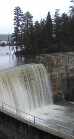
Klamath Dam Removal Video Goes Viral
Of the thirteen presentations at the Klamath Basin Monitoring Program (KBMP) meeting in May, a recording of one providing updates on Klamath Dam Removal went viral.