Browse Our Stories
Tue, Jul 7 2026
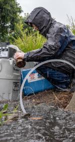
A new study shows that rain gardens substantially reduce levels of 21 contaminants in stormwater before that water ends up in San Francisco Bay.
Mon, Jun 29 2026
Mountain View’s New Plan for a Thriving Urban Ecosystem
Mountain View’s newly adopted Biodiversity and Urban Forest Plan pioneers an approach to managing the city’s trees, parks, facilities, and open spaces as one connected, functioning landscape.
Fri, Jun 26 2026
20 Years of Investigating Underregulated Chemicals
The Regional Monitoring Program for Water Quality in San Francisco Bay has grown into a world leader in studying under-regulated and poorly understood contaminants. The efforts have led to groundbreaking studies about forever chemicals, flame retardants, microplastics, pesticides, tire chemicals, and more—and inspired policy changes.
Fri, May 15 2026
New Data on Salmon-Killing Chemical In San Francisco Bay
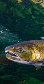
A new dataset on San Francisco Bay water includes some of the world's the first information about levels of the car tire chemical 6PPDQ in an estuary. Threatened steelhead trout may be susceptible to levels found in the Bay.
Wed, May 13 2026
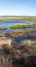
New Snapshot of Bay’s Tidal Wetland Recovery
As San Francisco Bay’s tidal marshes are being restored at an unprecedented rate, the need for a centralized, accurate and reliable way to track the restoration of tidal wetlands has never been more important.
Tue, May 5 2026
SFEI Seeks Our Next Executive Director
San Francisco Estuary Institute seeks a collaborative, strategic, and dynamic Executive Director. Serving as SFEI's visionary leader, public champion, and internal cornerstone, this individual will join the organization during a period of expanded federal investment and organizational growth. This is a rare opportunity to shape the next chapter of an impactful organization.
Thu, Apr 30 2026
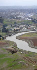
A New Course for Adobe Creek’s Baylands
One of Petaluma’s best natural defenses against flooding could be the Adobe Creek Baylands, a fragmented patchwork of tidal marshes, diked ponds, and channelized creeks. Because the natural processes that once sustained the landscape were disrupted, the area will need help persisting in the 21st century. A new SFEI report offers a science-based roadmap to help this 500-acre landscape keep pace with rising seas.
Tue, Apr 28 2026
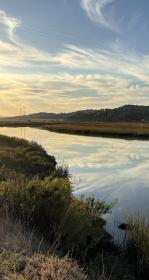
Explore Tidal Marsh Metrics with EcoAtlas WRMP Profile Tool
The SF Wetlands Regional Monitoring Program has upgraded the SF Estuary Wetlands Profile tool in EcoAtlas so scientists and managers can compare and share data about the Bay’s marshes.
Thu, Apr 9 2026
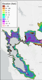
First High-Resolution Elevation Map for Whole Bay-Delta
A new mapping effort has produced the first high-resolution elevation data across the entire San Francisco Bay-Delta Estuary. The sub-ten-centimeter vertical accuracy makes the data key tool to planning for flood risk, sea level rise, and habitat restoration.

Mon, Mar 16 2026
Meet SFEI’s New Interim Executive Director Emily Corwin
As the Board of Directors begins the search for a permanent Executive Director, they have turned to a familiar and trusted leader to guide the helm: Emily Corwin. Emily steps into the role of Interim Executive Director with a deep understanding of the organization’s mission and a clear vision for its immediate future.
Fri, Mar 13 2026
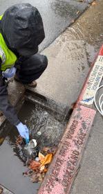
How Stormwater Studies Can Make the Bay Cleaner
As stormwater sampling across the San Francisco Bay Area reveals more poorly regulated chemicals, those who want clean water in the Bay face a tricky question: what can be done about it? The final part of a special feature series on stormwater monitoring.
Fri, Mar 6 2026
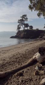
To Save the Bay, Save its Sediment
Sand and mud are the essential building blocks for the Bay's shoreline to keep pace with sea level rise. But San Francisco Bay is losing 1.7 million metric tons more of sand and mud per year than it's gaining—more than double the weight of the Golden Gate Bridge. Sand mining and other human extraction are major drivers of the Bay’s sand deficit.

Fri, Mar 6 2026
California Aquatic Resource Inventory v3.3 has been published!
This latest update integrates two of SFEI’s recent regional semi-automated mapping efforts into the CARI dataset. A major addition is the newly released Russian River Aquatic Resource Inventory (RRARI) v1.0, which spans the entire Russian River watershed and Sonoma County.
Fri, Feb 27 2026
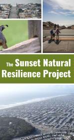
Nature-Based Approaches for a Resilient San Francisco
A new report details tangible lessons for urban greening gleaned from The Sunset Natural Resilience Project, which explores how to make San Francisco’s Sunset neighborhood greener and more resilient.

Tue, Feb 17 2026
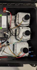
When rainstorms wash contaminants into the Bay, scientists can only sample stormwater in a few places at once. Three years of inventing and testing have led to a solution in the form of 15 briefcase-sized robots, with names like “Captain Capture” and “Missus Sippy,” to slurp up samples without human supervision onsite.

Mon, Feb 9 2026
Measuring Tobacco Product Waste Via a New Mobile App
Tobacco product waste—particularly cigarette butts, wrappers, filters, and electronic cigarette parts—are among the most common forms of environmental litter. SFEI developed and adapted methods for tobacco product waste monitoring as a mobile app for easy use with the California Department of Public Health.

Thu, Feb 5 2026
Why The Fate of Antimicrobial Chemicals Matters for San Francisco Bay
Antimicrobial chemicals called QACs have soared in popularity since the COVID-19 pandemic, and are a possible threat to Bay water quality. A new study finds that sewage treatment plants remove 98% of QACs on average from wastewater—but that's not necessarily a success for human and environmental health.
Thu, Jan 22 2026
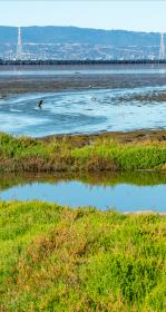
"Warner Chabot Shifts Gears": SFEI's executive director retires from his position after eleven years
KneeDeep Times, a local publication that features content related to climate change and sea level rise adaptation, shares news of Warner Chabot's departure from the San Francisco Estuary Institute.
Thu, Jan 15 2026
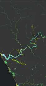
New Basemap of Surface Waters and Riparian Areas in the Russian River Watershed
In collaboration with regional partners, SFEI is developing a comprehensive standardized basemap to support the Russian River Regional Monitoring Program and regional needs. The Russian River Aquatic Resources Inventory uses automated, repeatable methods to deliver up‑to‑date mapping of wetland habitats.
Wed, Jan 14 2026
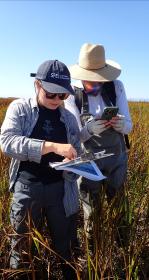
A Milestone! 10,000 Wetland Condition Assessments Publicly Shared on EcoAtlas
On November 11, 2025 we reached an exciting milestone: 10,000 wetland condition assessments are now publicly available on EcoAtlas. This statewide visualization and mapping tool expands public access to environmental information, supporting wetland protection, restoration planning, and project performance tracking.
Fri, Jan 9 2026
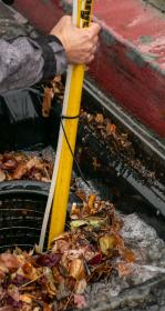
The Storm Chasers: What Stormwater Reveals About Pollution In San Francisco Bay
SFEI’s stormwater monitoring team has grown and is innovating techniques to further expand its influential studies. Part one of a special feature series on stormwater.
Mon, Jan 5 2026
With gratitude, SFEI wishes its Executive Director Warner Chabot a happy retirement
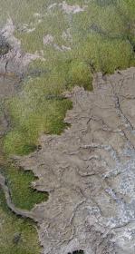
As we begin a new year, we want to recognize and express our sincere gratitude to Warner Chabot, who retired as SFEI’s Executive Director at the end of 2025 after more than eleven years of dedicated service.
Fri, Nov 14 2025
Winning Stormwater Robot Names Selected
Meet Captain Capture, Pre Sipitation, and our 13 other stormwater sampling robots we named with help from the public.

Wed, Nov 5 2025
400+ projects in Central Coast updated in EcoAtlas!
Olivia Beaudoin, UCSC created a workflow and updated over 400 restoration projects located along the Central Coast in EcoAtlas Project Tracker.
Challenges and Lessons Learned
Tue, Oct 28 - Wed, Oct 29 2025
Baylands Habitat Map wins Outstanding Environmental Project Award at State of the Estuary!
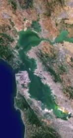
Baylands Habitat Map receives Outstanding Environmental Project Award from the Friends of the San Francisco Estuary at this year’s State of the Estuary Conference! Baylands Habitat Map receives Outstanding Environmental Project Award from the Friends of the San Francisco Estuary at this year’s State of the Estuary Conference!
Wed, Oct 15 2025
“More Science, and Better” for RMP with Historic Grant
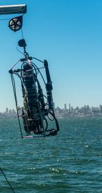
“For a lot of years we were very budget constrained, so we were making really small steps in our progress,” says Bridgette DeShields, the Chair of the RMP’s Technical Review Committee. “By having that extra funding it'll allow us to advance at a faster rate—we can make strides in our management actions and trying to meet our long-term goals.”
Wed, Oct 1 2025
WRMP Releases Multiple Tools for Region-wide Planning
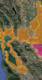
This summer marks a major milestone in regional data collection as the Wetlands Regional Monitoring Program and several key agencies launch the first Estuary-wide low tide LiDAR (Light Detection and Ranging) elevation collection. The data will enhance our understanding of our wetlands, shorelines, and restoration progress.
Wed, Oct 1 2025
EcoAtlas Essentials Webinar Showcases Practical Tools for Ecological Planning
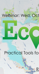
On October 1, 2025, the San Francisco Estuary Geospatial Workgroup (SFEGWG) hosted EcoAtlas Essentials: Practical Tools for Effective Ecological Planning, a webinar designed to guide participants in exploring how EcoAtlas supports data-driven ecological planning across California.
Fri, Sep 26 2025
Explore Our Latest Historical Ecology StoryMap!
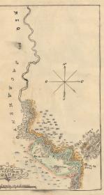
The Resilient Landscapes Program at SFEI recently completed the first phase of the Sacramento Valley Historical Ecology Study. The study hopes to inform a pathway for creating more functional floodplains in the Sacramento Valley.
Thu, Sep 18 2025
All Aboard for Water Quality Sampling
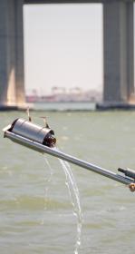
Hundreds of bottles of Bay water. Thousands of chemicals. Five dawn-to-dusk days all over San Francisco Bay. Every two years, the Regional Monitoring Program embarks on a mission to sample water from the surface of the Bay for water quality measurements and pollutants. Explore our 2025 efforts.