Browse Our Stories
Mon, Apr 18 2022
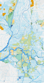
The Delta Aquatic Resource Inventory (DARI) is a map of surface waters, wetlands and other aquatic resources in the Sacramento-San Joaquin Delta. A similar mapping approach used to create the Bay Area Aquatic Resource Inventory (BAARI) was applied to complete a consistent map across the larger San Francisco Estuary. Both DARI and BAARI are integrated into the California Aquatic Resource Inventory (CARI), which serves as the basemap in EcoAtlas.

Mon, Apr 18 2022
The Wetland Regional Monitoring Program for SF Estuary enters significant new phase
The Wetlands Regional Monitoring Program or WRMP is a broad, multi-organizational effort designed to produce coordinated and rigorous science about the baylands in the San Francisco Bay area. Through the power of diverse partnerships, a broad network of stakeholders are working rapidly to protect and restore wetlands that can provide flood protection, tribal, community and recreational benefits, water quality improvement, wildlife habitat, and other benefits for surrounding communities. To meet a regional target of 100,000 acres restored by 2030, close coordination is needed between managers, scientists, community groups, tribal partners, and regulators. However, this project-by-project approach to restoration monitoring has left our state, regional, and local decision makers effectively insensitive to the overall regional conditions that might bear direct influence over restoration success and failure. As the effects of climate change and sea level rise generate their own set of challenges, the WRMP will improve the success of wetland restoration projects by putting in place regionally coordinated monitoring that will increase the impact, utility and application of monitoring to inform adaptive management.
Mon, Apr 18 2022
RMP Journal Article: Targeted Monitoring of Organophosphate Esters and Bisphenols
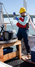
Organophosphate esters (OPEs) and bisphenols are two classes of mobile, endocrine-disrupting chemicals that are ubiquitously detected in environmental matrices due to high global production and use, particularly as plastic and polymer additives.
Mon, Apr 18 2022
Monitoring for COVID in wastewater informs local, regional, and state public health departments
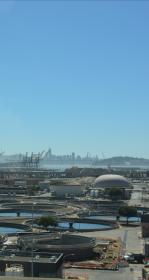
For 18 months, innovative data visualization of SARs-CoV-2 in wastewater samples informed local, regional, and state public health departments.

Tue, Mar 15 2022
Environmental Analyst - Field Monitoring
The San Francisco Estuary Institute (SFEI) seeks an environmental analyst to join an interdisciplinary team investigating nutrient biogeochemistry and ecosystem responses in San Francisco Bay.
Fri, Mar 11 2022
Geospatial Information Systems (GIS) Analyst
SFEI is seeking a GIS/Environmental Analyst to join the Geographic Information Systems (GIS) team.
Fri, Feb 4 2022
Forum on PFAS elevates the perspectives of local fishing communities
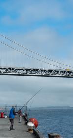
Known as “forever chemicals” due to their persistence in the environment, per- and polyfluoroalkyl substances (PFAS) are a broad class of fluorine-rich specialty chemicals. Thousands of different PFAS are registered for use in consumer, commercial and industrial applications.

Wed, Nov 3 2021
A Synthesis of Microplastic Sources and Pathways to Urban Runoff
What do clothes dryers and car tires have in common?

Mon, Nov 1 2021
Newly published research sheds light on the future of the California quail
The Journal of Applied Ecology has just published research by Kelly Iknayan of the San Francisco Estuary Institute (SFEI) and co-authors from the Presidio Trust and SFEI that will help to guide a joint study on the feasibility of bringing back the native California quail to San Francisco

Mon, Oct 11 2021
Erica Spotswood and a team of scientists published pioneering research in Nature Sustainability, finding that COVID-19 tracks neighborhood greenness in the US, exacerbating existing inequity.
Mon, Oct 11 - Fri, Dec 31 2021
10-year Reassessment of Streams in the Coyote Creek Watershed
SFEI and the Santa Clara Valley Water District just completed a report characterizing the amount, diversity, and distribution of aquatic resources in the Coyote Creek watershed, and the overall ecological conditions of streams in the watershed.
Fri, Oct 1 2021 - Sun, Oct 1 2023
Having an accurate basemap is critical for monitoring and assessing our valuable habitats and supporting their restoration and protection. To assist with developing these important resources, USEPA has funded two mapping projects to develop basemaps in the Delta and Baylands.

Fri, Oct 1 2021 - Thu, Jun 30 2022
The EcoAtlas Site Mitigation Tool (Mitigation Tool) can be used to prioritize, plan, and track aquatic habitat projects in the watershed context.
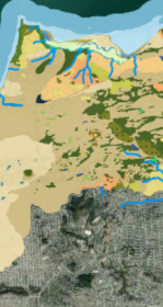
Tue, Sep 21 - Fri, Dec 31 2021
Big updates from Hidden Nature SF, including new interactive content!
Hidden Nature SF seeks to uncover the natural history of San Francisco’s past landscape.
Thu, Jul 29 2021
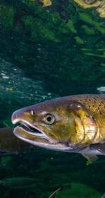
SFEI Experts Assist California’s Safer Consumer Products Program
Recent studies by the San Francisco Estuary Institute (SFEI) and the Regional Monitoring Program (RMP) have pinpointed chemical and microplastic contami
Tue, Apr 13 2021
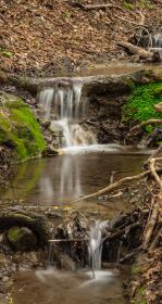
Sediment for Survival report released
SFEI worked with local, state, and federal science experts to develop the new Sediment for Survival report.

Fri, Apr 2 2021
Trees, Hydrology, Urban-Greening, and Nature-Based Solutions
Two key reports support nature-based solutions. Green stormwater infrastructure (GSI) and enhancements to the urban tree canopy offer benefits to stormwater management, urban ecological improvements, and complementary urban greening activities.
On KGO TV, these projects were featured on July 1, 2021.
Wed, Mar 24 2021
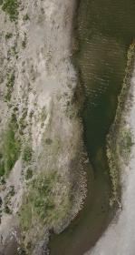
“Towards a Coarse Sediment Strategy for the Bay Area” completed!
The release of “Towards a Coarse Sediment Strategy for the Bay Area” represents a step forward towards beneficially reusing coarse flood control channel sediment by outlining reuse challenges, and identifying i
Mon, Mar 1 2021
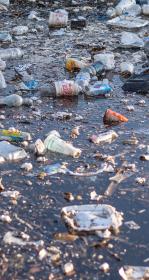
California Trash Monitoring Playbook now available
With the Ocean Protection Council-funded trash monitoring project concluded, the project team is eager to deliver its results to you.

Wed, Feb 24 2021
SFEI and our partners from the Exploratorium, the San Francisco Department of the Environment, and the Presidio Trust were joined live by over 400 participants for a conversation around the nature, both past and present, that is hidden in plain sight in San Francisco.

Wed, Feb 17 2021
New article published in BioScience: Cities contribute more than we think to regional biodiversity
Erica Spotswood and a team of scientists published a peer-reviewed scientific paper, just released in the journal BioScience. In this perspective piece, we identify ways cities may contribute to regional biodiversity conservation.

Tue, Jan 19 2021
Dr. Kelly Moran Joins SFEI Staff
SFEI is excited to announce that veteran RMP contributor Dr.
Tue, Dec 22 2020 - Sun, Apr 3 2022
Coordinated Mapping: How various efforts can work together
SFEI is coordinating the mapping for two inventories of surface waters, wetlands and other aquatic resources in the Sacramento-San Joaquin Delta and along California’s coast.
Fri, Dec 4 2020
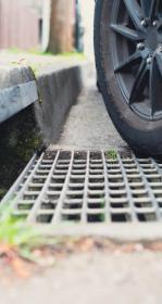
Toxic Tire Contaminant Found in Bay Area Stormwater
Scientists at the San Francisco Estuary Institute (SFEI) have found a highly toxic tire-related contaminant at levels lethal to coho salmon in stormwater flowing through four sites in the Bay Area. The contaminant, derived from a tire preservative, has been discovered by Washington state researchers to be responsible for high levels of coho salmon deaths in Puget Sound streams. These findings will inform a petition by state stormwater leaders to the Department of Toxic Substances Control to address pollution of California streams caused by tires.
Tue, Nov 10 2020 - Fri, Mar 5 2021
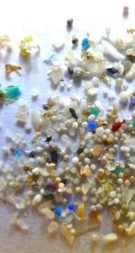
Big problem, small size: Improving methods in microplastics research
When it comes to plastic pollution, that candy wrapper half buried in the dirt is only the tip of the iceberg. Plastic bags, cigarette butts, and bottle caps are not just an eyesore, but over time they break down in the environment, creating small pieces of debris known as microplastics.

Mon, Aug 31 2020
Cities and Covid-19 Analysis Featured at The Nature of Cities
Mon, Jul 13 2020
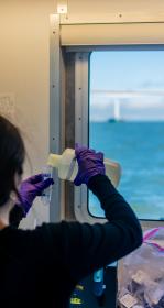
Bay RMP Non-Targeted Analysis Fact Sheet
In 2016, the RMP launched a novel investigation to detect new or unexpected contaminants in Bay waters, as well as treated sewage (or wastewater) discharged to the Bay.
Tue, Jul 7 2020
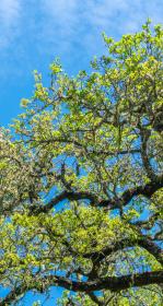
United Nations Global Urban Lecture Released on Making Nature's City
SFEI's Urban Nature Lab and the UN-Habitat Global Urban Lectures series have produced a video on SFEI's Making Nature's City report. The lecture demonstrates why urban conservation planning is an essential component of urban design...
Thu, May 7 2020
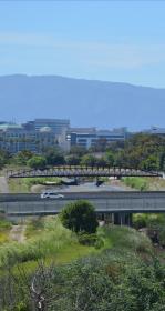
Assessing Five Watersheds in Santa Clara County
A new synthesis report characterizing the amount, distribution, and diversity of streams and wetlands within the County employing CARI, and an ambient survey of the overall ecological condition of streams employing CRAM.
Thu, May 7 2020
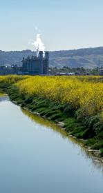
PFAS Stays in San Francisco Bay
SFEI senior scientist, Dr. Rebecca Sutton, published a new study in the journal Chemosphere showing that it will take almost 50 years for PFOA concentrations in water to stabilize in San Francisco Bay. This pales in comparison to the trajectory of PFOS concentrations that will not stabilize in sediment and fish for 500 years. PFOS and PFOA are harmful to humans, causing liver damage, endocrine disruption, fertility decrease, and cancer.