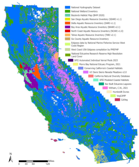
CARI is a statewide dataset that compiles the most comprehensive wetland mapping available in California.
It serves as a valuable resource for coordinating landscape-scale monitoring and assessment across multiple agencies.
Funded by Caltrans, the updated California Aquatic Resource Inventory (CARI) integrates data from the San Francisco Baylands Habitat Map 2020 and the San Diego Aquatic Resource Inventory. It serves as a valuable resource for coordinating landscape-scale monitoring and assessment across agencies and informing local land-use planning.
The update made capable use of automated mapping techniques and scripts, enabling the integration of data from various sources. A thorough QA/QC review was conducted to validate updates, compare changes between versions, and ensure consistent attribution. Future enhancements to the CARI dataset will focus on refining data integration scripts and incorporating improved wetland and stream mapping as new information becomes available.
CARI is accessible through multiple platforms. It can be visualized on EcoAtlas, accessed as a web service via the California Department of Fish and Wildlife’s (CDFW) BIOS web mapping application, and downloaded from SFEI’s Data Center.
For more information, visit CARI