Restoring sediment pathways to build a climate-resilient shoreline.
For decades, the Adobe Creek Baylands have existed as a fragmented patchwork of tidal marshes, diked ponds, and channelized creeks. While a beloved spot for local birdwatchers and hikers, the natural sediment delivery that once nourished this landscape has been disrupted. A new report by the San Francisco Estuary Institute, Restoring Sediment Pathways: A Resilient Landscape Vision for the Adobe Creek Baylands (the Vision), offers a science-based roadmap to help this 500-acre landscape keep pace with rising seas while enhancing habitat for endangered species, protecting Petaluma from floods, and ensuring community members and Federated Indians of Graton Rancheria can access the baylands for decades to come.
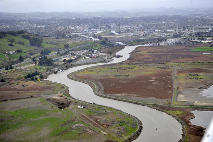
Restoring Creek-Bayland Connections for Resilience
The Adobe Creek Baylands, located along the Petaluma River, have undergone a radical transformation over the last two centuries. They shifted from a thriving tidal marsh complex to agricultural land and landfills before returning to public open space in the 1980s. Today, the area faces a sediment deficit: tidal marshes need sand and dirt to build elevation, yet the channelized creek carries this marsh-building material past the wetlands and out to the river. Without intervention, these valued ecosystems are at risk of drowning as sea level rise accelerates.
Supported by a grant from the US Environmental Protection Agency, the Vision establishes a framework for reintegrating natural processes to solve these modern challenges. By reconnecting Adobe Creek to Alman Marsh, the creek can deliver fine-grained sediment directly to the marsh plain during storms. Reconnecting Shollenberger Park to tidal flow will convert a vulnerable diked bayland to a resilient wetland that can build elevation by using sediment floating in the water column. This nature-based approach creates wildlife habitat as well as natural infrastructure that slows and absorbs floodwaters, protecting nearby businesses and infrastructure better than traditional barriers alone.
In the near term, the focus is on achievable improvements to Alman and Gray’s marshes over the next decade, such as creating side channels to improve sediment flow and constructing ecotone levees—gentle, vegetated slopes that provide high-tide refuge for wildlife and space for marshes to migrate inland. The long-term Vision extends restoration efforts to Shollenberger Park and prepares the site for sea level rise through the end of the century.
To Go Far, Go Together
The Vision was developed collaboratively with Sonoma Water, City of Petaluma, Friends of the Petaluma River, San Francisco Estuary Partnership, the Federated Indians of Graton Rancheria, and the many participants in the community meetings and vision workshop. The Vision incorporates many priorities and aims to deliver multiple benefits. Beyond preserving natural habitat and delivering flood protection benefits, the Vision also includes planting culturally significant species like willow and basket sedge for the Tribe to gather, and adds walking paths for people seeking fresh air and a chance to observe nature.
The Adobe Creek Vision is not a rigid construction plan, but a flexible framework designed to guide a billion-dollar shift toward nature-based resilience. It supports coordinated decision-making among the City of Petaluma, Sonoma Water, Federated Indians of Graton Rancheria, and community members as they work together to build a resilient landscape over the coming decades. As environmental conditions shift, this roadmap will help managers align funding and permitting to safeguard the Petaluma shoreline for generations to come.


SFEI thanks the U.S. Environmental Protection Agency Region IX for their generous support of the Sediment Solutions project, including the Adobe Creek Bayland Vision, from the San Francisco Bay Water Quality Improvement Fund.
Read Restoring Sediment Pathways: A Resilient Landscape Vision for the Adobe Creek Baylands.
Read about the Sediment Solutions project.