A key goal of the Wetlands Regional Monitoring Program (WRMP) is to disseminate data and monitoring results to inform science-based decision-making for wetland restoration and adaptive management. Through the SF Estuary Wetlands Profile (Profile) tool in EcoAtlas, managers and practitioners can compile essential data to protect aquatic resources, inform policy, and measure our regional success in meeting restoration goals.
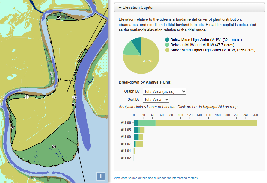
The Profile synthesizes critical tidal wetland metrics, including tidal wetland extent, restoration status, unvegetated to vegetated ratio, and wetland elevation relative to tidal range (elevation capital). These data are derived from the Baylands Habitat Map 2020, Project Tracker Tidal Wetland Restoration Map 2020, and Tracking Tidal Wetland Extent in San Francisco Bay: A 2020 mapping update. To ensure consistent and replicable tracking change over time, the WRMP categorizes data at multiple scales of analysis:
- WRMP Subembayments: The broadest scale, reflecting regional estuarine characteristics, such as salinity, sediment dynamics, and tidal influence.
- WRMP Operational Lands Units (OLUs): Areas expected to support a suite of ecosystem functions, along with the physical processes needed to sustain these functions.
- Wetland Management Units (WMUs): Practical groupings based on geomorphology or ownership that align with how managers assess on-the-ground actions.
- Analysis Units: The most granular scale, where hydrology defines marsh or diked bayland units for metric calculation.
Standardized metrics facilitate regional coordination and data-driven decision-making. Organizing results across multiple spatial scales highlights variations across the estuary, allowing managers to see beyond individual sites to broader regional insights. The flexibility of EcoAtlas allows the Profile tool to expand and evolve with the WRMP. Future updates will incorporate new metrics, such as patch size/connectivity and comparative change detection between the 2020 and 2025 Baylands Habitat Maps.