Frequently Asked Questions
What could an El Niño look like in the Sacramento-San Joaquin Delta and San Francisco Bay?
El Niño is already contributing to temporary elevated sea levels in San Francisco Bay. Higher than usual rainfall this winter and warmer water entering the Bay from the ocean are also likely effects in our region. However, nobody can predict exactly what El Niño will bring Northern California.
How are SFEI scientists preparing for potentially extreme conditions?
Data from extreme events, like heavy rains and higher sea level, are critical for anticipating future conditions in the Bay and understanding how it works today. SFEI is a core member of several collaboratives that monitor the long-term health of different parts of the San Francisco Estuary that strong El Niño conditions could impact (see following questions for details).
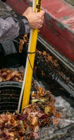
- The Regional Monitoring Program for Water Quality in San Francisco Bay (RMP) monitors stormwater runoff each winter around the Bay. Scientists measure various metals and chemicals as well as sediment (sand and silt) that stormwater carries from land to the Bay. SFEI will grow these stormwater efforts to its largest size ever this winter, with up to six teams of scientists deployed during storms, plus up to fourteen robot samplers. The RMP is also piloting new ways to collect sediment, and has set aside special funding if intense storms arrive for even more expanded monitoring.
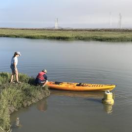
- The Nutrient Management Strategy (NMS)’s network of 16 water quality monitoring stations throughout the Bay can measure dissolved oxygen, temperature, salinity, and other factors. NMS scientists have modified some stations to better weather storms and higher water levels, and are considering additional data collection to better understand how El Niño impacts water quality in the Bay.
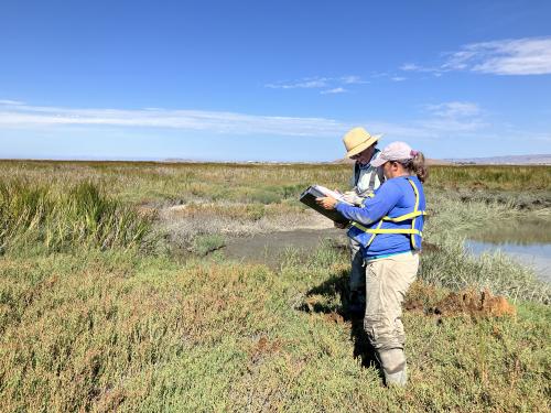
- Collaborators with the San Francisco Estuary Wetlands Regional Monitoring Program (WRMP, co-administered with the San Francisco Estuary Partnership) are assessing marsh vegetation, water levels and quality in marshes, fish abundance, and sediment deposition. Elevated water levels could give clues about whether the Bay’s wetlands will keep pace with future sea level rise.
We’re balancing collecting as much data as possible with keeping staff safe.
What could we learn about the Bay from El Niño conditions?
Understanding large events like those El Niño could bring will help SFEI scientists understand the Estuary’s ecosystems and how they may change in the future.
One area of strong interest is sediment (sand and silt) supply to the Bay. New sediment carried in by storms is a lifesource for marshes and other habitats in the Bay, but can also carry contaminants from the landscape. Understanding how much sediment moves in the Bay with El Niño conditions is important for habitat restoration, water quality, and the overall health of the Bay.
How could El Niño impact habitats around San Francisco Bay, like tidal marshes?
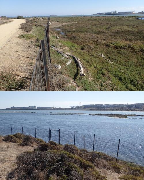
Most of the sediment that enters the Bay from the surrounding landscapes arrives during ultra-wet winters. This sediment is the foundation for the Bay’s marshes and beaches, but isn’t guaranteed to be distributed in ways that help build them up. Slightly higher water levels may encourage plant growth and sediment buildup, but when water levels increase too much, plant growth slows and wetlands can drown. Strong flows and waves in storms can also increase erosion.
How could El Niño affect Bay water quality?
The fresh sediment that storms bring into the Bay from the landscape can carry contaminants, like mercury from mining or PCBs from contaminated sites. Mercury and PCB levels in the Bay have stayed stubbornly high for decades of monitoring, so mixing in fresh, cleaner sediment is essential for the Bay’s long-term recovery. SFEI scientists will monitor sediment entering the Bay at several sites to test mercury and PCB levels.
Shifts in the health and populations of some species could have cascading impacts on algae levels in the Bay. Warmer water also carries lower dissolved oxygen, which aquatic life needs to breathe.
Is the Bay warmer than usual? Is that because of El Niño?
El Niño didn’t drive the marine heatwave off the coast that raised coastal temperatures earlier in 2026. However, it’s likely to bring more warmer-than-average water this fall through early 2027. The Bay has been noticeably warmer than average for much of the year so far.
How could El Niño impact ecosystems in San Francisco Bay?
Warmer coastal waters can bring some species further north than their usual range, including into the Bay. It could also reduce numbers of some species that usually live in the Bay.
Large amounts of fresh water entering the Bay from heavy rainfall could also change the typical balance of species, including ones near the bottom of the food chain, with cascading effects on the food web.
Learn More
El Niño 2026-2027: A Potentially Historic Global Climate Event
Understanding El Niño & ENSO
California-Current Ocean Assessment Status Takeaways
A ‘Super’ El Niño Is Here. What Does It Mean for the Bay Area?
An El Niño-Driven ‘Kelvin Wave’ Will Raise Bay Area Sea Levels and Flooding Risk
The Storm Chasers: What Stormwater Reveals About Pollution In San Francisco Bay
SFEI’s stormwater monitoring team has grown and is innovating techniques to further expand its influential studies. Part one of a special feature series on stormwater.