The Geospatial Compliance Monitoring System (GCMS) is an online tool designed for the US Fish and Wildlife Service (USFWS) to safeguard threatened and endangered species and their habitat. Developed with the San Francisco Estuary Institute (SFEI), GCMS helps the Carlsbad and Washington Offices of the USFWS to track conservation commitments made during environmental reviews, ensuring that vital promises to protect nature are kept.
GCMS currently monitors more than 250 active conservation, restoration, and development projects across Southern California. By keeping every project organized in one central hub, the system ensures that key steps—like restoring habitats or protecting sensitive species—stay on schedule and deliver real results for the environment.
Key Benefits at a Glance
|
Feature Area |
Technical Functionality |
Practical Benefit |
|
Complete Records |
Centralized data for over 250 projects |
Ensures complex wildlife protection plans are effectively tracked |
|
Visual Mapping |
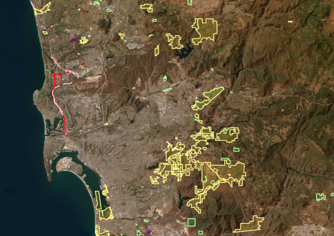
Color-coded maps of project boundaries |
Provides a clear picture of conservation lands and active work |
|
Timely Alerts |
Automated email notification digests |
Keeps environmental actions on schedule and avoids delays |
|
Consistency |
Standardized lists for species and habitats |
Improves data accuracy across regional conservation efforts |
How GCMS Makes a Difference
GCMS helps conservation teams safeguard wildlife and streamline everyday oversight through four key features:
- Detailed Project Profiles: Organizes essential project information—from local plant and animal species to responsible agencies—so agency staff and project managers can quickly find the details they need.
- Interactive Maps: Displays clear, visual maps showing where protected lands, restoration sites, and development projects are located across the landscape.
- Automatic Reminders: Sends friendly email alerts to biologists and project leads before environmental commitments are due, preventing missed deadlines.
- Team Collaboration: Connects staff biologists, external partners, and local organizations to specific projects for seamless teamwork and continuous oversight.
Upgrades and Future Growth
To support long-term success and expand its impact, the GCMS team recently completed several key improvements:
Modernizing the Platform
The platform received a major software update to boost security, performance, and user experience. This ensures the tool remains reliable for years to come.
Expanding to New Regions
While originally created for Southern California, GCMS has now been rolled out to the Washington Office.
As system updates wrap up, GCMS will continue expanding to empower biologists and partner agencies in protecting local wildlife and ecosystems.
The GCMS remains a system internal to the USFWS, not available to the general public. It bridges across the agency’s many personnel and continues to expand to new USFWS users.