Browse Our Stories
Thu, Apr 9 2026
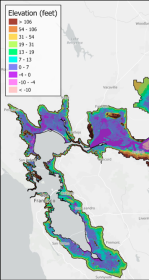
First High-Resolution Elevation Map for Whole Bay-Delta
A new mapping effort has produced the first high-resolution elevation data across the entire San Francisco Bay-Delta Estuary. The sub-ten-centimeter vertical accuracy makes the data key tool to planning for flood risk, sea level rise, and habitat restoration.

Fri, Mar 6 2026
California Aquatic Resource Inventory v3.3 has been published!
This latest update integrates two of SFEI’s recent regional semi-automated mapping efforts into the CARI dataset. A major addition is the newly released Russian River Aquatic Resource Inventory (RRARI) v1.0, which spans the entire Russian River watershed and Sonoma County.

Mon, Feb 9 2026
Measuring Tobacco Product Waste Via a New Mobile App
Tobacco product waste—particularly cigarette butts, wrappers, filters, and electronic cigarette parts—are among the most common forms of environmental litter. SFEI developed and adapted methods for tobacco product waste monitoring as a mobile app for easy use with the California Department of Public Health.
Thu, Jan 15 2026
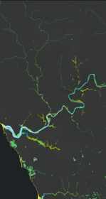
New Basemap of Surface Waters and Riparian Areas in the Russian River Watershed
In collaboration with regional partners, SFEI is developing a comprehensive standardized basemap to support the Russian River Regional Monitoring Program and regional needs. The Russian River Aquatic Resources Inventory uses automated, repeatable methods to deliver up‑to‑date mapping of wetland habitats.
Wed, Jan 14 2026
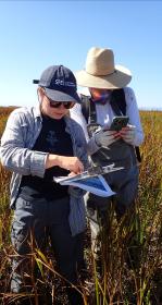
A Milestone! 10,000 Wetland Condition Assessments Publicly Shared on EcoAtlas
On November 11, 2025 we reached an exciting milestone: 10,000 wetland condition assessments are now publicly available on EcoAtlas. This statewide visualization and mapping tool expands public access to environmental information, supporting wetland protection, restoration planning, and project performance tracking.
Tue, Oct 28 - Wed, Oct 29 2025
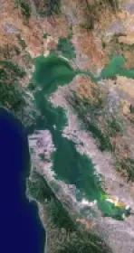
Baylands Habitat Map wins Outstanding Environmental Project Award at State of the Estuary!
Baylands Habitat Map receives Outstanding Environmental Project Award from the Friends of the San Francisco Estuary at this year’s State of the Estuary Conference! Baylands Habitat Map receives Outstanding Environmental Project Award from the Friends of the San Francisco Estuary at this year’s State of the Estuary Conference!
Wed, Oct 1 2025
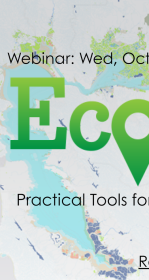
EcoAtlas Essentials Webinar Showcases Practical Tools for Ecological Planning
On October 1, 2025, the San Francisco Estuary Geospatial Workgroup (SFEGWG) hosted EcoAtlas Essentials: Practical Tools for Effective Ecological Planning, a webinar designed to guide participants in exploring how EcoAtlas supports data-driven ecological planning across California.
Fri, Aug 8 2025
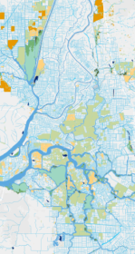
Helping California Track and Protect Its Wetlands
With millions spent on restoration projects across California, how are we able to consistently track the condition of wetlands—or the success of projects meant to protect them? Tools like SFEI’s EcoAtlas, Project Tracker, and CRAM are changing that. By bringing transparency, accountability, and science into the permitting process, these tools help ensure wetlands are not only restored, but truly recovered.

Thu, Jun 5 2025
Broader Access to Lake County Tribal Water Quality Data
The Habematolel Pomo of Upper Lake (HPUL) and the Lake County Watershed Protection District (District) approached SFEI with a challenge: how can they submit their years of water quality data in a format compatible with the California Environmental Data Exchange Network (CEDEN)?
Wed, Feb 5 2025
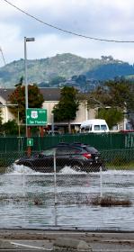
Great Strides for an Oakland Community: Green Stormwater Infrastructure
SFEI collaborated with community partners to generate components for a community plan for green stormwater infrastructure (GSI).
Mon, Nov 18 2024 - Fri, Dec 5 2025
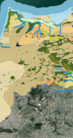
WRMP Webinar Series: Introducing the Baylands Habitat Map 2020!
The San Francisco Estuary Wetlands Regional Monitoring Program (WRMP) held a webinar on October 15, 2024 to introduce the recently released Baylands Habitat Map 2020.
Thu, Aug 22 2024
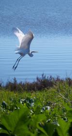
New Baylands Habitat Map Tracks Restoration Progress
The Baylands Habitat Map 2020 is the first complete map of San Francisco Bay wetland and aquatic habitats produced since 2009. It provides updated maps of tidal habitats and diked baylands, expanding our understanding of the full impact of recent habitat change and restoration.

Wed, Aug 7 2024
Modeling outfall plumes with a web-based, open-source tool
The Software Engineering team has undertaken an effort to migrate an older Pascal codebase into a modern, opensource, web based platform.
Tue, Oct 3 2023
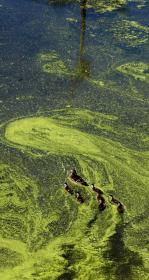
New $3 million grant to support harmful algae monitoring in the San Francisco Estuary
NOAA recently announced that it is awarding a $3-million grant, through its Monitoring and Event Response Research Program (MERHAB) to support the development of a harmful algal bloom (HAB) monitoring program for the San Francisco Estuary. The project, led by scientists at the San Francisco Estuary Institute (SFEI), US Geological Survey, and California Department of Water Resources (DWR), will leverage on-going research and monitoring activities in the Bay and Delta to build a robust system-wide HAB monitoring program for the Estuary.
Wed, Jan 18 2023
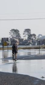
Groundwater Mapping Reveals New Vulnerabilities for the Bay Area
Featured in the Los Angeles Times, Mercury News, San Francisco Chronicle, San Francisco Examiner, KneeDeep Times, Marin Independent Journal, KQED, KALW, and ABC News, a new study sheds light on the hazards presented by rising groundwater. Pathways Climate Institute and SFEI have collaborated to produce maps that show where shallow groundwater, tied to sea-level rise, is an issue today and where it is likely to be a concern in the future as seas continue to rise.
Fri, May 13 2022
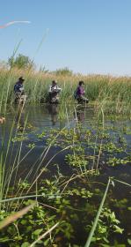
Introducing the Landscape Scenario Planning Tool Version 2.0
In partnership with the Delta Stewardship Council, the San Francisco Estuary Institute has developed version 2.0 of the Landscape Scenario Planning Tool, a GIS-based analysis toolkit to evaluate user-designed land use and restoration scenarios for the Sacramento-San Joaquin Delta and Suisun Marsh
Mon, Apr 18 2022
The Delta Aquatic Resource Inventory (DARI) is a map of surface waters, wetlands and other aquatic resources in the Sacramento-San Joaquin Delta. A similar mapping approach used to create the Bay Area Aquatic Resource Inventory (BAARI) was applied to complete a consistent map across the larger San Francisco Estuary. Both DARI and BAARI are integrated into the California Aquatic Resource Inventory (CARI), which serves as the basemap in EcoAtlas.

Mon, Apr 18 2022
The Wetland Regional Monitoring Program for SF Estuary enters significant new phase
The Wetlands Regional Monitoring Program or WRMP is a broad, multi-organizational effort designed to produce coordinated and rigorous science about the baylands in the San Francisco Bay area. Through the power of diverse partnerships, a broad network of stakeholders are working rapidly to protect and restore wetlands that can provide flood protection, tribal, community and recreational benefits, water quality improvement, wildlife habitat, and other benefits for surrounding communities. To meet a regional target of 100,000 acres restored by 2030, close coordination is needed between managers, scientists, community groups, tribal partners, and regulators. However, this project-by-project approach to restoration monitoring has left our state, regional, and local decision makers effectively insensitive to the overall regional conditions that might bear direct influence over restoration success and failure. As the effects of climate change and sea level rise generate their own set of challenges, the WRMP will improve the success of wetland restoration projects by putting in place regionally coordinated monitoring that will increase the impact, utility and application of monitoring to inform adaptive management.
Mon, Apr 18 2022
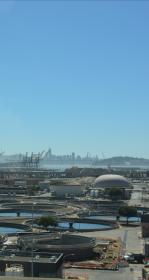
Monitoring for COVID in wastewater informs local, regional, and state public health departments
For 18 months, innovative data visualization of SARs-CoV-2 in wastewater samples informed local, regional, and state public health departments.
Fri, Oct 1 2021 - Sun, Oct 1 2023
Having an accurate basemap is critical for monitoring and assessing our valuable habitats and supporting their restoration and protection. To assist with developing these important resources, USEPA has funded two mapping projects to develop basemaps in the Delta and Baylands.
Fri, Oct 1 2021 - Thu, Jun 30 2022
The EcoAtlas Site Mitigation Tool (Mitigation Tool) can be used to prioritize, plan, and track aquatic habitat projects in the watershed context.
Mon, Mar 1 2021
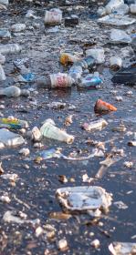
California Trash Monitoring Playbook now available
With the Ocean Protection Council-funded trash monitoring project concluded, the project team is eager to deliver its results to you.
Thu, May 7 2020
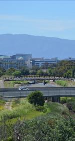
Assessing Five Watersheds in Santa Clara County
A new synthesis report characterizing the amount, distribution, and diversity of streams and wetlands within the County employing CARI, and an ambient survey of the overall ecological condition of streams employing CRAM.

Tue, Apr 7 - Thu, Apr 30 2020
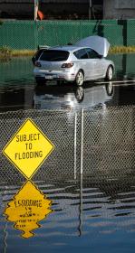
SF Estuary Wetlands Regional Program Plan Released!
The Wetland Regional Monitoring Program (WRMP) Plan has been released! The WRMP will improve wetland restoration project success by putting in place regional-scale monitoring increasing the impact, utility and application of permit-driven monitoring to inform science-based decision-making.

Mon, Mar 30 2020 - Mon, Mar 1 2021
We offer you a simple tool that we created for our 75-person “work community” to help each other that yours might also find helpful. This is a mapping tool, which we call Care in the Time of Corona. It helps us locate and efficiently provide the support that our SFEI staff might offer one another. Quite simply, it facilitates assistance within our organization so that people can help their colleagues deal with challenges of this unprecedented situation. The errands, food, medicine, or even compassionate discussion they need can be addressed through a convenient and filterable map. We hope this guidance and the spirit behind it will help support your community and sustain a sense of well-being as we meet this challenge head on together.
Thu, Jan 23 2020
California Rapid Assessment Method for Wetlands (CRAM) Updates
CRAM Training sessions for 2020 have been posted on the CRAM website.
Wed, Jan 22 2020
Project Tracker assists with regional reporting
More and more groups rely on Project Tracker to assist with their reporting. Why? Because Project Tracker standardizes project data across programs so it is easier to summarize information for reporting purposes.

Thu, Nov 21 2019
In a partnership with Kinetica, a data analytics start-up, and Oracle, SFEI and SCCWRP leveraged public funding from the California Ocean Protection Council to advance automated trash detection capabilities. The team deployed servers in the @Oracle Cloud to increase performance dynamically.
Thu, Sep 26 2019
SFEI Provides Science Leadership and Support for State of the Estuary Report and Conference
The San Francisco Estuary Partnership (SFEP) brings together the estuarine community every two years at the State of the Estuary Conference and, periodically, SFEP also reports on the State of the Estuary, summarizing the latest scientific findings about ecosystem health.