Browse Our Stories
Sun, Oct 11 2026
Bridging the Gap for Wetland Restoration
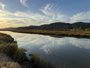
California has lost over 90% of its historic coastal and deltaic wetlands, which play a critical role in storing carbon, buffering communities from flooding, filtering water and supporting biodiversity.

Mon, Sep 14 2026
Unearthing Morro Bay's Historical Landscapes
Communities seeking to revitalize Morro Bay face the question: how can we heal the landscape if we don’t understand how it functioned prior to European colonization and disruption? Answering that question drove the research for the Morro Bay Historical Ecology Study, which SFEI conducted in partnership with the Morro Bay National Estuary Program.
Tue, Jul 7 2026
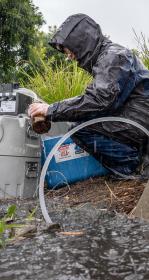
A new study shows that rain gardens substantially reduce levels of 21 contaminants in stormwater before that water ends up in San Francisco Bay.
Mon, Jun 29 2026
Mountain View’s New Plan for a Thriving Urban Ecosystem
Mountain View’s newly adopted Biodiversity and Urban Forest Plan pioneers an approach to managing the city’s trees, parks, facilities, and open spaces as one connected, functioning landscape.
Thu, Apr 9 2026
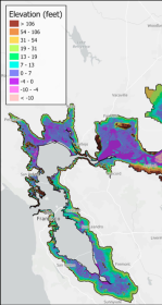
First High-Resolution Elevation Map for Whole Bay-Delta
A new mapping effort has produced the first high-resolution elevation data across the entire San Francisco Bay-Delta Estuary. The sub-ten-centimeter vertical accuracy makes the data key tool to planning for flood risk, sea level rise, and habitat restoration.
Fri, Mar 6 2026
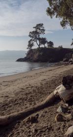
To Save the Bay, Save its Sediment
Sand and mud are the essential building blocks for the Bay's shoreline to keep pace with sea level rise. But San Francisco Bay is losing 1.7 million metric tons more of sand and mud per year than it's gaining—more than double the weight of the Golden Gate Bridge. Sand mining and other human extraction are major drivers of the Bay’s sand deficit.
Fri, Feb 27 2026
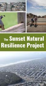
Nature-Based Approaches for a Resilient San Francisco
A new report details tangible lessons for urban greening gleaned from The Sunset Natural Resilience Project, which explores how to make San Francisco’s Sunset neighborhood greener and more resilient.
Thu, Jan 15 2026
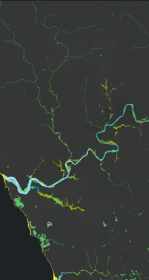
New Basemap of Surface Waters and Riparian Areas in the Russian River Watershed
In collaboration with regional partners, SFEI is developing a comprehensive standardized basemap to support the Russian River Regional Monitoring Program and regional needs. The Russian River Aquatic Resources Inventory uses automated, repeatable methods to deliver up‑to‑date mapping of wetland habitats.
Wed, Jan 14 2026
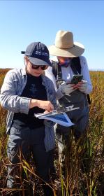
A Milestone! 10,000 Wetland Condition Assessments Publicly Shared on EcoAtlas
On November 11, 2025 we reached an exciting milestone: 10,000 wetland condition assessments are now publicly available on EcoAtlas. This statewide visualization and mapping tool expands public access to environmental information, supporting wetland protection, restoration planning, and project performance tracking.
Tue, Oct 28 - Wed, Oct 29 2025
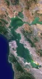
Baylands Habitat Map wins Outstanding Environmental Project Award at State of the Estuary!
Baylands Habitat Map receives Outstanding Environmental Project Award from the Friends of the San Francisco Estuary at this year’s State of the Estuary Conference! Baylands Habitat Map receives Outstanding Environmental Project Award from the Friends of the San Francisco Estuary at this year’s State of the Estuary Conference!
Mon, Nov 18 2024 - Sat, Jan 25 2025
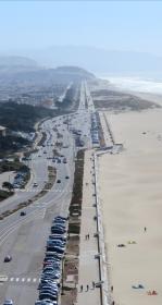
Changing Course on San Francisco’s Great Highway
A fixture of Western San Francisco, the Great Highway is home to a diverse ecosystem of sand dunes, native plants, and wildlife.
Mon, Nov 18 2024 - Fri, Dec 5 2025
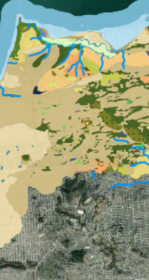
WRMP Webinar Series: Introducing the Baylands Habitat Map 2020!
The San Francisco Estuary Wetlands Regional Monitoring Program (WRMP) held a webinar on October 15, 2024 to introduce the recently released Baylands Habitat Map 2020.
Thu, Aug 22 2024
New Baylands Habitat Map Tracks Restoration Progress
The Baylands Habitat Map 2020 is the first complete map of San Francisco Bay wetland and aquatic habitats produced since 2009. It provides updated maps of tidal habitats and diked baylands, expanding our understanding of the full impact of recent habitat change and restoration.
Tue, Apr 30 2024 - Sat, Jan 31 2026
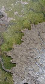
Tracking Coastal Habitat Change Over Time: Considerations for a Statewide Mapping Program
Managing California’s coastal habitats and tracking progress requires up-to-date and comprehensive mapping. So far, that mapping has only happened periodically, and often in a piecemeal manner. We summarized options for routinely mapping coastal wetlands, beaches and dunes, eelgrass, and rocky intertidal coastal habitats statewide in a new report for California’s Ocean Protection Council.

Tue, Mar 12 2024
ASLA-NCC Lunch with Leaders Connecting Biodiversity and Health
Join us for a lunch webinar on March 20th, 2024, where Vanessa Lee (Associate Environmental Scientist), Karen Verpeet (Resilient Landscapes Program Managing Director), and Kelly Iknayan (Senior Scientist) will speak to members of the ASLA Norther

Sun, Mar 10 2024
Sustainability and resilience expert Laura Feinstein to lead the SFEI Resilient Landscapes Program
The San Francisco Estuary Institute (SFEI) is excited to announce Laura Feinstein as the new Director of the Resilient Landscapes Program. Laura brings many years of experience at the science-policy interface and a love for the natural and urban communities of the San Francisco Bay Area and Delta region. As Director, she will lead SFEI’s interdisciplinary Resilient Landscapes team of 30+ staff with an annual budget of over $5 million.
Tue, Aug 29 2023
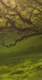
Restoration Plan for the Laguna de Santa Rosa Completed!
SFEI completed a Restoration Plan for the Laguna de Santa Rosa in the Russian River watershed. SFEI, Sonoma Water, and the Laguna de Santa Rosa Foundation worked with technical advisors, stakeholders, tribal representatives, and local landowners to develop the Restoration Plan that provides a restoration planning framework and conceptual designs for multi-benefit habitat restoration projects that support people and wildlife.
Wed, Jul 5 2023
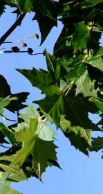
Recently completed “Sycamore Alluvial Woodland Restoration and Enhancement Suitability Study”
The “Sycamore Alluvial Woodland Restoration and Enhancement Suitability Study” addresses distribution and regeneration patterns and restoration strategies of sycamore alluvial woodland (SAW) habitat, a unique and relatively rare native vegetation community adapted to California’s intermittent riv
Wed, Jan 18 2023
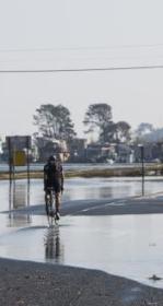
Groundwater Mapping Reveals New Vulnerabilities for the Bay Area
Featured in the Los Angeles Times, Mercury News, San Francisco Chronicle, San Francisco Examiner, KneeDeep Times, Marin Independent Journal, KQED, KALW, and ABC News, a new study sheds light on the hazards presented by rising groundwater. Pathways Climate Institute and SFEI have collaborated to produce maps that show where shallow groundwater, tied to sea-level rise, is an issue today and where it is likely to be a concern in the future as seas continue to rise.
Mon, Oct 10 2022
Introducing the Making Nature’s City Toolkit
In partnership with the International Union for the Conservation of Nature (IUCN) Urban Alliance, the San Francisco Estuary Institute (SFEI) has developed the Making Nature’s City Toolkit (makingnaturescity.org), an interactive, beautifully designed webs
Fri, May 13 2022
Introducing the Landscape Scenario Planning Tool Version 2.0
In partnership with the Delta Stewardship Council, the San Francisco Estuary Institute has developed version 2.0 of the Landscape Scenario Planning Tool, a GIS-based analysis toolkit to evaluate user-designed land use and restoration scenarios for the Sacramento-San Joaquin Delta and Suisun Marsh

Mon, Apr 18 2022
The Wetland Regional Monitoring Program for SF Estuary enters significant new phase
The Wetlands Regional Monitoring Program or WRMP is a broad, multi-organizational effort designed to produce coordinated and rigorous science about the baylands in the San Francisco Bay area. Through the power of diverse partnerships, a broad network of stakeholders are working rapidly to protect and restore wetlands that can provide flood protection, tribal, community and recreational benefits, water quality improvement, wildlife habitat, and other benefits for surrounding communities. To meet a regional target of 100,000 acres restored by 2030, close coordination is needed between managers, scientists, community groups, tribal partners, and regulators. However, this project-by-project approach to restoration monitoring has left our state, regional, and local decision makers effectively insensitive to the overall regional conditions that might bear direct influence over restoration success and failure. As the effects of climate change and sea level rise generate their own set of challenges, the WRMP will improve the success of wetland restoration projects by putting in place regionally coordinated monitoring that will increase the impact, utility and application of monitoring to inform adaptive management.
Mon, Nov 1 2021
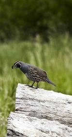
Newly published research sheds light on the future of the California quail
The Journal of Applied Ecology has just published research by Kelly Iknayan of the San Francisco Estuary Institute (SFEI) and co-authors from the Presidio Trust and SFEI that will help to guide a joint study on the feasibility of bringing back the native California quail to San Francisco
Mon, Oct 11 2021
Erica Spotswood and a team of scientists published pioneering research in Nature Sustainability, finding that COVID-19 tracks neighborhood greenness in the US, exacerbating existing inequity.
Fri, Oct 1 2021 - Sun, Oct 1 2023
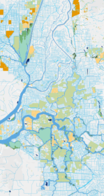
Having an accurate basemap is critical for monitoring and assessing our valuable habitats and supporting their restoration and protection. To assist with developing these important resources, USEPA has funded two mapping projects to develop basemaps in the Delta and Baylands.
Tue, Sep 21 - Fri, Dec 31 2021
Big updates from Hidden Nature SF, including new interactive content!
Hidden Nature SF seeks to uncover the natural history of San Francisco’s past landscape.
Tue, Apr 13 2021
Sediment for Survival report released
SFEI worked with local, state, and federal science experts to develop the new Sediment for Survival report.
Fri, Apr 2 2021
Trees, Hydrology, Urban-Greening, and Nature-Based Solutions
Two key reports support nature-based solutions. Green stormwater infrastructure (GSI) and enhancements to the urban tree canopy offer benefits to stormwater management, urban ecological improvements, and complementary urban greening activities.
On KGO TV, these projects were featured on July 1, 2021.
Wed, Mar 24 2021
“Towards a Coarse Sediment Strategy for the Bay Area” completed!
The release of “Towards a Coarse Sediment Strategy for the Bay Area” represents a step forward towards beneficially reusing coarse flood control channel sediment by outlining reuse challenges, and identifying i

Wed, Feb 24 2021
SFEI and our partners from the Exploratorium, the San Francisco Department of the Environment, and the Presidio Trust were joined live by over 400 participants for a conversation around the nature, both past and present, that is hidden in plain sight in San Francisco.