Browse Our Stories

Fri, Mar 6 2026
California Aquatic Resource Inventory v3.3 has been published!
This latest update integrates two of SFEI’s recent regional semi-automated mapping efforts into the CARI dataset. A major addition is the newly released Russian River Aquatic Resource Inventory (RRARI) v1.0, which spans the entire Russian River watershed and Sonoma County.
Thu, Jan 15 2026
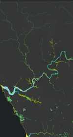
New Basemap of Surface Waters and Riparian Areas in the Russian River Watershed
In collaboration with regional partners, SFEI is developing a comprehensive standardized basemap to support the Russian River Regional Monitoring Program and regional needs. The Russian River Aquatic Resources Inventory uses automated, repeatable methods to deliver up‑to‑date mapping of wetland habitats.
Wed, Jan 14 2026
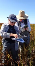
A Milestone! 10,000 Wetland Condition Assessments Publicly Shared on EcoAtlas
On November 11, 2025 we reached an exciting milestone: 10,000 wetland condition assessments are now publicly available on EcoAtlas. This statewide visualization and mapping tool expands public access to environmental information, supporting wetland protection, restoration planning, and project performance tracking.
Wed, Oct 1 2025
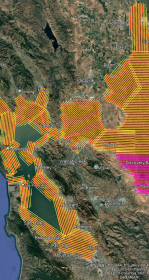
WRMP Releases Multiple Tools for Region-wide Planning
This summer marks a major milestone in regional data collection as the Wetlands Regional Monitoring Program and several key agencies launch the first Estuary-wide low tide LiDAR (Light Detection and Ranging) elevation collection. The data will enhance our understanding of our wetlands, shorelines, and restoration progress.
Fri, Aug 8 2025
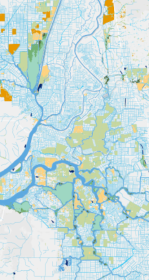
Helping California Track and Protect Its Wetlands
With millions spent on restoration projects across California, how are we able to consistently track the condition of wetlands—or the success of projects meant to protect them? Tools like SFEI’s EcoAtlas, Project Tracker, and CRAM are changing that. By bringing transparency, accountability, and science into the permitting process, these tools help ensure wetlands are not only restored, but truly recovered.
Tue, Apr 1 2025
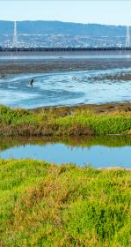
Tracking Tidal Wetland Extent in San Francisco Bay
The Wetlands Regional Monitoring Program updates acreage, highlighting restoration efforts. The WRMP delivers coordinated regional monitoring of the San Francisco Estuary’s wetlands to inform science-based decision-making for wetland restoration and adaptive management and increase the cost-effectiveness of permit-driven monitoring associated with wetland restoration projects. Learn how these new products advance our understanding of tidal wetland monitoring in the Estuary.
Tue, Apr 30 2024 - Sat, Jan 31 2026
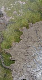
Tracking Coastal Habitat Change Over Time: Considerations for a Statewide Mapping Program
Managing California’s coastal habitats and tracking progress requires up-to-date and comprehensive mapping. So far, that mapping has only happened periodically, and often in a piecemeal manner. We summarized options for routinely mapping coastal wetlands, beaches and dunes, eelgrass, and rocky intertidal coastal habitats statewide in a new report for California’s Ocean Protection Council.
Sat, Mar 9 2024
Enhanced Landscape Profile Modes in EcoAtlas deliver new insights
EcoAtlas is a mapping and geographic data visualization tool that continues to evolve to meet emerging needs. The toolset now includes new data layers and summaries to support the watershed planning, tracking, and reporting needs for the state.
Tue, Apr 7 - Thu, Apr 30 2020
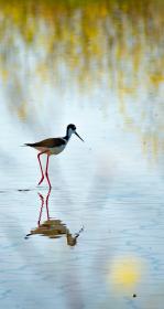
SF Estuary Wetlands Regional Program Plan Released!
The Wetland Regional Monitoring Program (WRMP) Plan has been released! The WRMP will improve wetland restoration project success by putting in place regional-scale monitoring increasing the impact, utility and application of permit-driven monitoring to inform science-based decision-making.

Mon, Oct 1 2018 - Tue, Dec 31 2019
Tracking Habitat Restoration Performance Measures
This collaborative project was funded by the USEPA to enhance the functionality of EcoAtlas Project Tracker to collect information on the expected goals of a project, and report performance measures in a consistent way across programs and agencies.

Fri, Jun 29 2018
Dashboards track cumulative benefits on the landscape
EcoAtlas dashboards are comprehensive views of qualified information provided by Project Tracker and the California Aquatic Resource Inventory (CARI). These dynamic visualizations help measure the cumulative benefits of public policies and programs for California's aquatic resources.

Thu, Dec 15 2016 - Tue, Jan 31 2017
New data layers and Landscape Profile mode added to EcoAtlas
New data layers and Landscape Profile mode have been added to EcoAtlas (ecoatlas.org), an online tool for visualizing the abundance, diversity, and condition of wetlands, along with the project activities that are affecting the landscape. Enhancements include:

Tue, Oct 25 2016
The Delta as Changing Landscapes - Presentation by Letitia Grenier
The Delta Science Program, CDFW Watershed Restoration Grants Branch, and the Surface Water Ambient Monitoring Program will jointly host a Delta Science Brown Bag seminar on October 25th

Sat, Mar 5 2016
CRAM BBE module now available!
With funding from the State Coastal Conservancy, SFEI staff developed the eCRAM data entry forms for uploading BBE assessments into the CRAM database.
Sat, Mar 5 - Sat, Apr 30 2016
How do you know if the ecological conditions of your wetland project are aligned with expected rates of improvement?
Tue, Dec 1 2015
Historical Ecology for Lower Walnut Creek promises to deliver insights at an upcoming event
SFEI scientists Sean Baumgarten and Scott Dusterhoff will present findings from the Lower Walnut Creek Historical Ecology Study at the Quadrennial Contra Costa County Creek and Watershed Symposium, to be held on December 3, 2015, at the Pleasant Hill Community Center.
Wed, Oct 21 - Thu, Oct 22 2015
KQED Forum: Bay Area Infrastructure, Communities at Risk Without Wetlands Restoration
On KQED Forum, Michael Krasny interviewed SFEI's Letitia Grenier and the State Coastal Conservancy's Sam Schuchat about the release of the new Science Update Report and its findings regarding the urgency to restore wetlands in advance of accelerating sea-level rise. As offered on KQED's website, "the new report reveals that 42,000 acres of wetlands in the Bay Area must be restored over the next 15 years to mitigate the effects of climate change. Rising sea levels, swelling tides and strong storms threaten billions of dollars worth of businesses, homes and infrastructure." The Baylands and Climate Change: What We Can Do, from over 100 scientists and 17 governmental agencies, urges action to restore wetlands as a key component to protect cities and critical infrastructure from imminent threats.
Mon, Oct 19 - Fri, Oct 30 2015
Baylands Goals Report Released to a Flurry of Media Attention
An update to the 1999 Bayland Ecosystem Habitat Goals, the new report called The Baylands and Climate Change: What We Can Do urges swift action to restore our wetlands as a buffer against rising seas and associated flooding. Sea-level rise will increase in a few decades. If we do not act swiftly to restore our Bay Area wetlands, our cities will be in greater peril for increased flooding and infrastructure impairment. Our highways, airports, utility services, pipelines, water treatment plants are all threatened by rising tides.
The report synthesizes the recommendations of 200 scientists and government experts on climate change, sea level rise, watershed systems and urban engineering.
Thu, Oct 1 2015
New Project Tracker online forms
New Project Tracker online forms enhance EcoAtlas' regional capacity for habitat restoration project tracking, assessment and reporting. Partners can now upload and edit project information and approve projects for display on EcoAtlas.
Thu, Aug 20 2015
EcoAtlas: New Map Enhancements
The latest release of EcoAtlas (v4.1) includes two new map enhancements:
Mon, Jul 6 2015
EcoAtlas: New CARI Editor and Modern Delta Habitat Types
An accurate basemap is fundamental to watershed planning and assessments. The California Aquatic Resources Inventory, or CARI, offers such a basemap for aquatic resource identification and classification. But to keep it current and enhance its details, SFEI-ASC must leverage local knowledge. The new CARI Editor promotes regional stewardship and allows users to submit updates, deletions or new features for streams and wetlands.
Tue, Jun 30 2015
Version 2 of the BAARI (Bay Area Aquatic Resource Inventory) GIS dataset has been released. Local experts provided advice on and reviewed BAARI’s baylands, stream and wetland data layers to increase its accuracy and detail.