Browse Our Stories
Thu, Apr 9 2026
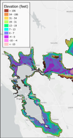
First High-Resolution Elevation Map for Whole Bay-Delta
A new mapping effort has produced the first high-resolution elevation data across the entire San Francisco Bay-Delta Estuary. The sub-ten-centimeter vertical accuracy makes the data key tool to planning for flood risk, sea level rise, and habitat restoration.

Fri, Mar 6 2026
California Aquatic Resource Inventory v3.3 has been published!
This latest update integrates two of SFEI’s recent regional semi-automated mapping efforts into the CARI dataset. A major addition is the newly released Russian River Aquatic Resource Inventory (RRARI) v1.0, which spans the entire Russian River watershed and Sonoma County.
Tue, Oct 28 - Wed, Oct 29 2025
Baylands Habitat Map wins Outstanding Environmental Project Award at State of the Estuary!
Baylands Habitat Map receives Outstanding Environmental Project Award from the Friends of the San Francisco Estuary at this year’s State of the Estuary Conference! Baylands Habitat Map receives Outstanding Environmental Project Award from the Friends of the San Francisco Estuary at this year’s State of the Estuary Conference!
Thu, Sep 18 2025
The Atlas for Regional Shoreline Adaptation Planning
The Regional Shoreline Adaptation Plan Atlas is a comprehensive resource for understanding and addressing the impacts of sea level rise along shorelines. Learn more about the San Francisco Bay Conservation and Development Commission's new tool to serve the best available science and information to a receptive community of municipal planners.
Sat, Mar 1 2025
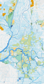
Mapping our Wetlands: Explore the Latest CARI Updates
CARI is a statewide dataset that compiles the most comprehensive wetland mapping available in California. It serves as a valuable resource for coordinating landscape-scale monitoring and assessment across multiple agencies.
Wed, Feb 5 2025
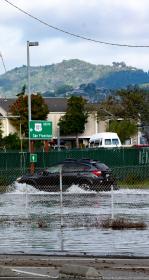
Great Strides for an Oakland Community: Green Stormwater Infrastructure
SFEI collaborated with community partners to generate components for a community plan for green stormwater infrastructure (GSI).
Thu, Aug 22 2024
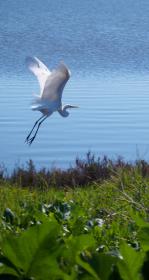
New Baylands Habitat Map Tracks Restoration Progress
The Baylands Habitat Map 2020 is the first complete map of San Francisco Bay wetland and aquatic habitats produced since 2009. It provides updated maps of tidal habitats and diked baylands, expanding our understanding of the full impact of recent habitat change and restoration.
Wed, Aug 7 2024
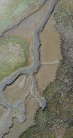
A Drone Upgrade and a New Pilot Propel SFEI’s Efforts
Join us in congratulating SFEI's Associate GIS Specialist, Kat Palermo, for successfully attaining her Part 107 Remote Pilot License from the FAA! She joins GIS Manager, Pete Kauhanen, as a second drone pilot at SFEI.
Fri, Mar 8 2024
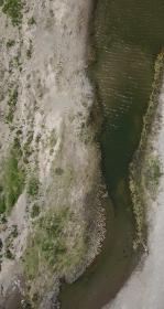
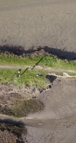
Vision from the Skies: Using UAS Surveys to Monitor a Key Restoration Project
At the McCosker Creek Restoration site, 3,000 linear feet of creek channel that previously had been flowing through underground culverts since the 1950s was daylighted and reconstructed. In addition, invasive and non native plants were removed and replaced with over 5,000 native plants.
Mon, Oct 17 2022
SFEI's Recent Work with Unoccupied Aerial Systems (UAS)
SFEI continues to leverage our Unoccupied Aerial Systems (UAS) capabilities to support conservation and monitoring efforts around the Bay. Two recent projects include monitoring for the Sears Point Restoration Project in San Pablo Bay, as well as conducting a number of flights to support the US Environmental Protection Agency (USEPA) filming of existing marshes and marsh restoration projects that help protect both communities and critical infrastructure.
Mon, Apr 18 2022
The Delta Aquatic Resource Inventory (DARI) is a map of surface waters, wetlands and other aquatic resources in the Sacramento-San Joaquin Delta. A similar mapping approach used to create the Bay Area Aquatic Resource Inventory (BAARI) was applied to complete a consistent map across the larger San Francisco Estuary. Both DARI and BAARI are integrated into the California Aquatic Resource Inventory (CARI), which serves as the basemap in EcoAtlas.
Fri, Apr 2 2021
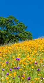
Trees, Hydrology, Urban-Greening, and Nature-Based Solutions
Two key reports support nature-based solutions. Green stormwater infrastructure (GSI) and enhancements to the urban tree canopy offer benefits to stormwater management, urban ecological improvements, and complementary urban greening activities.
On KGO TV, these projects were featured on July 1, 2021.

Thu, Nov 21 2019
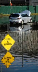
In a partnership with Kinetica, a data analytics start-up, and Oracle, SFEI and SCCWRP leveraged public funding from the California Ocean Protection Council to advance automated trash detection capabilities. The team deployed servers in the @Oracle Cloud to increase performance dynamically.

Fri, Jun 29 2018
GreenPlan-IT Phase II nears completion
SFEI has completed development of Phase II of our GreenPlan-IT application -- a toolset to empower municipalities to plan, assess, track, and report their green infrastructure investments. This helps restore the water cycle and improve filtration of water quality contaminants.
Fri, May 13 2016
GreenPlan-IT featured in the newsletter of the National Water Quality Monitoring Council
GreenPlan-IT, a toolset created in a collaboration with SFEP, US EPA, and local partners, has been featured in the newsletter of the National Water Quality Monitoring Council, which has been distributed broadly to subscribers throughout the nation and beyond.
Thu, Apr 7 2016
Now Available: SF Bay Shore Inventory: Mapping for Sea Level Rise Regional Dataset
SFEI and the San Francisco Estuary Partnership are proud to announce the release of the SF Bay Shore Inventory: Mapping for Sea Level Rise.
Tue, Jun 30 2015
Version 2 of the BAARI (Bay Area Aquatic Resource Inventory) GIS dataset has been released. Local experts provided advice on and reviewed BAARI’s baylands, stream and wetland data layers to increase its accuracy and detail.