
This project will build on existing projects funded by the CA State Water Board, Ocean Protection Council, Sonoma Ecology Center, and Sonoma County to produce a basemap of aquatic resources, using the updated Standard Operating Procedures (SOP) of the California Aquatic Resource Inventory (CARI), including at-risk waters and their riparian areas, to support the Russian River Regional Monitoring Program (R3MP). The main tasks of the project are to:
- Produce a new Geodatabase of the Aquatic Resources for the Russian River Watershed (RRW) and Sonoma County by piloting the updated CARI SOP; and
- Map riparian areas of the RRW, based on the riparian definition supporting the new Dredge and Fill Procedures of the State Water Board.
This CARI SOP is being updated by the new Statewide Mapping Committee of the CA Wetland Monitoring Workgroup (CWMW), while filling basic information gaps about the distribution, abundance, and diversity of aquatic and riparian habitats of the RRW. The new Russian River Aquatic Resource Inventory (RRARI) dataset is needed to implement the Sonoma County Riparian Corridor Protection Ordinance. It will also be used as the basemap for the planned online public R3MP GIS for sharing, visualizing, and summarizing environmental data in the watershed context.
The R3MP was established in 2019 by the formation of its current Steering Committee (SC), which represents fifteen public agencies largely responsible for the wellbeing of the people and wildlife of the Russian River Watershed (RRW). The R3MP SC has since published a detailed R3MP Charter, prioritized two Management Questions that drive the Program, established a standing Technical Advisory Team (TAC) of state and regional experts to recommend and guide the science and technology needed to address the Management Questions, secured funding from the CA Water Resources Control Board (State Water Board) to develop the R3MP science plan through the TAC, and is leveraging other projects to build partnerships that will serve the RRW’s many interests. The two-co-equal Management Questions are: 1) What are the status and trends of biostimulation in the watershed? 2) What are the status and trends of stream habitat in the watershed?
Funding from the State Water Board is being used to support the initial tasks of the TAC, including identification and prioritization of habitat condition and eutrophication indicators; identification of data needed to quantify the indicators; and identification and prioritization of data gaps. While the TAC is still undertaking these tasks, some gaps in fundamentally important data have been identified. Two of these gaps are the incomplete maps of RRW surface waters and riparian areas. A related project funded by the Ocean Protection Council (OPC) is quantifying these gaps by assembling existing data for R3MP TAC review. Completing these datasets is essential to account for the inputs of light and the loads of sediment, nutrients, and other materials that strongly affect stream habitat and biostimulatory conditions. These maps will be completed using the updated CARI SOP and the Riparian Zone Estimator Tool (RipZET) of WRAMP, with ongoing advice and review by the R3MP TAC. RipZET output will be compared to existing riparian maps produced for portions of the RRW using other methods to understand their relative limitations and benefits. Based on this comparison, the R3MP TAC will recommend future changes in riparian mapping for the RRW.
The RRARI dataset will serve as the basemap for the planned online R3MP GIS for data and information aggregation, sharing, and visualization. To support the R3MP online GIS, this Project will train map stewards in local agencies and NGOs to revise and update the basemap, using the existing CARI Online Editor. In addition, to help track changes in aquatic resources due to local, state, and federal permitted actions, and to otherwise support R3MP implementation, selected staff within the member agencies of the R3MP SC will be trained to use additional WRAMP tools, namely Project Tracker and Landscape Profile Tool. It is anticipated that the map stewards and WRAMP tool trainees will be selected by the R3MP SC, with input from the TAC.
R3MP Mapping Workgroup
Adrienne Cibor -Town of Windsor
Alex Young - Sonoma County Agricultural Preservation and Open Space
Allison Schichtel - Sonoma County Agricultural Preservation and Open Space
Amber Fisette - Mendocino County
Anne Morkill - Laguna Foundation
Ben Wishnoff - Sonoma County Department of Agriculture
Brent Reed - Laguna Foundation
Deborah Waller - Permit Sonoma
Emilia Bartnick - US Fish and Wildlife Service
Gil Falcone - North Coast Regional Water Quality Control Board
Indigo Bannister - West Yost Associates/Russian River Watershed Association
Jessica Martini-Lamb - Sonoma Water
John Mack - Permit Sonoma
Karen Gaffney - North Coast Resource Partnership
Katherine Gledhill - North Coast Resource Partnership
Lance Le - North Coast Regional Water Quality Control Board
Lauren Healey - US Fish and Wildlife Service
Leif Farr - Mendocino County
Mark Tukman - Tukman Geospatial
Robert Pennington - Permit Sonoma
Shelly Bianchi-Williamson - Permit Sonoma
Sierra Cantor - Gold Ridge RDC
Steve Lee - Sonoma Ecology Center
Tarah Rhine - Mendocino County
Terri McCartney - Pinoleville Pomo Nation
TJ VanderYacht - Conservation Works









Other Individual Contributors









California Aquatic Resource Inventory v3.3 has been published!
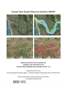
This latest update integrates two of SFEI’s recent regional semi-automated mapping efforts into the CARI dataset. A major addition is the newly released Russian River Aquatic Resource Inventory (RRARI) v1.0, which spans the entire Russian River watershed and Sonoma County.
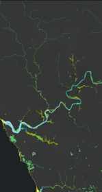
New Basemap of Surface Waters and Riparian Areas in the Russian River Watershed
In collaboration with regional partners, SFEI is developing a comprehensive standardized basemap to support the Russian River Regional Monitoring Program and regional needs. The Russian River Aquatic Resources Inventory uses automated, repeatable methods to deliver up‑to‑date mapping of wetland habitats.