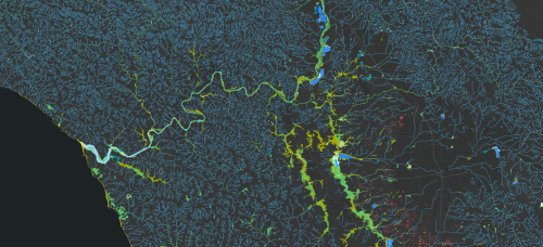
The Russian River Aquatic Resource Inventory (RRARI) is an inventory of aquatic resources and their associated vegetated areas in the Russian River Watershed and Sonoma County in California. The inventory was largely developed using an automated approach consisting of a computer algorithm developed by GIS staff, to apply a standardized and regionally relevant classification system in order to support environmental planning and resource management tracking at a local and regional scale.
RRARI is meant to serve as a basemap of aquatic resources, using the updated Standard Operating Procedures (SOP) of the California Aquatic Resource Inventory (CARI) to support the Russian River Regional Monitoring Program (R3MP). RRARI addresses basic information gaps about the distribution, abundance, and diversity of aquatic and riparian habitats of the Russian River Watershed. The RRARI dataset is needed to implement the Sonoma County Riparian Corridor Protection Ordinance. It will also be used as the basemap for the planned online public R3MP GIS for sharing, visualizing, and summarizing environmental data in the watershed context.
The RRARI dataset extent includes the Russian River Watershed spanning portions of Mendocino and Marin counties, and all of Sonoma County in California. The extent covers approximately 1,371,475 acres.
RRARI’s aquatic resource inventory classes were adapted from past Aquatic Resource Inventory classification systems, such as Delta Aquatic Resource Inventory (DARI) and San Diego Aquatic Resource Inventory (SDARI). It was adjusted to include aquatic resources that are distinct to the Russian River watershed and Sonoma coast employing the same nomenclature. Wetlands are mapped as polygonal features and are a combination of the open water bodies produced by NV5 Geospatial and the results of SFEI’s wetland classification process. The channel network is a line feature class that was mapped by associates at NV5 Geospatial to meet USGS 3DHP standards and can be used for modeling and other purposes. It consists of line work that is mapped continuously through narrow and wide channels, and through other aquatic features (including reservoirs and lakes) by the addition of Artificial Paths through those open water features.
RRARI v1.0 Streamlines data disclaimer: This data is provided as draft for review and discussion purposes only. It does not represent the final version and has not been reviewed, approved, or accepted by the USGS 3D Hydrography Program (3DHP). All content is subject to change based on further analysis, stakeholder input, and 3DHP requirements. Do not distribute, cite, or rely on this draft as official 3DHP-approved data.
For more information on classifications and methods, see the RRARI v1.0 Standard Operating Procedures document.
San Francisco Estuary Institute (SFEI). 2025. "Russian River Aquatic Resource Inventory (RRARI) v 1.0" Accessed [date retrieved]. https://www.sfei.org/data/russian-river-aquatic-resource-inventory-rrari.
This file is part of Russian River Aquatic Resource Inventory GIS Data
Russian River Aquatic Resource Inventory GIS Data is free data: you can redistribute it and/or modify it under the terms of the GNU General Public License as published by the Free Software Foundation, either version 3 of the License, or (at your option) any later version.
Russian River Aquatic Resource Inventory GIS Data is distributed in the hope that it will be useful, but WITHOUT ANY WARRANTY; without even the implied warranty of MERCHANTABILITY or FITNESS FOR A PARTICULAR PURPOSE. See the GNU General Public License for more details.
More information about GNU General Public License is available at http://www.gnu.org/licenses/.SFEI data are available without restriction upon use with the following caveats. Prudent usage, knowledge of the data quality, and professional courtesy should all be considered in obtaining and using SFEI data. As this dataset is NOT a survey document, neither use it as such nor use it beyond the limits of the source scale. Please read and fully comprehend all available metadata prior to data use. SFEI requests that the use of these data in any map, publication, or report should include citation of the data source(s) used and give proper attribution and credit to the originators of the data. Questions about SFEI data may be directed to the GIS Manager, at 510-746-7334.