Browse Our Stories
Tue, Mar 1 2016
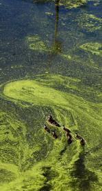
SFEI provides perspective on emerging harmful bacterial blooms in the State's larger waterbodies
The State has contracted SFEI to provide intellectual, scientific, and technical resources to support its efforts to monitor and report on the ever-growing problem of cyanobacterial blooms in its lakes and rivers.

Thu, Jan 28 2016
Help us improve CD3 to better meet your visualization and reporting needs by completing a brief survey. We're interested to learn which features you use and to read your suggestions on any desired, new functionality.
Other enhancements in this release include:
Mon, Dec 7 2015
Shortening the Distance between Science and Effective Stewardship
Under the aegis of the Delta Stewardship Council, SFEI helped usher forth a vision document with recommendations for enhancements to California's information technology infrastructure and associated practices.
Fri, Dec 4 2015
GreenPlan-IT Toolbox evolving quickly to meet increased demand
With the conclusion of the first round of funding for the Green Plan Bay Area project http://www.sfestuary.org/our-projects/water-quality-improvement/greenplanning/, SFEI produced GreenPla
Wed, Nov 18 2015
SFEI representatives Cristina Grosso and Josh Collins helped to foster the use of EcoAtlas and related tools in the Lahontan region during a recent workshop, which is part of a broader project. The objective of the workshop was to train interested parties inside and outside of the Tahoe Basin on EcoAtlas’ watershed-based decision support tools. The workshop began with a presentation on the applications of watershed-based decision support tools in the regulatory context. A Technical Demo Session and Open Lab provided hands-on training for EcoAtlas’ planning (CARI/TARI, CARI Editor), tracking (Project Tracker), and visualization tools (Landscape Profile Tool).
Fri, Oct 2 2015
USGS StreamStats API available in EcoAtlas
StreamStats is a web service provided by the US Geological Survey and used to delineate an upstream catchment from a user-defined pour point.
Thu, Oct 1 2015
New Project Tracker online forms
New Project Tracker online forms enhance EcoAtlas' regional capacity for habitat restoration project tracking, assessment and reporting. Partners can now upload and edit project information and approve projects for display on EcoAtlas.
Tue, Sep 29 2015
New Trends Charts and Data on Safe To Eat Portal
Fish and shellfish are nutritious and good for you to eat. But some fish and shellfish may absorb toxic chemicals from the food they eat and the water in which they live.
Wed, Aug 26 2015
2014 RMP Sediment and Bivalve Data Now Available on CD3!
In 2014, the Regional Monitoring Program for Water Quality in San Francisco Bay (RMP) collected sediment and bivalve samples from San Francisco Bay as part of its long-term monitoring program.
Thu, Aug 20 2015
EcoAtlas: New Map Enhancements
The latest release of EcoAtlas (v4.1) includes two new map enhancements:
Mon, Jul 6 2015
EcoAtlas: New CARI Editor and Modern Delta Habitat Types
An accurate basemap is fundamental to watershed planning and assessments. The California Aquatic Resources Inventory, or CARI, offers such a basemap for aquatic resource identification and classification. But to keep it current and enhance its details, SFEI-ASC must leverage local knowledge. The new CARI Editor promotes regional stewardship and allows users to submit updates, deletions or new features for streams and wetlands.
Tue, Jun 30 2015
Version 2 of the BAARI (Bay Area Aquatic Resource Inventory) GIS dataset has been released. Local experts provided advice on and reviewed BAARI’s baylands, stream and wetland data layers to increase its accuracy and detail.
Fri, Jun 19 - Mon, Jun 22 2015
Web Services Available for CRAM and Wetland Projects
Web services provide a standard way to access geo-referenced data online.
Tue, Jun 16 - Mon, Jun 22 2015
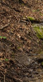
Carlos Street Rain Garden Interpretative Sign
An informative and beautifully designed interpretative sign educates the public on the effects of stormwater runoff, the impacts on water quality and aquatic life, the beneficial uses of "rain gardens" or natural stormwater treatment areas, and the role individuals can play in cleaning-up our wat
Fri, Jun 5 2015
This release of CD3 features an advanced download tool for accessing all data for a project and the ability to dynamically generate Sum of PCBs. Detailed instructions for using the tool's different features are provided in a pop-up box for easy reference.
Mon, Jun 1 - Mon, Jun 22 2015
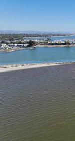
SF Bay Nutrients Visualization Tool
This visualization tool facilitates intuitive comparison of continuous data from around the Bay, and across a variety of analytes, to demonstrate the potential for collaborative monitoring across programs.
Mon, Jun 1 - Mon, Jun 22 2015
Riparian zone decision support tool just released!
In April 2015, SFEI released a GIS-based decision support tool called the Riparian Zone Estimation Tool (RipZET).
Tue, May 5 2015
NOAA remote sensing tools and application for evaluating CyanoHABs in California lakes
There are thousands of lakes in the State of California. A number of these lakes are experiencing “harmful algal blooms” associated with cyanobacteria, or CyanoHABs.
Wed, Dec 31 2014 - Tue, Mar 31 2015
San Francisco Bay Joint Venture Projects Map
In partnership with the San Francisco Bay Joint Venture (SFBJV), SFEI/ASC developed a new interactive map to display active and completed SFBJV partner projects throughout the region. Useful project information can be obtained by clicking on a location.
Fri, Dec 12 2014
CD3: New interface and Improved Functionality
CD3 or Contaminant Data Display and Download is a web-based visualization tool for accessing water quality data for the San Francisco Bay-Delta region, including the RMP’s long-term dataset.
Thu, Dec 11 2014 - Tue, Mar 31 2015
RipZet: GIS Tool for Estimating Riparian Zones
The Riparian Zone Estimator Tool (RipZET) is a GIS-based decision support tool under development for estimating riparian zones at the watershed and/or project scale.
Sat, Dec 6 - Wed, Dec 31 2014
SFEI's Regional Data Center contains over 2 million results!
With the recent upload of the Klamath Tribes water quality data (1990-2013) by Randy Turner and the Data Services Team, SFEI's Regional Data Center database now contains over 2 million results!
Fri, Dec 5 - Wed, Dec 31 2014
EcoAtlas’ Landscape Profile Tool v2.0
The recent EcoAtlas release delivers new functionality and enhancements to the Landscape Profiler, a tool that summarizes ecological information at various spatial scales for assessment, planning, and reporting.
Sat, Nov 1 - Wed, Dec 31 2014
CD3: New interface and Improved Functionality
CD3 or Contaminant Data Display and Download is a web-based visualization tool for accessing water quality data for the San Francisco Bay-Delta region, including the RMP’s long-term dataset.
Thu, Jul 10 2014
Water Year 2013 Stormwater Data - Signed, Sealed, Delivered!
The SFEI Data Technical Services (DTS) team manages the data for a multi-year stormwater monitoring project within the San Francisco Bay area.
Thu, Jul 10 2014
EcoAtlas, SFEI's flagship product launched last summer, was just awarded three Wetland Program Development grants by the USEPA for further enhancement and support.
Thu, Jun 5 - Fri, Jun 6 2014
Cristina Grosso, Tony Hale, and others from SFEI-ASC participate in the Environmental Data Summit
Cristina Grosso presented EcoAtlas to an audience of policy-makers, scientists, technologists, agency staffers, and private industry consultants on June 5th and 6th. Meanwhile, Tony Hale helped to organize and announce the talks.
Sun, Jul 14 2013
Meredith Williams discusses the primary benefits of EcoAtlas to the state's body of knowledge about its wetlands. How does EcoAtlas advance our collective understanding about wetland condition? What restoration projects are underway and where are they taking place?
Wed, Jun 26 2013
SFEI Announces New Wetlands Web Tools

Wed, May 29 2013
Establishment of the NFWF San Francisco Bay Estuary Conservation Fund
The National Fish and Wildlife Foundation (NFWF) announced the establishment of the NFWF San Francisco Bay Estuary Conservation Fund.