Browse Our Stories
Fri, Mar 8 2024
Vision from the Skies: Using UAS Surveys to Monitor a Key Restoration Project
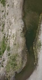
At the McCosker Creek Restoration site, 3,000 linear feet of creek channel that previously had been flowing through underground culverts since the 1950s was daylighted and reconstructed. In addition, invasive and non native plants were removed and replaced with over 5,000 native plants.
Wed, Feb 21 2024
Restoration Plan for the Laguna de Santa Rosa
The Laguna de Santa Rosa, an expansive freshwater wetland complex located in the Russian River watershed of Sonoma County, CA, is a vital ecological and cultural resource that has undergone considerable change over the past 150 years.
Tue, Aug 29 2023
Restoration Plan for the Laguna de Santa Rosa Completed!
SFEI completed a Restoration Plan for the Laguna de Santa Rosa in the Russian River watershed. SFEI, Sonoma Water, and the Laguna de Santa Rosa Foundation worked with technical advisors, stakeholders, tribal representatives, and local landowners to develop the Restoration Plan that provides a restoration planning framework and conceptual designs for multi-benefit habitat restoration projects that support people and wildlife.
Wed, Jul 5 2023
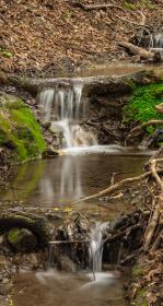
Recently completed “Sycamore Alluvial Woodland Restoration and Enhancement Suitability Study”
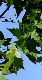
The “Sycamore Alluvial Woodland Restoration and Enhancement Suitability Study” addresses distribution and regeneration patterns and restoration strategies of sycamore alluvial woodland (SAW) habitat, a unique and relatively rare native vegetation community adapted to California’s intermittent riv
Tue, Apr 13 2021
Sediment for Survival report released
SFEI worked with local, state, and federal science experts to develop the new Sediment for Survival report.
Wed, Mar 24 2021
“Towards a Coarse Sediment Strategy for the Bay Area” completed!
The release of “Towards a Coarse Sediment Strategy for the Bay Area” represents a step forward towards beneficially reusing coarse flood control channel sediment by outlining reuse challenges, and identifying i

Wed, Nov 13 2019
Newark considering controversial 469-home development at the edge of the Baylands
SFEI scientist Julie Beagle was consulted to discuss the value of wetlands at the Bay's edge in Newark, where a controversial new development is planned for an area adjacent to critical marshland.
Fri, Jun 21 2019
Eleven years to save San Francisco Bay
SFEI scientist Julie Beagle and SPUR-based collaborator Laura Tam co-authored an article featured in the SF Chronicle:
Fri, May 24 2019
A New Atlas for Dealing With Rising Seas in the Bay Area
SFEI's Julie Beagle penned a new article for Bay Nature, describing the importance of the new Adaptation Atlas, a guide for those around the Bay Area looking for the best ways to adapt their local area to sea-level rise
Fri, Nov 9 2018
Working with Nature to Adapt San Francisco Bay’s Shoreline for Sea Level Rise
Impacts from sea level rise and combined flooding are increasing along S.F. Bay’s shoreline.
Tue, Oct 10 - Wed, Oct 11 2017
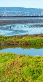
Flood Control 2.0 Wins an Outstanding Environmental Project Award!
The Flood Control 2.0 project team was presented with an Outstanding Environmental Project Award at the 13th Biennial State of the Estuary Conference in Oakland, CA.
Thu, Jun 22 2017
The Resilience Atlas is an interactive mapping platform that visualizes the past, present and future conditions of the Bay’s edge and surrounding watersheds by combining layers of information, such as shoreline infrastructure, shoreline change over time, and sea level rise.
Thu, Jun 22 2017
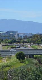
SFEI and several agency partners recently completed a multi-year, EPA funded project called Flood Control 2.0. The goal of the project was to develop information that is useful for integrating habitat restoration into flood management at the Bay edge. Project outputs are now available at floodcontrol.sfei.org.
Thu, Jun 22 2017
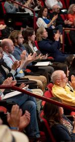
South Bay Landscape Vision Workshop
On June 7, SFEI, in partnership with the Santa Clara Valley Water District and South Bay Salt Ponds Restoration Project, hosted a landscape “visioning” workshop in San Jose.
Mon, Nov 7 2016
How Creeks Meet the Bay: Current Sediment Dynamics
The transition zones between our watersheds and the Bay are often occupied by flood control channels that provide a variety of societal and environmental services but often require sediment removal to maintain flood conveyance capacity.
Fri, Jan 22 2016
"SF Expert Warns King Tides, El Nino Pose Flood Risk"
SFEI's Jeremy Lowe speaks to NBC reporter Stephanie Chuang about the opportunity the Bay Area currently faces to transform its natural infrastructure to reduce flood risk. Chuang writes,
Wed, Oct 21 - Thu, Oct 22 2015
KQED Forum: Bay Area Infrastructure, Communities at Risk Without Wetlands Restoration
On KQED Forum, Michael Krasny interviewed SFEI's Letitia Grenier and the State Coastal Conservancy's Sam Schuchat about the release of the new Science Update Report and its findings regarding the urgency to restore wetlands in advance of accelerating sea-level rise. As offered on KQED's website, "the new report reveals that 42,000 acres of wetlands in the Bay Area must be restored over the next 15 years to mitigate the effects of climate change. Rising sea levels, swelling tides and strong storms threaten billions of dollars worth of businesses, homes and infrastructure." The Baylands and Climate Change: What We Can Do, from over 100 scientists and 17 governmental agencies, urges action to restore wetlands as a key component to protect cities and critical infrastructure from imminent threats.
Fri, Oct 9 - Fri, Oct 30 2015
Our Bay on the Brink: SFEI's Jeremy Lowe explains the urgency for sea-level-rise adaptation
SFEI's senior scientist Jeremy Lowe has appeared in a video with the Coastal Conservancy's Amy Hutzel, the South Bay Salt Pond Project's John Bourgeois, the Bay Area Economic Council's Sean Randolph, Save the Bay's Allison Chan, and Match.com's Gary Kremen, to provide background in sea level
Tue, Apr 7 2015
Flood Control 2.0 in Bay Nature
The April 2015 issue of Bay Nature features an article about Flood Control 2.0, an ambitious project being co-led by SFEI to develop a framework for designing resilient, multi-benefit flood control channels at the interface with the San Francisco Bay shoreline.