How Creeks Meet the Bay: Current Sediment Dynamics
Nov 7, 2016
The transition zones between our watersheds and the Bay are often occupied by flood control channels that provide a variety of societal and environmental services but can require sediment removal to maintain flood conveyance capacity. The causes of sedimentation problems in these channels are often complex, driven in large part by a combination of high watershed sediment yield and excess tidal sediment accumulation due to decreased tidal scour.
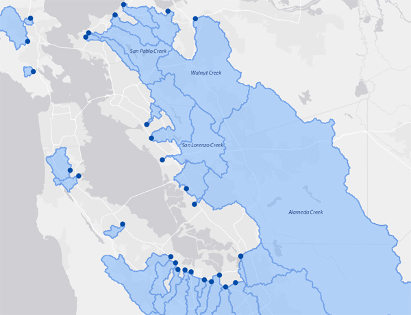
As part of the Flood Control 2.0 project, SFEI gathered and collated key sediment data for the past 50+ years from the major flood control channels around the Bay. The effort focused on data related to the supply of watershed sediment entering these channels and the details of individual sediment removal events for each channel (e.g., location, volume, sediment grain size, and cost). This information is intended to help clarify the amount of sediment trapped in flood control channels that could be used to restore baylands and support long-term bayland resilience as sea level continues to rise.
An interactive map displaying the summary flood control channel sediment data can be found here. A report synthesizing these data with other Flood Control 2.0 regional analyses will be released in December 2016.
Source:
Associated Staff:
Programs and Focus Areas:
Clean Water Program
Watershed Monitoring and Modeling
Resilient Landscapes Program
Watershed Science & Management
Related Projects, News, and Events:
 Flood Control 2.0 (Project)
Flood Control 2.0 is an ambitious regional effort aimed at helping restore stream and wetland habitats, water quality, and shoreline resilience around San Francisco Bay. The project leverages local resources from several forward-looking flood control agencies to redesign major flood control channels so that they provide both future flood conveyance and ecological benefit under a changing climate. This timely project will develop a set of innovative approaches for bringing environmental benefits and cost-savings to flood protection efforts at the mouths of creeks that drain to San Francisco Bay.