Browse Our Stories

Fri, Dec 26 2014
Ten Years After Toxic Chemical Phase-Out, Strong Signs of Recovery for San Francisco Bay
The attached fact sheet details the widespread and rapid declines in flame retardant pollution in many San Francisco Bay species, according to a new study released by the
Fri, Dec 19 2014 - Fri, Mar 27 2015
Fri, Dec 12 2014
CD3: New interface and Improved Functionality
CD3 or Contaminant Data Display and Download is a web-based visualization tool for accessing water quality data for the San Francisco Bay-Delta region, including the RMP’s long-term dataset.
Thu, Dec 11 2014 - Tue, Mar 31 2015
RipZet: GIS Tool for Estimating Riparian Zones
The Riparian Zone Estimator Tool (RipZET) is a GIS-based decision support tool under development for estimating riparian zones at the watershed and/or project scale.
Sat, Dec 6 - Wed, Dec 31 2014
SFEI's Regional Data Center contains over 2 million results!
With the recent upload of the Klamath Tribes water quality data (1990-2013) by Randy Turner and the Data Services Team, SFEI's Regional Data Center database now contains over 2 million results!
Fri, Dec 5 - Wed, Dec 31 2014
EcoAtlas’ Landscape Profile Tool v2.0
The recent EcoAtlas release delivers new functionality and enhancements to the Landscape Profiler, a tool that summarizes ecological information at various spatial scales for assessment, planning, and reporting.
Thu, Dec 4 2014
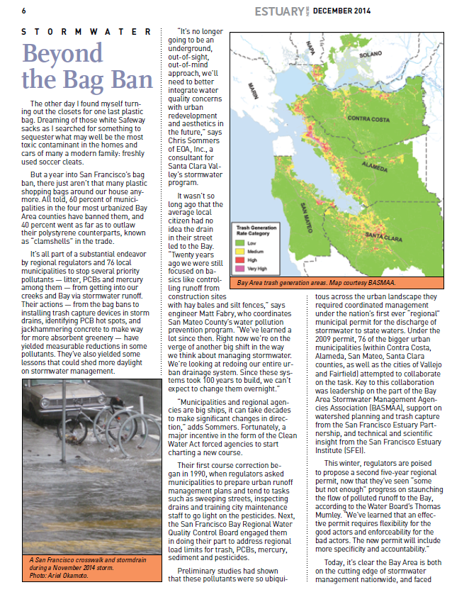
City tries to eliminate toxic runoff with green infrastructure
SAN FRANCISCO (KTVU) - In the last few days, many Bay Area storm sewers got their biggest flush out, spewing all kinds of nasty materials out into the Bay.Most Bay Area cities have two sewer systems, one for human waste, the other for storm runoff.
Wed, Nov 19 2014
Historical Ecology Highlighted at John Muir Symposium
Sense of (dis)Place
Mon, Nov 17 2014
Regional Monitoring Program (RMP) Update, 2014 - Now an eBook
The Regional Monitoring Program (RMP), is a 23-year year running “annual check-up” on the health of San Francisco Bay. Led by an SFEI science team, the RMP Update provides a concise overview of what the RMP is finding about Bay pollution, sources and trends.
Wed, Nov 5 2014
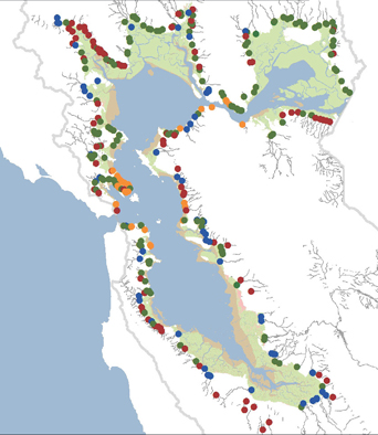
How Creeks Meet the Bay: Changing Interfaces
Sat, Nov 1 - Wed, Dec 31 2014
CD3: New interface and Improved Functionality
CD3 or Contaminant Data Display and Download is a web-based visualization tool for accessing water quality data for the San Francisco Bay-Delta region, including the RMP’s long-term dataset.
Sat, Nov 1 - Wed, Dec 31 2014
Wetlands Change Analysis and T-sheet Website
In collaboration with our partners at SCCWRP and the CSUN Center for Geographic Studies, SFEI completed the southern California Wetlands Change project.
Thu, Oct 30 2014
"Why California’s Largest Estuary No Longer Works for Wildlife"
California’s historic drought has put the state’s water problems in the forefront this year and those problems aren’t likely to be solved when the clouds open up again. Nowhere is that more apparent than in the water system’s central hub — the Sacramento-San Joaquin Delta.
Tue, Oct 28 2014
"A Delta Transformed" report released at the 2014 Bay-Delta Science Conference
The newly published A Delta Transformed: Ecological Functions, Spatial Metrics, and Landscape Change in the Sacramento-San Joaquin Delta provides the first analysis of landscape ecology metrics in the pre-disturba
Mon, Oct 20 2014
SFEI study paints a palette of rich diversity
Early observers who viewed the coastal lagoons of North County described glittering salt flats and shifting landscapes, according to a new report by the California Coastal Conservancy.
Tue, Oct 14 2014
RMP Annual Meeting on Tuesday, October 14th
The Annual Meeting of the Regional Monitoring Program for Water Quality in San Francisco Bay (RMP) was held on Tuesday, October 14, 2014 at the David Brower Center in Berkeley, CA from 9 AM to 4 PM.
Tue, Oct 14 2014
The RMP Update, An Annual Report of the Regional Monitoring Program
The RMP Update summarizes findings from 12 recent months of research by top scientists on the health and water quality trends in the San Francisco Bay Estuary. The report highlights the “RMP Top Ten”: a list of recent activities and accomplishments.
Mon, Sep 29 2014
Futures Past: Exploring California Landscapes with SFEI
An article exploring the work of SFEI's Resilient Landscapes Program was published in the Fall 2014 issue of Boom: A Journal of California.
Mon, Sep 29 - Wed, Dec 31 2014
Retracing the History of Chinese Shrimp Fishing in San Francisco Bay
In September, SFEI participated in Chinese Whispers: Bay Chronicles, a project combining science, art, and community.
Mon, Sep 22 2014
PCB Synthesis Report and Estuary News Article
The RMP has produced a synthesis report on PCBs that summarizes recent advances in understanding and makes recommendations for future studies.
Mon, Sep 1 - Wed, Dec 31 2014
Futures Past: Exploring California Landscapes with SFEI
An article exploring the work of SFEI's Resilient Landscapes Program was published in the Fall 2014 issue of Boom: A Journal of California.
Mon, Sep 1 - Wed, Dec 31 2014
Head of Tide report available online
SFEI recently completed a pilot study focused on creating a framework for a rapid protocol that can be used to delineate the current and future Head of Tide zone for San Francisco Bay tributaries using both “desktop” and field investigations.
Mon, Sep 1 2014
Study on Northern San Diego County lagoons just released
We are pleased to announce the release of our latest study, the Northern San Diego County Lagoons Historical Ecology Investigation: Regional patterns, local diversity, and landscape trajectories.
Fri, Aug 15 2014
Southern California T-sheets phase 2 completed
Phase 2 of the southern California t-sheets study has been completed.
Thu, Jul 10 2014
Water Year 2013 Stormwater Data - Signed, Sealed, Delivered!
The SFEI Data Technical Services (DTS) team manages the data for a multi-year stormwater monitoring project within the San Francisco Bay area.
Thu, Jul 10 2014
EcoAtlas, SFEI's flagship product launched last summer, was just awarded three Wetland Program Development grants by the USEPA for further enhancement and support.
Thu, Jul 10 - Sun, Aug 31 2014
Alameda Creek Watershed Ecological Study
A comprehensive study of the transformation of the Alameda Creek watershed, the largest tributary draining directly to San Francisco Bay, shows the remarkable native habitats that were found in today’s cities of Fremont, Newark, Pleasanton, and Livermore.
Wed, Jul 9 2014
Within the tributaries that drain to San Francisco Bay, there exists a transition between fluvial and tidal processes and conditions.
Wed, Jul 9 2014 - Sun, Feb 1 2015
RMP Documents Decline of PBDEs in the Bay
The Regional Monitoring Program for Water Quality in San Francisco Bay (RMP) recently published a technical report, authored by Dr.
Mon, Jul 7 - Sat, Sep 13 2014
Recent Presentations by the Resilient Landscapes Team
The Resilient Landscapes (RL) team delivered a number of presentations during the last quarter highlighting recent accomplishments and initiatives.