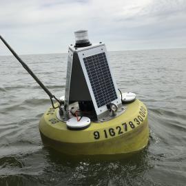
The Moored Sensor Program (MSP) is a network of high-frequency continuous water quality sensors distributed throughout San Francisco Bay. The network was first established in 2013 as part of the Nutrient Management Strategy, a program tasked with building the scientific foundation needed to inform nutrient-related management decisions in the Bay. The MSP has grown from two monitoring sites to more than fourteen, with more anticipated. Data from the sensors track changes in water quality conditions over time, and enable mechanistic interpretations, calibration, and refinement of a state-of-the-art hydrodynamic/biogeochemical model.
The primary instrument the MSP uses is the YSI EXO2 multiparameter sonde, which records data at a 15 minute interval. Measured parameters vary by station location and include temperature, conductivity (salinity), depth, dissolved oxygen, chlorophyll a, blue-green algae, turbidity, fluorescent dissolved organic matter, and pH.
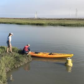
EXO2s are serviced every 3–6 weeks. This consists of data download, sensor cleaning, and battery replacement. The instruments are retrieved from the field every 2–4 months for laboratory calibration following procedures outlined in the instrument manual. During this time they are field-swapped with new sondes to prevent data gaps. Following download, data are subject to a semi-automated quality assurance/quality control procedure that includes manual inspection and data cleaning.
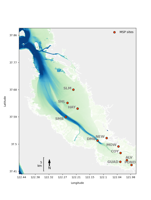
The current dataset includes water quality data from 2013-2021 collected at 11 stations [SLM, SHL, HAY, SMB, DMB, NEW, MOW, COY, ALV, GUAD, POND]. More recent EXO2 data from an additional 3 stations [EMR, SPA8, SPA4] will be uploaded after passing through quality assurance/quality control procedures.
The Nutrient Management Strategy collects and processes data in collaboration with USGS California Water Science Center, USGS Pacific Coastal and Marine Science Center, and the California Conservation Corps Watershed Stewards Program.
Current and previous SFEI contributors include: Kristin Art, Philip Bresnahan, Ariella Chelsky, Charlotte Diamant, Erika King, Lissa MacVean, Lucy Montgomery, Lilia Mourier, Katie Noland, Emily Novick, Derek Roberts, David Senn, Zephyr Sylvester, Martin Volaric, Taylor Winchell.
Chelsky, A., K. Art, P. Bresnahan, C. Diamant, E. King, L. MacVean, L. Montgomery, L. Mourier, K. Noland, E. Novick, D. Roberts, Z. Sylvester, M. Volaric, T. Winchell, and D. Senn. 2026. San Francisco Bay High-frequency Water Quality Sensor Data ver 1. Environmental Data Initiative. https://doi.org/10.6073/pasta/69b73427d4f9021e2fbcf7b89bbfbf23 (Accessed YYYY-MM-DD).
This file is part of Moored Sensor Program data.
Moored Sensor Program data are free data: you can redistribute them and/or modify them under the terms of the GNU General Public License as published by the Free Software Foundation, either version 3 of the License, or (at your option) any later version.
Moored Sensor Program data are distributed in the hope that they will be useful, but WITHOUT ANY WARRANTY; without even the implied warranty of MERCHANTABILITY or FITNESS FOR A PARTICULAR PURPOSE. See the GNU General Public License for more details.
More information about GNU General Public License is available at http://www.gnu.org/
Disclaimer: In no event shall the creators, custodians, or distributors of this information be liable for any damages arising out of its use. These data are not legal documents or of survey or engineering quality and are not intended to be used as such. Although effort has been made to produce error-free and complete data, all geographic information has limitations due to the scale, resolution, date and interpretation of the original source materials. Data completeness also varies by data availability for specific dataset attributes. Data may be subject to change without prior notification. These maps are not to be used for purposes of accessing any locations or properties depicted, and distribution of these maps in no way implies any approval or authority to enter the subject properties, unless otherwise indicated. Interested parties must contact the appropriate landowner for current information on property access and condition of features. We request that the use of these data in any map, publication, or report should cite the data source(s) used and give proper attribution and credit to the originators of the data.