About the Project
A tool for land use planning that brings together ten years of science-based research in the Sacramento-San Joaquin Delta.
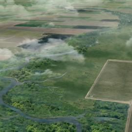
As climate change exacerbates vulnerabilities in the Delta and Suisun Marsh, resource managers, planners, and other decision makers must weigh multiple objectives for ecosystems and communities. A resilient future for the region requires landscape-scale planning that considers multiple management goals such as wildlife support, subsidence and greenhouse gas mitigation, reliable water provision, and a vibrant agricultural economy. Designed to inform this planning, the Landscape Scenario Planning Tool (LSPT) helps users create land use scenarios, efficiently evaluate their benefits and tradeoffs, and quantify progress towards regional goals. Bringing together a decade of research and peer-reviewed methods, the LSPT has been used by agencies, planners, and researchers to envision a healthy and resilient Delta and Suisun Marsh.
This project builds on a decade of work funded by the California Department of Fish and Wildlife, the Delta Stewardship Council, the Delta Conservancy, the US Fish and Wildlife Service, and others to describe and map the historical Delta landscape, to develop a suite of landscape metrics to quantify how the Delta has changed over time, and to provide science-based guidelines for ecological restoration moving forward.

How the LSPT supports land use planning
The LSPT is designed to help planners, resource managers, project developers, and funders quantify the benefits of potential projects and landscape visions. This information can be used to set management objectives, assist in compliance with regional policies, and support or evaluate funding proposals. Projects such as Delta Adapts: Creating a Climate Resilient Future, the Delta Island Adaptations project, and Resilient Staten Island have used the LSPT to compare the benefits of alternative land use decisions. You can use the LSPT too! Here’s how it works:
- Users create spatial scenarios in the form of GIS layers. Scenarios represent alternative landscape configurations, and can include habitat restoration, levee changes, and other structural changes such as crop type conversions.
- The tool’s 16+ analysis modules assess how scenarios influence wetland habitat, fish support, agricultural economy, carbon sequestration, and a range of other landscape functions.
- Analyses facilitate comparisons between alternative scenarios, looking at both modern and historical conditions.
- The LSPT generates data files, maps, and a synthesized report with summary text, figures, and tables.
Interested in working with SFEI to develop or run a scenario? Reach out!
Interested in exploring the LSPT on your own? The tool is free to use and available for download.
Download the tool and user guide
Download the overview pamphlet
Example Scenario

The EcoRestore example scenario allows users to explore a complete LSPT analysis. California EcoRestore is a collaboration between California’s Department of Water Resources (DWR) and other agencies to advance habitat restoration in the Delta and Suisun Marsh. This example LSPT scenario reflects the existing and planned EcoRestore projects in the Delta and Suisun Marsh, as of 9/16/2021. The results for the example scenario can be viewed here without the need to run the tool. The input data for the EcoRestore example are also included with the tool download, and can be modified by the user to create their own scenarios.
Disclaimer: The EcoRestore example scenario was developed by SFEI staff from GIS datasets provided by DWR, with adjustments and additional details added based on publicly-accessible reports and maps. It may not reflect the latest plans for these projects, nor is it endorsed by any State agencies or project proponents. The scenario is included here solely to demonstrate tool functionality and data formats and is subject to change in the future.

Guiding Datasets
Guiding Datasets
These datasets are useful for the design of landscape-restoration scenarios. They are offered for download as part of the tool package. These layers (and others) can also be viewed on the Webmap.
Landscape Potential & Restoration Opportunities Analysis
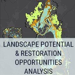
The landscape potential & restoration opportunities analysis is a package of layers that identifies spatially-explicit restoration opportunities in the Delta and Suisun to support multiple desired ecological functions. These analyses are informed by past and present land cover, elevation, sea-level rise projections, and other data sets. They are useful for developing scenarios that can then be evaluated with the tool.
Modern Habitats

The modern habitats map layer is a compilation of several spatial datasets detailing Delta and Suisun vegetation and land use, with each vegetation type crosswalked to the historical habitat types. This layer also includes some types that were not in the historical habitat map, including agriculture/ruderal and urban/barren. See the metadata for additional details.
Historical Habitats

The historical habitats map layer shows the habitat types in the Delta and Suisun in the early to mid 1800s. It was initially developed by SFEI for the Delta from hundreds of historical maps, photographs, and texts as part of the “Sacramento-San Joaquin Delta Historical Ecology Investigation.” The dataset classifies the historical Delta into 17 habitat types, the majority of which are based on modern classification systems. Suisun was mapped first through a “reconnaissance-level” effort, and then in greater detail as part of the Suisun Landscapes project.
Geomorphic Zones

Elevation is a critical driver of what restoration actions might be appropriate in a given area. Particularly important is a site’s elevation relative to the tides: whether an area is situated within, above, or below the tidal zone (and by how much) influences what types of natural communities can be supported and how vulnerable the area is to flooding. The geomorphic zones layer combines current topographic and bathymetric datasets with local tidal datums to identify different elevation-based zones with different associated opportunities and constraints. For more information about the geomorphic zones and suitable restoration and management actions appropriate for each zone, please see "Elevation and Opportunity in the Delta.”

Connection with Regional Data Sets
EcoAtlas Project Tracker is a tool for tracking information on wetland restoration, mitigation, and habitat conservation projects throughout California. The LSPT currently allows users to bring in project data from EcoAtlas Project Tracker to help build and refine landscape scenarios. Integrating the LSPT with other regional datasets and planning tools, such as EcoAtlas, can help improve coordination and communication among conservation planners and land managers.
LSPT Versions and Downloads
The latest version (LSPT v3.0) of the Landscape Scenario Planning Tool is available for download as of January 2025.
The previous versions of the tool are also still available for download for users working with an older version of ArcGIS, however, the new modules and expanded spatial extent are not included.
LSPT v3.0 (2025)
Systems Requirements:
- Requires ArcPro 3.0 or later
Updates:
- Updated data
- Updated historical and modern habitats
- Updated modern levees
- Updated protected areas to 2022 published data
- Updated EcoRestore scenario
- New Suisun Restoration scenario
- New organic soils layer (for subsidence)
- New migration space 2-m elevation band (for migration space)
- Habitat class updates
- Handling for tidal flat (barren and nontidal)
- Renaming "willow riparian scrub/shrub" as “riparian scrub/shrub”
- New habitat groups: SEASONAL_WETLAND, SUBSIDENCE_REVERSAL, MANAGED_SEASONAL_WETLAND, WATERFOWL_MANAGEMENT
- New class for handling habitat references (to minimize/centralize hard-coded values)
- Revised subsidence module
- Subsidence classes estimated based on decision tree analysis
- Change in subsidence classes analysis
- Revised wetland buffer module
- Three levels of buffers by habitat function
- Greater granularity of habitat types breakdown
- New upland edge analysis
- New migration space module
- Analysis of marsh units and migration space
- Polygon splitting and fragment rejoining algorithms to isolate distinct patches
- Breakdown of migration space by habitat and protected
- Breakdown of marsh units by barriers to migration
Landscape Scenario Planning Tool User Guide v3.0
LSPT v2.2 (2023)
Systems Requirements:
- Requires ArcPro 3.0 or later
Updates:
- Updated EcoRestore layer
- New wetland resilience module
- Baseline correction bugfix
- Fish module fixes
Landscape Scenario Planning Tool User Guide v2.0
LSPT v2.1 (2022)
System Requirements:
- Requires ArcPro 2.8 or later
Updates:
- Enhanced ArcGIS Basic License compatibility. Advanced license workarounds or alternative methods implemented for "Polygon to Line", "Aggregate Polygon", and "Union" tools.
- Updated layers for subsidence and carbon module. Hotfixes and rule modifications to carbon, fish, and agriculture/economics modules.
- Fish module ensures use of tidal wetlands where appropriate. Carbon storage updated to calculate and report low/med/high uncertainties.
- Tweaks and fixes to region delineation for carbon elevation. Fix potential no-data handling error in carbon elevation calculation.
- Fix for agriculture/economics outputs related to collating unique crop types in specified area of analysis.
Landscape Scenario Planning Tool User Guide v2.1
LSPT v2.0 (2022)
System Requirements:
- Requires ArcPro 2.8 or later
Updates:
- Expansion of spatial extent: While DLSPT 1.0 was focused on the Delta, LSPT 2.0.1 has been expanded to cover the Suisun-Delta region.
- Addition of new analysis modules: We have added two new modules to LSPT 2.0.1 that were not included in DLSPT 1.0. These new analysis modules include Carbon and Greenhouse Gas Emissions, and Economics, making a total of 14 analysis modules available in the tool.
- Implementation of technical improvements.
- Upgrade in compatibility to ArcGIS Pro: LSPT 2.0.1 now runs on ArcGIS Pro, whereas DLSPT 1.0 is only compatible with older versions of ArcMap.
DLSPT v1.0 (2020)
Notes:
- Initial release
- ArcPy Toolbox designed for ArcGIS 10.x and Python 2.7.5 with ArcPy (installed with ArcGIS)
Delta Landscapes Scenario Planning Tool User Guide v1.0
Webmap “LSPT Light”
The LSPT webmap allows users to view a variety of data layers that are useful for developing restoration scenarios. It is available at http://deltaplanningmap.sfei.org/
Unlike the downloaded desktop version of the LSPT, which allows users to analyze data and scenarios, the webmap is only for viewing data layers. Users can select from existing data and upload their own data, though the data will not be saved or permanently uploaded to the internet. The webmap includes layers developed for LSPT 3.0 and 2.0, as well as a subset of layers developed with DLSPT 1.0 that have not been updated. Click the “About this data” tab on a data layer in the webmap for more information.
Using the Webmap
The webmap layers are broadly organized around different habitat types. Each habitat type folder will contain layers showing the primary opportunities for restoring the habitat type, as well as a variety of related layers. Clicking on a data layer will generate a preview of the layer, a description of the dataset, and source details. See webmap for more details.


















The future of Suisun Marsh depends on understanding its past
SFEI recently completed the Suisun Landscapes project, a multi-million, multi-year effort funded by Delta Stewardship Council and the US Bureau of Reclamation.
Introducing the Landscape Scenario Planning Tool Version 2.0
In partnership with the Delta Stewardship Council, the San Francisco Estuary Institute has developed version 2.0 of the Landscape Scenario Planning Tool, a GIS-based analysis toolkit to evaluate user-designed land use and restoration scenarios for the Sacramento-San Joaquin Delta and Suisun Marsh

"A Delta Renewed" report released at the 2016 Bay-Delta Science Conference
The San Francisco Estuary Institute (SFEI) released A Delta Renewed – A Guide to Science-Based Ecological Restoration in the Sacramento-San Joaquin Delta.
Rising seas threaten San Francisco Bay and Delta wetlands and land
Dennis Cuff of the San Jose Mercury News wrote an article on the relationship between the region's wetlands and sea level rise.
"A Delta Transformed" report released at the 2014 Bay-Delta Science Conference
The newly published A Delta Transformed: Ecological Functions, Spatial Metrics, and Landscape Change in the Sacramento-San Joaquin Delta provides the first analysis of landscape ecology metrics in the pre-disturba