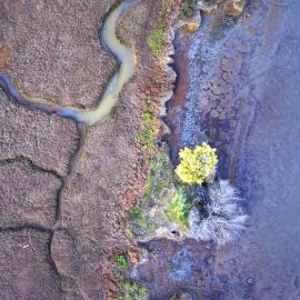
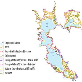
The Baylands Habitat Map 2020 (BHM2020) represents the condition of the San Francisco Bay Baylands in the year 2020. It was first published in April 2024. It was developed to meet the needs of the San Francisco Estuary Wetlands Regional Monitoring Program's (WRMP) by mapping habitat types for the purpose of monitoring regional change over time using primarily remote sensing data.
The Baylands Habitat Map was celebrated as one of the region's most outstanding environmental projects at the 2025 State of the Estuary Conference, and received a 2025 Outstanding Environmental Project Award from the Friends of the San Francisco Estuary.
The BHM2020 is a fundamental component of the WRMP and serves as a common reference map to help coordinate baylands protection and restoration for all interests. It is intended to be used commonly by public agencies to visualize and track baylands projects in EcoAtlas. The creation of the Baylands Habitat Map was funded by the U.S. Environmental Protection Agency, San Francisco Bay Water Quality Improvement Fund. The San Francisco Estuary Institute developed and refined the ruleset to produce the map through regular consultation and collaboration with the WRMP Geospatial Workgroup and WRMP Technical Advisory Committee. The dataset was developed using Object Based Image analysis and a rule based approach in Trimble eCognition and ESRI ArcGIS Pro software. The dataset was first published in April 2024.
During the BHM2020 mapping effort, methods for differentiating one class from another were largely based upon relative tidal elevation, vegetation cover, and feature structure/shape. Tidal influence varies not only across the regions of the bay area, but also between bayland areas within that are constrained by levees and complex hydrological connections. To account for this variability and uncertainty, some flexibility in regard to modeled relative tidal elevation was required and adjustments based on spectral signature was necessary to accurately capture the habitats and extent of influence in areas with complex and varying tidal connections. More information can be found in the BHM2020 methods document.
The BHM 2020 can also be viewed in EcoAtlas.
Baylands Habitat Map 2020 v1.3 was released in October 2025.
Resources
- WRMP Baylands Habitat Map 2020 Classification Key.
- Mapping Methods And Standards For Bayland Habitats In The San Francisco Bay
- ArcGIS Webservice for the Baylands Habitat Map.
Related Data Products
- Baylands Habitat Map 2020 SF Bay Shore Inventory Update v1.0 (released 7/3/2025)
- Baylands Habitat Map 2020 Compiled DEM 1m v1.0 (released 7/7/2025)
- Bayland Habitat Map 2020 Metrics v1.0 (released 10/22/2025)
The Baylands Habitat Map 2020 Metrics layer provides a consistent, nested geographic framework that allows users to investigate and summarize BHM wetlands at multiple scales, from individual sites to bay-wide planning efforts. And is designed to support monitoring, assessing, and planning for tidal wetland condition, restoration, and resilience across the San Francisco Estuary.
Wetlands Regional Monitoring Program (WRMP). 2025. "Baylands Habitat Map 2020 v1.3" Accessed [date retrieved]. https://www.sfei.org/data/baylands-habitat-map-2020-gis-data.
San Francisco Estuary Institute (SFEI). 2025. "Baylands Habitat Map 2020 Metrics v1.0" Accessed [date retrieved]. https://www.sfei.org/data/baylands-habitat-map-2020-gis-data.
San Francisco Estuary Institute (SFEI). 2025. "SFEI_BayShoreInventory_BHM2020update_v1" Accessed [date retrieved]. https://www.sfei.org/data/sf-bay-shore-inventory-gis-data.
San Francisco Estuary Institute (SFEI). 2025. "Baylands Habitat Map 2020 Compiled DEM 1m v1.0" Accessed [date retrieved]. https://www.sfei.org/data/baylands-habitat-map-2020-gis-data.
This file is part of the Baylands Habitat Map 2020 GIS Data
The Baylands Habitat Map 2020 GIS Data is free data: you can redistribute it and/or modify it under the terms of the GNU General Public License as published by the Free Software Foundation, either version 3 of the License, or (at your option) any later version.
The Baylands Habitat Map 2020 GIS Data is distributed in the hope that it will be useful, but WITHOUT ANY WARRANTY; without even the implied warranty of MERCHANTABILITY or FITNESS FOR A PARTICULAR PURPOSE. See the GNU General Public License for more details.
More information about GNU General Public License is available at http://www.gnu.org/licenses/.SFEI data are available without restriction upon use with the following caveats. Prudent usage, knowledge of the data quality, and professional courtesy should all be considered in obtaining and using SFEI data. As this dataset is NOT a survey document, neither use it as such nor use it beyond the limits of the source scale. Please read and fully comprehend all available metadata prior to data use. SFEI requests that the use of these data in any map, publication, or report should include citation of the data source(s) used and give proper attribution and credit to the originators of the data. Questions about SFEI data may be directed to the GIS Manager, at [email protected].