Review our work products
We provide easy access to thousands of SFEI’s reports, journal articles, books, conference papers/proceedings, factsheets, hearing summaries, maps, and more.
These printable and downloadable materials connect our science to action, cover a broad range of topics, and have many applications. This library is searchable and filterable. If you have difficulty finding the information you are looking for, please contact us at [email protected].
Programs & Topics
Select the program or topic of your interest among the nested filters below.
Continuous Suspended Sediment Monitoring in South and Lower South San Francisco Bay Final Report
Author(s): Martin Volaric | Lilia Mourier | Lucy Montgomery | Katie Noland | David Senn | Ariella Chelsky
2025
This report presents results from a three-year effort (2022-2024) to estimate continuous suspended sediment concentration (SSC) in the South Bay (SB) and Lower South Bay (LSB) regions of San Francisco Bay (SFB). We used discrete SSC samples to calibrate high-frequency (15-min…

Author(s): Donald Yee | Adam Wong
2024
San Francisco Bay margins (i.e., mudflats and adjacent shallow areas of the Bay that are shallower than 1 foot below mean lower low water [MLLW]) are important habitats with high potential for aquatic life to be exposed to contaminants. These areas were not routinely sampled…
Author(s): Lilia Mourier | Lucy Montgomery | Martin Volaric | Ariella Chelsky | David Senn
2024
This report provides a project update for year two of a three-year collaboration between the San Francisco Bay Nutrient Management Strategy (NMS), San Francisco Bay Regional Monitoring Program, and South Bay Salt Pond Restoration Project, to estimate high frequency suspended…
Author(s):
2023
This report outlines details from the annual Regional Monitoring Program for Water Quality in the San Francisco Estuary (RMP) sediment cruise, conducted July 24 – 27, 2023. The Regional Monitoring Program conducts routine monitoring of water, sediment and biological tissue.…
Bathymetric change analysis in San Francisco Bay, California, from 1971 to 2020
Author(s): Theresa Fregoso | Bruce Jaffe | Amy Foxgrover
2023
This data release provides bathymetric change grids of four geographic areas of San Francisco Bay, California, comparing digital elevation models (DEMs) created from bathymetric data collected in the 1970s and 1980s with DEMs created from bathymetric data collected in the…
Conceptual Understanding of Fine Sediment Transport in San Francisco Bay
Author(s): Katie McKnight | Alex Braud | Scott Dusterhoff | Letitia Grenier | Sam Shaw | Jeremy Lowe | Melissa Foley | Lester McKee
2023
Sediment is a lifeblood of San Francisco Bay (Bay). It serves three key functions: (1) create and maintain tidal marshes and mudflats, (2) transport nutrients and contaminants, and (3) reduce impacts from excessive human-derived nutrients in the Bay. Because of these…
Author(s): Lilia Mourier | Martin Volaric | Ariella Chelsky | David Senn
2023
Suspended sediment concentration (SSC) is of critical importance to the management of San Francisco Bay (SFB), yet has not been a focus of sustained high frequency monitoring efforts in shallow shoal and slough habitats that make up a majority of the area of the South Bay (SB…
Author(s): Joanne Ferreira | Samantha Mcgill | Angela Tan | Jessica Lacy
2023
Sediment samples were collected on and adjacent to the Whale’s Tail South marsh. Short push-cores of bed sediment were collected in South San Francisco Bay adjacent to Whales Tail South marsh on five days from June through August 2021 and 3 days from November 2021 to January…
Author(s): Joanne Ferreira | Jessica Lacy | Samantha Mcgill | Lukas WinklerPrins | Daniel Nowacki | Andrew Stevens | Angela Tan
2023
The U.S. Geological Survey Pacific Coastal and Marine Science Center collected hydrodynamic and sediment-transport data at shallow water sites in South San Francisco Bay and in the Whale's Tail South marsh in Eden Landing Ecological Reserve in Alameda County, CA in 2021 and…
Re-evaluation of the Floating Percentile Method for Deriving Dredged Sediment Screening Guidelines
Author(s): Donald Yee | Adam Wong
2023
This document summarizes a study conducted for the Regional Monitoring Program for Water Quality in San Francisco Bay (RMP) to re-evaluate the use of the Floating Percentile Method
(FPM) to derive sediment screening guidelines for dredged material reuse in the San…
Author(s): Lester McKee | David Peterson | Alex Braud | Melissa Foley | Scott Dusterhoff | Jeremy Lowe | Allie King | Jay Davis
2023
This document was prepared with guidance gained through two RMP Sediment Workgroup workshops held in late 2022 and early 2023. Given the variety of participants involved, this Workplan encompasses interests beyond San Francisco Bay RMP funders. We thank the attendees for…
Author(s): K.M. Thorne | M.L. Bristow
2023
The U.S. Geological Survey, Western Ecological Research Center collected sediment and accretion data at a wave-exposed tidal salt marsh in South San Francisco Bay, California. Sediment traps and feldspar marker horizons (MH) were deployed along transects of increasing…
Author(s): Theresa Fregoso | Amy Foxgrover | Bruce Jaffe
2023
Bathymetric change analyses document historical patterns of sediment deposition and erosion, providing valuable insight into the sediment dynamics of coastal systems, including pathways of sediment and sediment-bound contaminants. In 2014 and 2015, the Office for Coastal…
Author(s): Theresa Fregoso | Amy Foxgrover | Bruce Jaffe
2023
Bathymetric change analyses document historical patterns of sediment deposition and erosion, providing valuable insight into the sediment dynamics of coastal systems, including pathways of sediment and sediment-bound contaminants. In 2014 and 2015, the California Ocean…
Author(s): J.B Logan | L.T. Winklerprins | J.R Lacy
2023
This data release presents digital surface models (DSMs) and orthomosaic images of the Whale's Tail Marsh region of South San Francisco Bay, CA. The data were created using structure-from-motion (SfM) processing of repeat aerial imagery collected from fixed-wing aircraft. The…
San Francisco Bay Watershed Dynamic Model (WDM) Progress Report, Phase 2
Author(s): Tan Zi | Alex Braud | Lester McKee | Melissa Foley
2022
The San Francisco Bay total maximum daily loads (TMDLs) call for a 50% reduction in mercury (Hg) loads by 2028 and a 90% reduction in PCBs loads by 2030. In support of these TMDLs, the Municipal Regional Permit for Stormwater (MRP) (SFBRWQCB, 2009, SFBRWQCB, 2015, SFBRWQCB,…
Author(s): Miguel Mendez | Cristina Grosso | Diana Lin
2022
The Dredged Material Management Office (DMMO) is responsible for annually approving dredging and disposal of millions of cubic yards of sediment to maintain safe navigation in San Francisco Bay. Dredged sediment is characterized for physical, chemical, and biological…
Author(s):
2021
This report details plans associated with sediment sampling for the Bay Margins Sediment Study for the Regional Monitoring Program for Water Quality in San Francisco Bay (RMP). Bay margins (i.e., mud flats and adjacent shallow areas of the Bay) are productive and highly…
Author(s): Rachel Allen | J.R. Lacy | S.C. McGill | J.C.T. Ferreira
2021
The U.S. Geological Survey (USGS) Pacific Coastal and Marine Science Center collected hydrodynamic and suspended sediment flocculation data at channel and shallow water sites in south San Francisco Bay in July 2020. The data were used to determine water column stratification,…
Author(s):
2021
This report contains information on the late summer/early fall field sampling efforts conducted
by the Marine Pollution Studies Lab at Moss Landing Marine Labs (MPSL-MLML) in support of
the San Francisco Bay Regional Monitoring Program (RMP) North Bay (San…
Author(s): Matthew Heberger | Rebecca Sutton | Nina Buzby | Jennifer Sun | Diana Lin | Miguel Mendez | Michelle Hladik | James Orlando | Corey Sanders | Edward Furlong
2020
The Regional Monitoring Program for Water Quality in San Francisco Bay (RMP) has recently focused attention on better characterization of contaminants in nearshore “margin” areas of San Francisco Bay. The margins of the Lower South Bay are mudflats and shallow regions that…
Author(s): Melissa Foley | Elizabeth Christian | Brenda Goeden | Brian Ross
2020
The beneficial reuse of dredged sediment is one strategy in a broader portfolio that is being developed for San Francisco Bay to help marshes adapt to rising sea level. Dredged sediment is currently being used in restoration projects around the Bay, but additional sediment is…
Author(s): Katie McKnight | Jeremy Lowe | Ellen Plane
2020
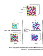
Sediment bulk density is the total mass of mineral and organic sediment within a defined volume. It is a key variable in many research questions pertaining to Bay sediment studies but one that is often poorly quantified and can be misinterpreted. The motivation for this…
Author(s): Daniel Livsey | Maureen Downing-Kunz | David Schoellhamer | Andrew Manning
2020
In this study, we investigate how changes in the vertical distribution of suspended sediment affect continuous suspended sediment flux measurements at a location in the San Francisco Estuary. Current methods for measuring continuous suspended sediment flux estimates relate…
Author(s): D. Livsey | Maureen Downing-Kunz | David Schoellhamer | A. Manning
2020
Recent modeling has demonstrated that sediment supply is one of the primary environmental variables that will determine the sustainability of San Francisco Estuary tidal marshes over the next century as sea level rises. Therefore, understanding the environmental controls on…