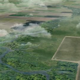
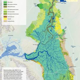
The Sacramento Valley Historical Ecology Study will synthesize historical data in order to understand the ecological, hydrological, and geomorphic conditions of the valley prior to major Euro-American modification. Using early sources such as historical maps, aerial photography, textual accounts, and early surveys, the study will reconstruct a picture of past landscape conditions, processes, and habitat types to help inform restoration and management projects within the Sacramento Valley. The multi-phase study will expand upon work completed for SFEI’s Sacramento-San Joaquin Delta Historical Ecology Study to provide an integrated picture of historical ecological and hydrological conditions.
As part of this effort, the team has developed an interactive, online StoryMap detailing the historical habitat patterns and channels of the Sacramento Valley. The StoryMap weaves together the preliminary, coarse-scale habitat mapping developed for this phase, historical maps and photos, and rich narrative to show how the valley's historical landscape once functioned ca. 1850. Explore the StoryMap to learn more about the Sacramento Valley's historical landscape and aid your interpretation of the mapping.












Explore Our Latest Historical Ecology StoryMap!
The Resilient Landscapes Program at SFEI recently completed the first phase of the Sacramento Valley Historical Ecology Study. The study hopes to inform a pathway for creating more functional floodplains in the Sacramento Valley.