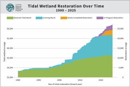
Tracking Tidal Wetland Restoration Over Time
The 1999 Baylands Goals set an ambitious target to expand tidal wetlands in the Bay to a total of 100,000 acres, roughly half its historical extent. Measure AA, passed in 2016, established a dedicated funding stream for protecting the Bay and helped drive the recent increase in tidal wetland restoration projects.
| Year | Total tidal wetland | Existing tidal marsh | Restored tidal marsh | Evolving wetland | Newly completed restorationd | In-progress restoration |
| 2020c | 53,700 | 32,800 | 10,600 | 10,300 | 900 | Not yet tracked |
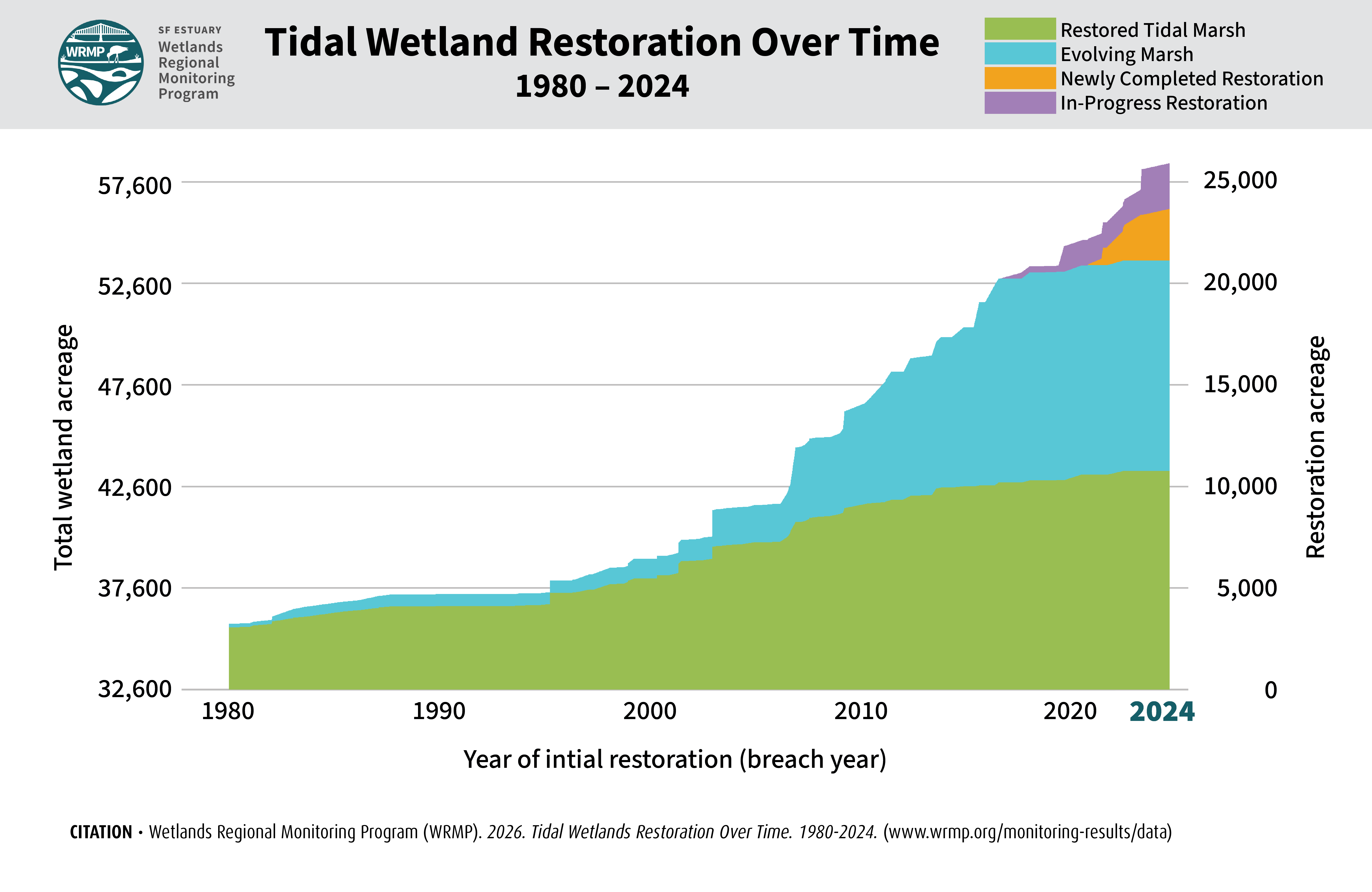
| 2024b | 56,300 | 32,800 | 10,600 | 10,300 | 2,600 | 2,200 |
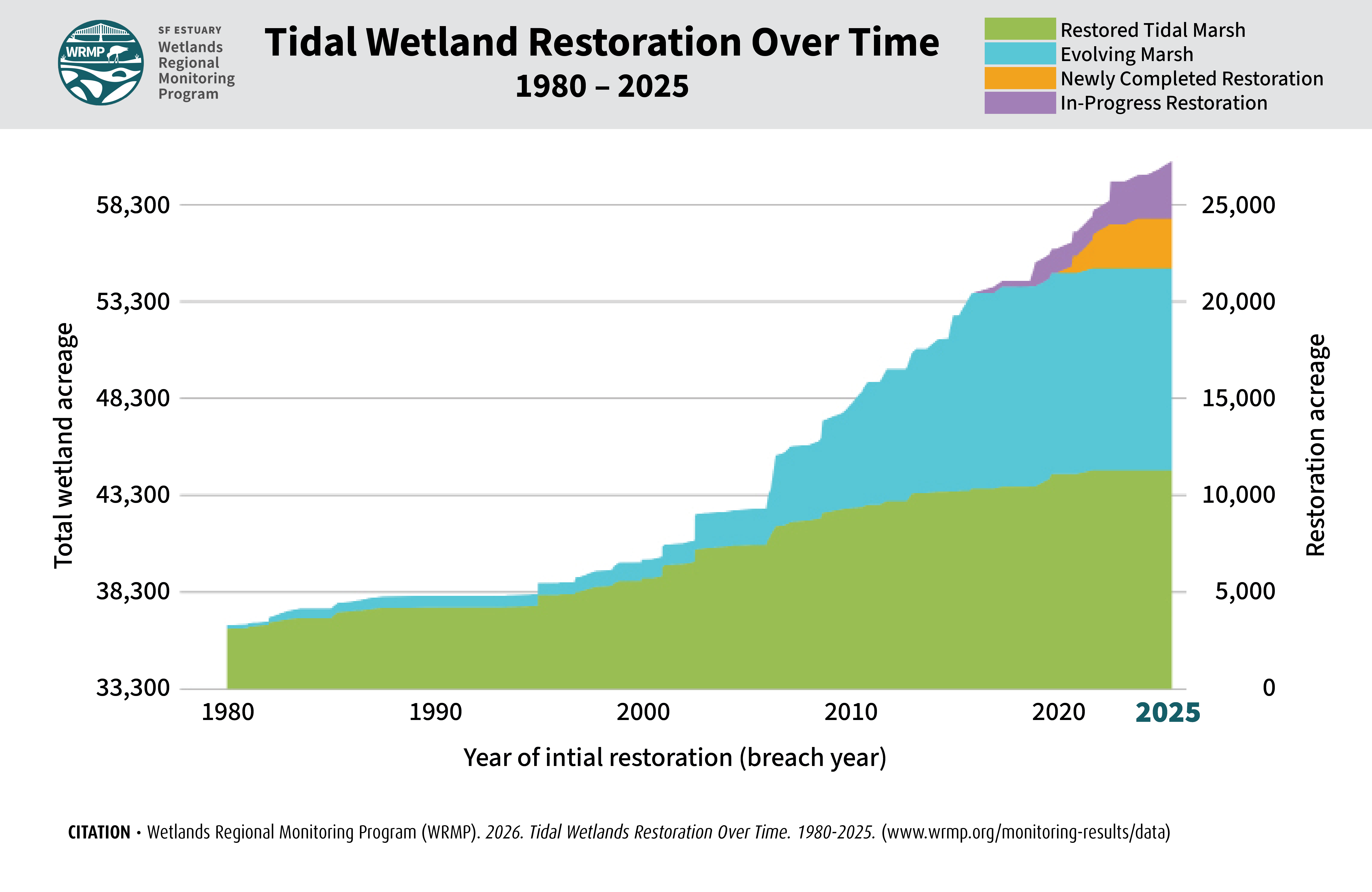
| 2025a | 57,400 | 33,300 | 11,100 | 10,400 | 2,600 | 3,000 |
|
Shaded cells not included in 'Total tidal wetland' value. aRestoration Map 2025 v1.0, BHM 2020 v1.3. |
||||||
How Reported Totals Have Changed Over Time
Our understanding of how much tidal wetland has been restored changes over time. These changes reflect changes on the ground, improvements in our knowledge, and updates to how habitats and restoration projects are defined and mapped. The reporting comes from two related datasets: (i) the Baylands Habitat Map (BHM), which maps habitats across the Bay; and (ii) the Project Tracker for Tidal Wetland Restoration Map (Restoration Map), which tracks the location and status of restoration projects.
The changes between 2024 and 2025 reporting include:
- Newly documented restoration: 180 acres of restoration completed before 2024 but added to the Restoration Map during the 2025 update.
- New work on the ground: No restoration projects were completed in 2025. However, work began on 450 acres of in-progress restoration, which is not included in the completed-restoration totals above.
- Data updates: 1,120 acres. We expanded the area evaluated to include Brown and Winter Island (680 acres), revised the boundaries of existing restoration sites, and incorporated updates to the BHM. These changes affect reported acreage but do not represent new restoration on the ground. A full accounting of changes attributable to data updates versus changes in on-the-ground conditions will accompany the BHM 2025 release.
Categories of Tidal Wetland Restoration
- Restored Tidal Wetland (green): areas within completed restoration projects that are mapped by BHM as tidal wetland.
- Evolving Wetland (blue): areas within completed restoration projects that are not currently functioning as tidal wetland (e.g., are mudflats or open water). Future change detection will help distinguish areas that are continuing to develop into functional tidal wetland from those where wetland development has stalled.
- Newly Completed Restoration (orange): areas that have been restored since the last BHM mapping update in 2020. These values are shown separately because their restored habitats have not yet been mapped in the BHM; therefore, we cannot distinguish between restored and evolving wetland in these areas.
- In-Progress Restoration (purple): sites where on-the-ground work has started but connection to the tides has not yet been restored. Some sites require years of work before they can be reconnected.
Key Data Source
For more information about the data source for this graphic, please see Project Tracker Tidal Wetland Restoration Map in San Francisco Bay
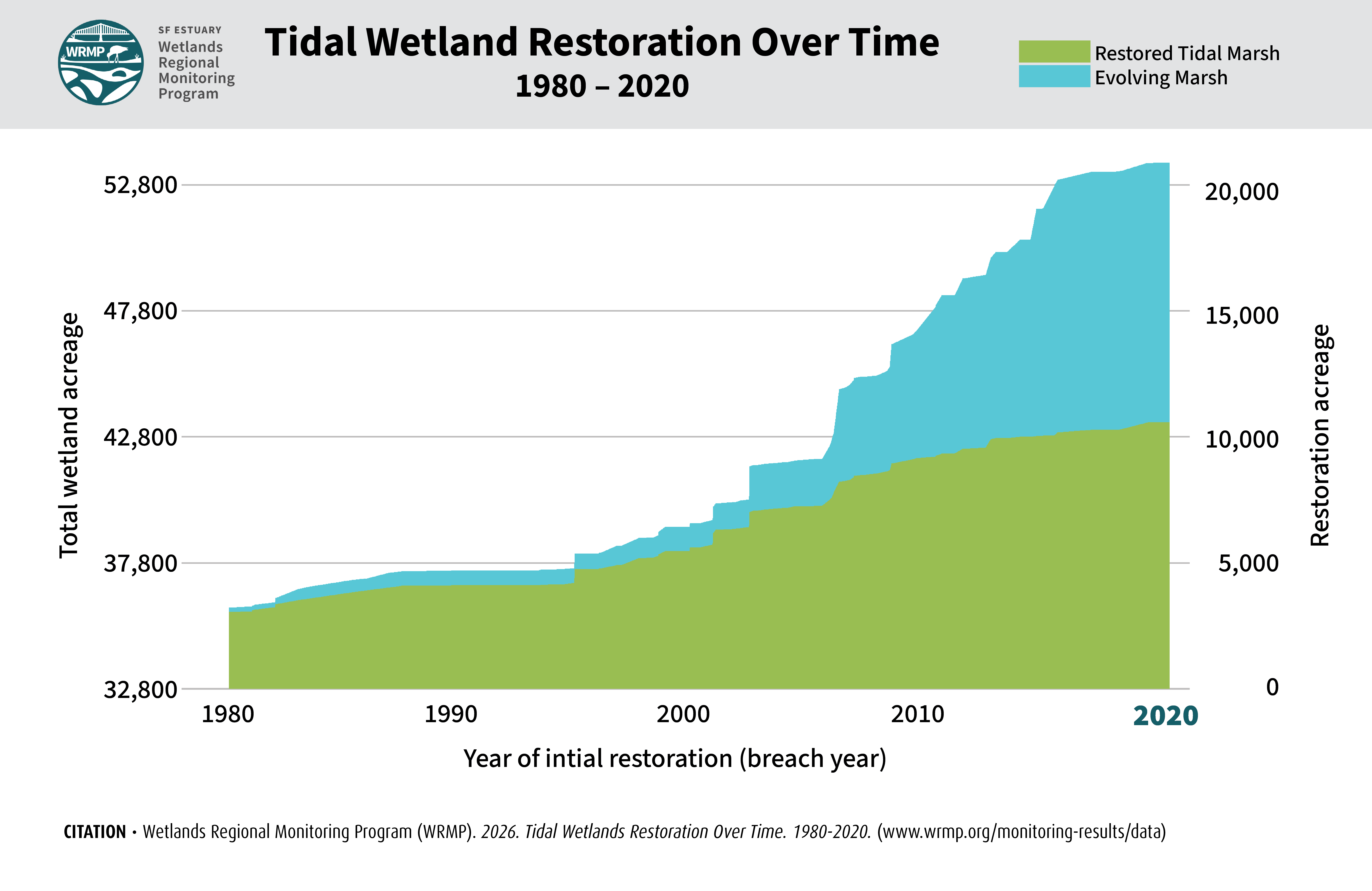
Wetlands Regional Monitoring Program (WRMP). 2026. Tidal Restoration Over Time using Project Tracker Tidal Wetland Restoration Layer 2020. 1980-2020.
Wetlands Regional Monitoring Program (WRMP). 2026. Tidal Restoration Over Time using Project Tracker Tidal Wetland Restoration Layer 2024. 1980-2024.
Wetlands Regional Monitoring Program (WRMP). 2026. Tidal Restoration Over Time using Project Tracker Tidal Wetland Restoration Layer 2025. 1980-2025. (https://www.wrmp.org/monitoring-results/data/)