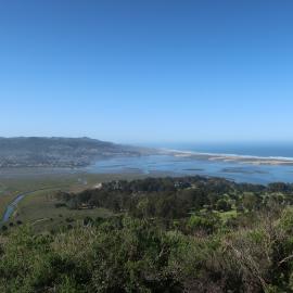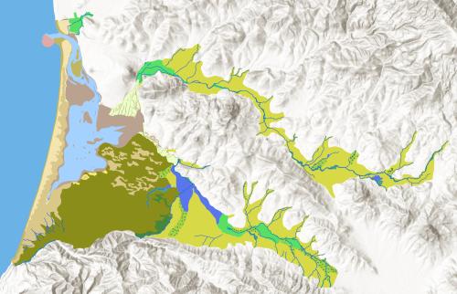
This mapping depicts the historical habitat types and channels of the Morro Bay estuary, the sandspit, and alluvial portions of Chorro Valley, Los Osos Valley, and lower Morro Creek downstream of highway 1, representing prevailing ecological conditions prior to substantial Euro-American modification (mid-1800s). The study area encompasses approximately 59 km2 (23 mi2) of the Morro Bay Watershed, but excludes the surrounding hillslopes outside of the valley floor areas. This project was funded by a grant from the U.S. Environmental Protection Agency in partnership with the Morro Bay National Estuary Program.
Extensive supporting information, including bibliographic references and research methods can be found in the accompanying report:
Satzman, B; Baumgarten, S; Casendino, H. 2026. Morro Bay Historical Ecology Study. San Francisco Estuary Institute, Richmond, CA. SFEI Contribution No. 1291.
This geodatabase contains two feature classes representing the historical landscape:
- MorroBay_Historical_Habitats
- MorroBay_Historical_Channels
A geographic information system was used to collect, catalog, and synthesize spatial data covering the study area. Historical maps were georeferenced and historical textual data was geolocated, allowing us to compare historical layers to each other. Spatial data synthesis and habitat mapping were conducted in ArcGIS Pro Version 3.5.0. Historical features were mapped through a process of manual digitization. Historical Channels were mapped as line features, and Historical Habitats were mapped as polygon features.
Each mapped feature was attributed with information about habitat classifi cation, digitizing source(s), supporting or interpretation sources, and certainty levels and notes. Three certainty levels were assigned to express the degree of certainty (high, medium or low) in a given feature’s shape, location and interpretation (i.e., classifi cation). Notes were included to provide additional clarifying information about how digitizing and interpretation sources were used to map the feature, especially in cases where a combination of sources were consulted.
San Francisco Estuary Institute and Aquatic Science Center (SFEI ASC). 2025. "Morro Bay Historical Habitats and Channels v1.0 GIS Data." Accessed [date retrieved]. https://www.sfei.org/data/morro-bay-historical-habitats-and-channels-gi….
Confidence or certainty varies geographically due to differences in source data or methods. This geodatabase provides direct information about the certainty level of each feature’s presence, shape, and location, noted in the fi elds titled Interp_Cert, Shape_Cert, and Loc_Cert, respectively. These certainty levels are rated as high, medium, or low. Referring to these attributes allows the user to assess the applicability of the data for the chosen technical question.
Technical users are strongly encouraged to read the full study report to gain a stronger understanding of the strengths and limitations of the dataset.
Disclaimer: In no event shall the creators, custodians, or distributors of this information be liable for any damages arising out of its use (or the inability to use it). These data are not legal documents or of survey quality and are not intended to be used as such. Although extensive effort has been made to produce error-free and complete data, all geographic information has limitations due to the scale, resolution, date and interpretation of the original source materials. Users should consult available data documentation (metadata) for these particular data to determine limitations and the precision to which the data depict distance, direction, location or other geographic characteristics. Data may be subject to change without prior notification. If this data is modified, changes should be documented in a metadata record that should accompany all redistributed data. If data is transmitted or provided in any form to another user, the data must be accompanied by a copy of this disclaimer and all documentation provided with the original data set, including the full metadata record. SFEI requests that the use of these data in any map, publication, or report should cite the data source(s) used and give proper attribution and credit to the originators of the data.