Working with Nature to Adapt to Sea Level Rise
The San Francisco Bay Area faces a major challenge with sea level rise. Without action, our region risks losing shoreline habitats – the baylands – and the critical services they provide, from flood protection to wildlife support to carbon sequestration.
Here’s the good news: nature can also be a part of the answer to this challenge. Nature-based solutions, or “NbS,” offer us ways to help protect Bay Area communities – particularly vulnerable shoreline communities – from sea level rise while also delivering other valuable services. NbS can also support the baylands, so these important ecosystems have a better chance of adapting to rising Bay waters.
SFEI has worked with many partners to create tools and data to help climate adaptation planners, regulators, community-based organizations, and others understand where and how to use NbS for sea level rise.
What are Nature-Based Solutions?
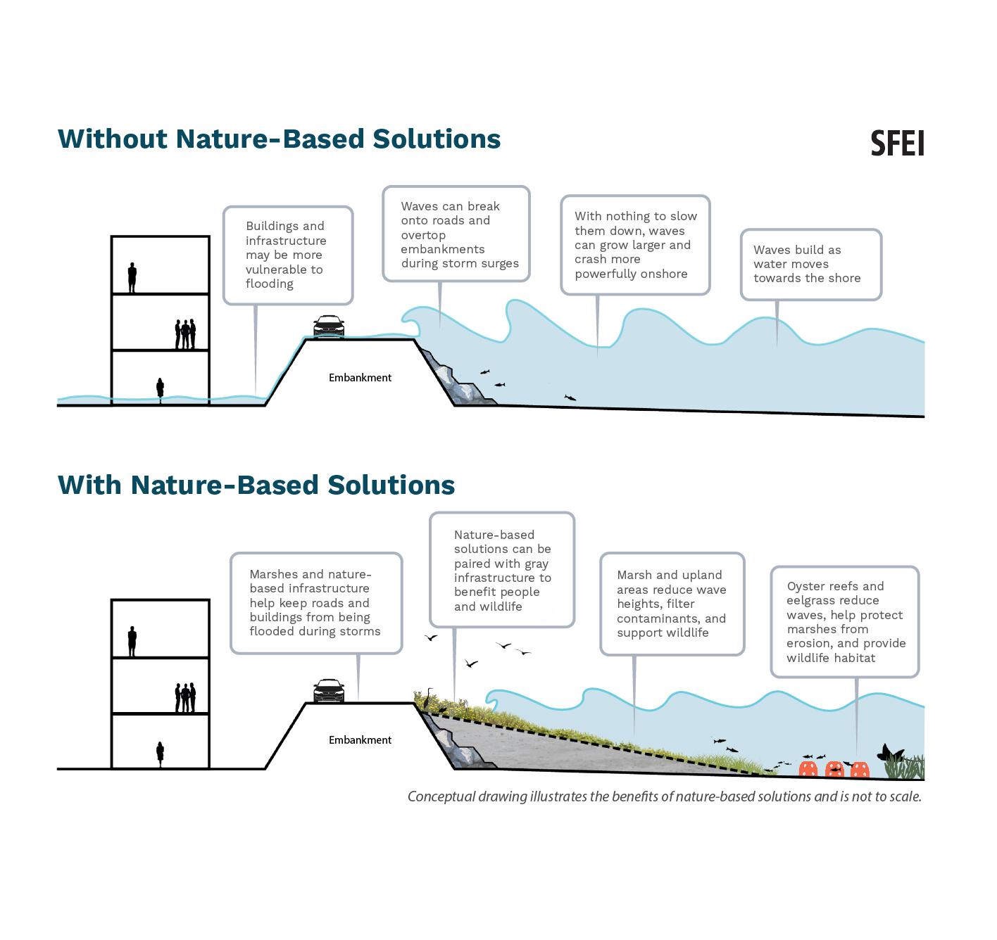
Nature-based solutions are management approaches that work with natural processes to address environmental and social challenges. NbS can help safeguard communities, ecosystems, and critical infrastructure from climate impacts like sea level rise and drought. They can also provide many other benefits, such as supporting biodiversity, improving water quality, and creating recreation opportunities. Examples of NbS for sea level rise include nearshore reefs, restored tidal marshes, and eelgrass plantings.
NbS can have lower overall costs over time, better adapt to change, and create more benefits compared to traditional gray infrastructure. Many communities will need to combine NbS strategies with traditional gray infrastructure, like seawalls and levees, to successfully prepare for and adapt to climate threats like sea level rise.
Using Nature’s Boundaries to Plan for Sea Level Rise
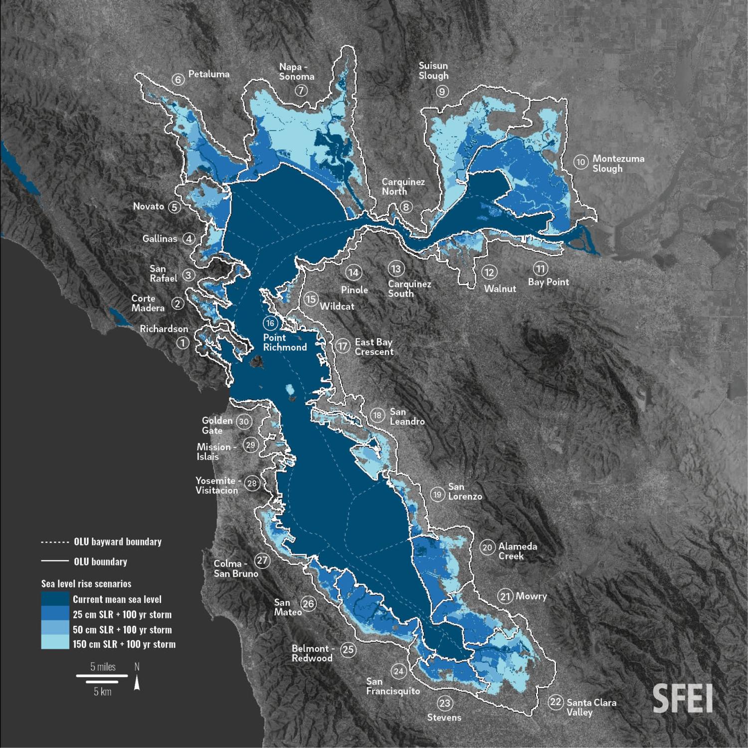
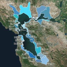
SFEI has created an innovative approach to plan for sea level rise in the San Francisco Bay Area: Operational Landscape Units, or “OLUs.” An OLU is a natural planning unit where the landscape shares certain physical characteristics and would benefit from being managed holistically. The Bay Area has 30 OLUs – they cross jurisdictional boundaries of cities and counties, but adhere to the boundaries of natural processes like tides, waves, and sediment movement. In other words, OLUs are “nature’s boundaries.”
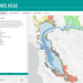
OLUs can help shoreline communities plan for and manage sea level rise risks in a more coordinated way. Ultimately, OLUs encourage climate adaptation planning at a scale appropriate for both people and the environment. Learn more about OLUs in SFEI’s S.F. Bay Shoreline Adaptation Atlas.
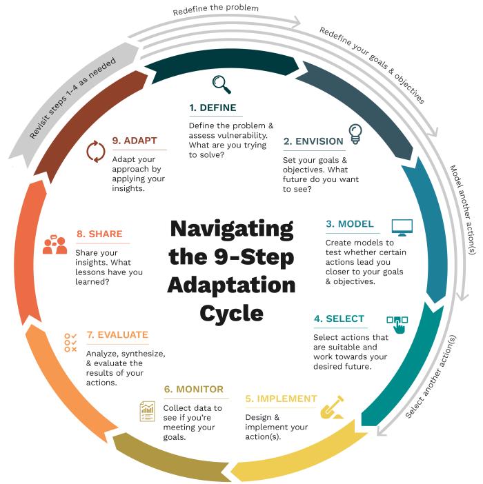
Where SFEI's Tools Fit into the Adaptation Cycle

|

|

|
|
What does success look like in the near- and long-term? Identify your goals and desired future. Use the Baylands Resilience Framework alongside regional habitat goals to identify which ecosystem services you would like to target. These insights can be used to define scenarios to model. |
Which actions align with your goals and objectives? Use modeling to test whether certain actions get you closer to your desired future. Use the Baylands Resilience Framework metrics to determine where NbS could help strengthen baylands resilience to sea level rise. For example, find places where restoring diked baylands to tidal marsh could create larger habitat patches or improve habitat connectivity. |
Which nature-based solutions are appropriate for your OLU? Assess initial suitability for your study area and then select strategies that work towards your goals. The Adaptation Atlas maps the suitability of 10 nature-based solutions across the entire San Francisco Bay. Use the Adaptation Atlas data to identify and select NbS potentially suitable for your study area, based on existing conditions. |
Latest News
Thu, Sep 18 2025
The Atlas for Regional Shoreline Adaptation Planning

Thu, Jun 5 2025
San Francisco Baylands Resilience Metrics Mapbook
Access the Tools
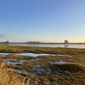

San Leandro Bay is located in the Central Bay, surrounded by the cities of Oakland and Alameda.
Historically, this area had extensive mudflats and tidal marshes. Since the mid-1800s, though, it has undergone widespread diking, draining, dredging, and filling. Today, San Leandro Bay’s shoreline is intensely developed and much of its historical baylands are gone – although small patches of critical habitat still exist.

The Oakland Alameda Adaptation Committee is creating plans and projects to accelerate sea level rise adaptation in its communities.
The committee was formed to pursue coordinated adaptation planning within the San Leandro OLU, and includes government and community partners from the cities of Oakland and Alameda. Since the committee formed, SFEI has provided it with technical support on NbS and we continue to serve as advisors. Our report, Adaptation Pathways: San Leandro Bay Operational Landscape Unit, helped jumpstart the committee’s efforts to use NbS in their sea level rise adaptation planning.
Photo: Maurice Ramirez

Ninth Root is an Oakland community-based organization and community advisor to the Oakland Alameda Adaptation Committee.
The organization is developing a climate resilience and community wellness project along the San Leandro Bay shoreline called ‘Sacred Spaces.’ With this project, Ninth Root plans to restore and enhance areas around Damon Marsh Trail in San Leandro Bay by using a variety of NbS, including oyster reefs.
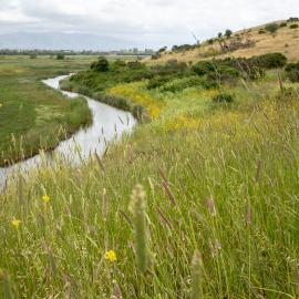
The Sacred Spaces site includes Damon Marsh, one of San Leandro Bay’s only remaining historical tidal marshes. The marsh is highly vulnerable to sea level rise because it is low in elevation and eroding from waves; NbS strategies will help it build elevation and migrate upslope as sea level rises. As a technical advisor for Ninth Root, SFEI used the Adaptation Atlas, the Baylands Resilience Framework, and other key data to determine NbS suitability for Damon Marsh and the rest of the project site.
Photo: Keta Price
MORE RESOURCES
Want to work with SFEI on Your Adaptation Project?
Get in touch.