Browse Our Stories
Thu, Sep 18 2025
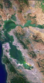
The Atlas for Regional Shoreline Adaptation Planning
The Regional Shoreline Adaptation Plan Atlas is a comprehensive resource for understanding and addressing the impacts of sea level rise along shorelines. Learn more about the San Francisco Bay Conservation and Development Commission's new tool to serve the best available science and information to a receptive community of municipal planners.

Wed, Aug 7 2024
Modeling outfall plumes with a web-based, open-source tool
The Software Engineering team has undertaken an effort to migrate an older Pascal codebase into a modern, opensource, web based platform.

Sat, Mar 9 2024
Enhanced Landscape Profile Modes in EcoAtlas deliver new insights
EcoAtlas is a mapping and geographic data visualization tool that continues to evolve to meet emerging needs. The toolset now includes new data layers and summaries to support the watershed planning, tracking, and reporting needs for the state.

Mon, Apr 18 2022
Monitoring for COVID in wastewater informs local, regional, and state public health departments
For 18 months, innovative data visualization of SARs-CoV-2 in wastewater samples informed local, regional, and state public health departments.

Fri, Apr 2 2021
Trees, Hydrology, Urban-Greening, and Nature-Based Solutions
Two key reports support nature-based solutions. Green stormwater infrastructure (GSI) and enhancements to the urban tree canopy offer benefits to stormwater management, urban ecological improvements, and complementary urban greening activities.
On KGO TV, these projects were featured on July 1, 2021.
Mon, Mar 1 2021
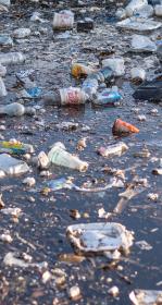
California Trash Monitoring Playbook now available
With the Ocean Protection Council-funded trash monitoring project concluded, the project team is eager to deliver its results to you.

Thu, Nov 21 2019
In a partnership with Kinetica, a data analytics start-up, and Oracle, SFEI and SCCWRP leveraged public funding from the California Ocean Protection Council to advance automated trash detection capabilities. The team deployed servers in the @Oracle Cloud to increase performance dynamically.

Mon, Mar 20 2017
GreenPlan-IT Site Locator Tool v2.1 Update
SFEI’s GreenPlan-IT is a planning level toolkit which help municipalities with green infrastructure planning, assessment and reporting.
Mon, Mar 20 2017
The Contaminant Data Display and Download Tool is a public tool for accessing and visualizing contaminant data. All data are comparable to CEDEN, the California Environmental Data Exchange Network.
We are happy to announce the release of some new enhancements to CD3 including: