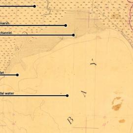
SFEI's Resilient Landscape Program recently completed a "reconnaissance" historical ecology study of San Diego's Mission Bay. This targeted project collected high-priority historical data (such as maps, photographs, and texts) that shed light on how Mission Bay and the surrounding region looked and functioned prior to major landscape modification during the 19th and 20th centuries.
The rich historical dataset reveals a complex and diverse landscape. In the Bay proper, islands of marsh grass were subject to the ebb and flow of the tides. Along the Bay's north shore, liberal growths of sycamores, willows, and oaks lined the former course of Rose Creek. To the south the San Diego River alternated between Mission Bay and San Diego Bay, building a great sandy delta (dotted with fresh-water ponds and willow groves) that extended between the two bays. To the west rolling sand dunes fifteen feet high covered what is now Mission Beach.
The historical ecology study, funded by the San Diego Audubon Society and the California Coastal Conservancy, was designed to support 'ReWild Mission Bay,' a three-year project led by San Diego Audubon to develop wetland restoration plans for the northeast corner of Mission Bay. SFEI staff presented its findings to the ReWild Mission Bay Science & Technical Advisory Committee, the Wetlands Working Group, and project consultants charged with developing an Existing Conditions Report. The historical ecology work has also been utilized as an educational resource at public stakeholder meetings. It is SFEI’s hope that the historical data, initial findings, and key questions raised by this reconnaissance study will serve as the foundation for an in-depth study into Mission Bay’s past that can be used to inform future restoration efforts and management decisions in the region.