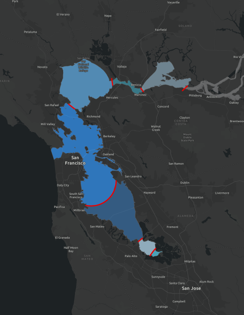
These are the official segments and associated boundaries for the Regional Monitoring Program (RMP) for Water Quality in San Francisco Bay. This geodatabase contains four layers:
- Official RMP Segments
- Cartographic RMP Segments
- Official RMP Bay Sample Frame
- Official RMP Margin Sample Frame
The cartographic segments differ from the official ones in that the boundary between the Central and South bay is a single arc instead of the official squiggly and exact demarcation of the boundary that is based off of bathymetry data and is used for dividing the sample frame areas.
San Francisco Estuary Institute (SFEI). 2026. "RMP Segments version 1.0". Accessed [date retrieved]. https://www.sfei.org/data/RMP_Segments
This file is part of RMP Segments.
RMP Segments is free data: you can redistribute it and/or modify it under the terms of the GNU General Public License as published by the Free Software Foundation, either version 3 of the License, or (at your option) any later version.
RMP Segments is distributed in the hope that it will be useful, but WITHOUT ANY WARRANTY; without even the implied warranty of MERCHANTABILITY or FITNESS FOR A PARTICULAR PURPOSE. See the GNU General Public License for more details.
More information about GNU General Public License is available at http://www.gnu.org/licenses/. SFEI data are available without restriction upon use with the following caveats. Prudent usage, knowledge of the data quality, and professional courtesy should all be considered in obtaining and using SFEI data. As this dataset is NOT a survey document, neither use it as such nor use it beyond the limits of the source scale. Please read and fully comprehend all available metadata prior to data use. SFEI requests that the use of these data in any map, publication, or report should include citation of the data source(s) used and give proper attribution and credit to the originators of the data. Questions about SFEI data may be directed to the SFEI GIS team at [email protected].