Providing Planning and Design Guidance
Project: San Francisco Bay Shoreline Adaptation Atlas
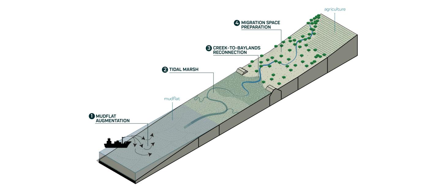
As sea levels rise, bay edge communities will need to create greater social, economic, and ecological resilience. SFEI developed a science-based framework for identifying site-appropriate adaptation strategies that take advantage of natural processes. The success and impact of the project is in part due to the integral role of design to communicate our findings and translate data into compelling guidance. For example, 3-dimensional images like this one emphasize the importance of building a cohesive strategy instead of a piecemeal approach.
Focus Area:
Providing Planning and Design Guidance
Providing Planning and Design Guidance
Project: Ecology for Health
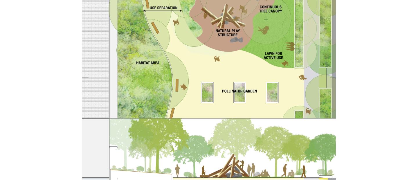
SFEI’s Ecology for Health study combines research on public health, landscape design, urban planning, and ecology to offer design guidance on how to build green spaces that promote human health and wellbeing while supporting biodiversity. We used illustrative plan view and cross-sectional drawings to demonstrate how ecological best practices can be translated into actionable design guidance across different scales.
Focus Area:
Providing Planning and Design Guidance
Providing Planning and Design Guidance
Project: Ecological Horticulture at the Presidio
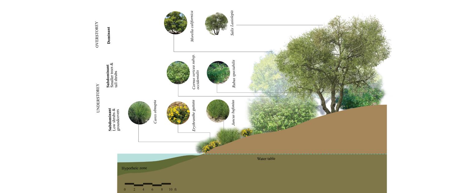
SFEI developed landscape design recommendations for urban areas inspired by the unique native habitats that once thrived in the region. Our historical ecology research shaped design by visually representing historical habitat types, such as the section of historic riparian habitat shown here. The graphic provides key information such as the height and canopy cover of vegetation that can help designers mimic natural habitat types in urban settings. Landscape design guidance recommendations, design specifications, and plant palettes were developed to further support the ecological design.
Focus Area:
Providing Planning and Design Guidance
Providing Planning and Design Guidance
Project: Delta Wetland Futures: Tidal Marsh Resilience to Sea Level Rise
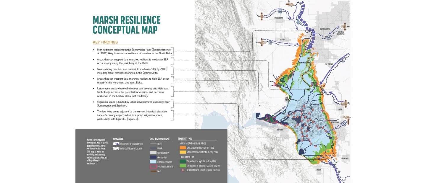
To inform wetland restoration planning in the Sacramento-San Joaquin Delta, SFEI mapped tidal wetland resilience for the past, present, and a range of future restoration and sea level rise scenarios. We visualized the findings in a detailed map connecting restoration concepts with real places. Conceptual maps like this one summarize modeled findings while acknowledging the uncertainties inherent in modeling. This work is part of the larger Landscape Scenario Planning Tool, which helps land use planners plan, evaluate, and manage restoration projects.
Focus Area:
Providing Planning and Design Guidance
Providing Planning and Design Guidance
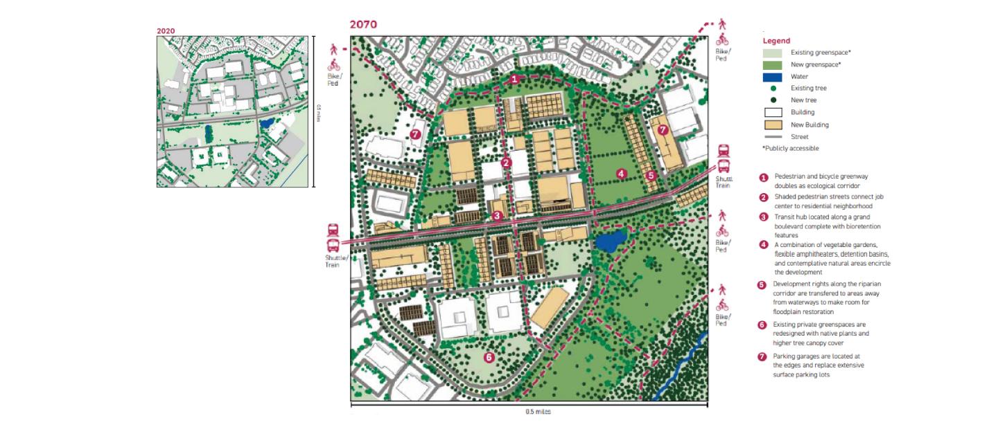
Project: Integrating Planning with Nature
In collaboration with SPUR and the Santa Clara Valley Open Space Authority, SFEI developed planning and policy recommendations for integrating nature-based solutions across the urban-to-rural gradient. Using the City of San José and the nearby Coyote Valley as a case study, the report quantifies the benefit of nature-based solutions and offers recommendations for implementation. The example shown here highlights how surface parking lots within office parks could be repurposed as large connected greenspaces that offer multiple benefits for people, plants, and wildlife.