Project: Delta Wetland Futures: Tidal Marsh Resilience to Sea Level Rise
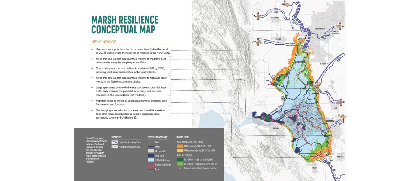
To inform wetland restoration planning in the Sacramento-San Joaquin Delta, SFEI mapped tidal wetland resilience for the past, present, and a range of future restoration and sea level rise scenarios. We visualized the findings in a detailed map connecting restoration concepts with real places. Conceptual maps like this one summarize modeled findings while acknowledging the uncertainties inherent in modeling. This work is part of the larger Landscape Scenario Planning Tool, which helps land use planners plan, evaluate, and manage restoration projects.