Project: Tijuana River Valley Historical Ecology Investigation
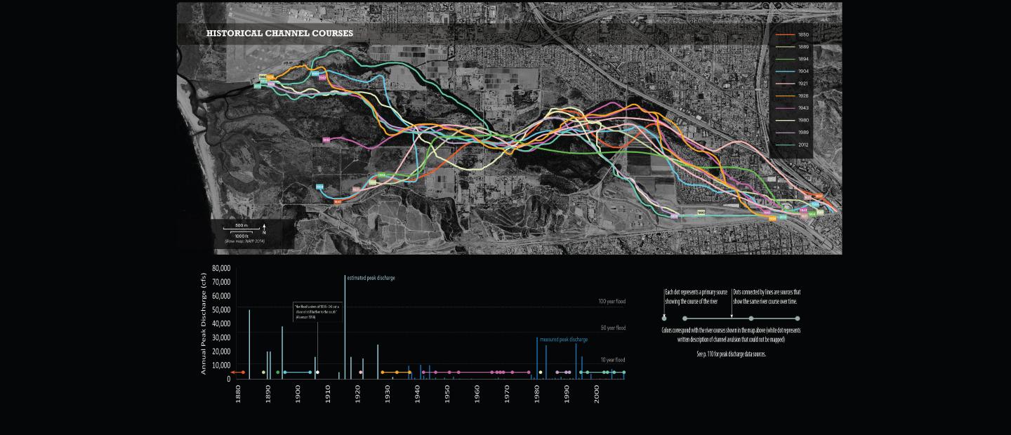
Within every landscape lies the story of its evolution. At SFEI, we often tell that story through maps, data, and historical photographs. Understanding how humans have changed the landscape creates the foundation to understanding how landscapes work today and how they will change in the future. This map depicts many of the major courses the Tijuana River has taken since 1848. Plotting the courses onto a chart of peak annual discharge helps illustrate the relationship between river movement and high flow events. This combination of maps and data can be used to explain the Tijuana River today.