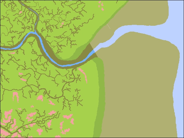
This dataset includes reconstructed habitat types and ecological characteristics of the Novato Creek Baylands, representing average dry-season conditions prior to substantial Euro-American modification (~late 1700s-late 1800s).  Documentation of historical ecological conditions is intended to serve as a tool to help support and guide wetland restoration and flood risk management along lower Novato Creek. 

This dataset was produced as part of the Flood Control 2.0 project which is funded by the EPA Water Quality Improvement Fund. It updates and adds detail to the existing Historical Baylands GIS (EcoAtlas v1.50b4, SFEI 1998)

Creation Date: 
Wednesday, October 28, 2015
Last Updated: 
Wednesday, October 28, 2015
Type of Data: 
GIS vector dataset
Programs and Focus Areas: 
Resilient Landscapes Program
Historical Ecology
Watershed Science & Management
Location Information
Data Availability
Please Cite This Dataset as: 

San Francisco Estuary Institute (SFEI). 2015. "Novato Creek Historical Ecology GIS Data." Accessed [date retrieved]. http://www.sfei.org/data/novato-creek-historical-ecology-gis-data.

Terms of Use: 
Copyright 2015 San Francisco Estuary Institute.
 
This file is part of  Novato Creek Historical Ecology Study GIS Data.
 
Novato Creek Historical Ecology Study GIS Data is free data: you can redistribute it and/or modify it under the terms of the GNU General Public License as published by the Free Software Foundation, either version 3 of the License, or (at your option) any later version.
 
Novato Creek Historical Ecology Study GIS Data is distributed in the hope that it will be useful, but WITHOUT ANY WARRANTY; without even the implied warranty of MERCHANTABILITY or FITNESS FOR A PARTICULAR PURPOSE.  See the GNU General Public License for more details.
 
You should have received a copy of the GNU General Public License along with Novato Creek Historical Ecology Study GIS Data. If not, see http://www.gnu.org/licenses/.
Data File(s):