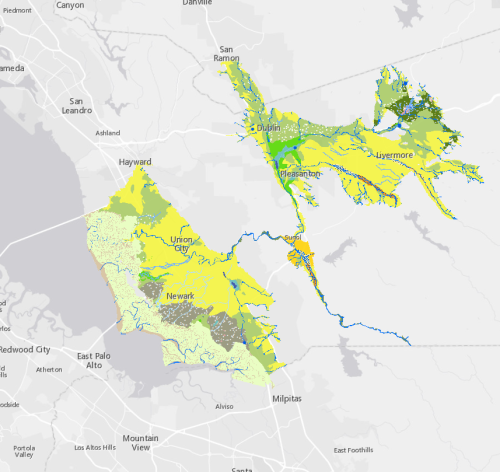
Alameda Creek Historical Ecology GIS Data
Last Updated
Type of Data
GIS vector dataset
General Project Location(s)
Alameda Creek
Terms of Use
Copyright 2013 San Francisco Estuary Institute.
This file is part of Alameda Creek Historical Ecology GIS Data.
Alameda Creek Historical Ecology GIS Data is free data: you can redistribute it and/or modify it under the terms of the GNU General Public License as published by the Free Software Foundation, either version 3 of the License, or (at your option) any later version.
Alameda Creek Historical Ecology GIS Data is distributed in the hope that it will be useful, but WITHOUT ANY WARRANTY; without even the implied warranty of MERCHANTABILITY or FITNESS FOR A PARTICULAR PURPOSE. See the GNU General Public License for more details.
You should have received a copy of the GNU General Public License along with Alameda Creek Historical Ecology GIS Data. If not, see http://www.gnu.org/licenses/.
Contact
Keywords
Alameda Creek
Altamont
Alvarado
Arroyo de la Laguna
Arroyo de las Positas
Arroyo del Valle
Arroyo Mocho
Dublin
Fremont
GIS
Hayward
Liverm
Mission San Jose
Newark
Niles
Niles Canyon
Pleasanton
San Ramon
San Ramon Creek
Sunol
Union City
Downloadable Datasets
Programs and Focus Areas
Environmental Informatics Program
Geographic Information Systems (GIS)
Resilient Landscapes Program
Historical Ecology