April Robinson

April Robinson
Senior Scientist
Resilient Landscapes Program
Carbon, Ecosystems & Climate
Delta Science & Management
510-746-7344
Bio coming soon.
Related Projects, News, and Events
 Baylands Change Basemap (Project)
The Baylands Change Basemap will update the existing map of tidal marsh, tidal flats and diked baylands to incorporate the many changes in baylands distribution and abundance that have occurred over the last two decades. It will also include new information about land use and infrastructure that affects baylands restoration and management constraints and opportunities. To ensure the map is as up-to-date as possible, the project will develop procedures for ongoing local updates and change detection to cost-effectively maintain the basemap’s high value.
 Sediment Solutions (Project)
Sediment Solutions is a timely and innovative project that builds on SFEI’s past work, operationalizing cutting-edge science to inform management approaches that take advantage of natural processes to provide more creek sediment to baylands, increase climate resilience, and enhance creek health. With study areas in North Bay, East Bay, and South Bay, the project will provide new guidance for management strategies that support flood risk management and ecosystem health benefits throughout the region.
 Delta Wetlands and Resilience: Blue Carbon and Marsh Accretion (Project)
Restoring wetlands in the Sacramento-San Joaquin Delta (Delta) can mitigate subsidence, sequester carbon, reduce GHG emissions, and provide habitat for wetland dependent species. These benefits–their magnitude, scope, and resilience to future sea level rise–depend on the type and siting of new wetlands; rates of carbon accumulation, GHG emissions, and vertical accretion; and opportunities for wetlands to migrate upslope.
 Restoration Plan for the Laguna de Santa Rosa (News)
The Laguna de Santa Rosa, an expansive freshwater wetland complex located in the Russian River watershed of Sonoma County, CA, is a vital ecological and cultural resource that has undergone considerable change over the past 150 years. Land conversion for agriculture and development have led to a decrease in habitat for native species within the Laguna and an increase in the delivery of streamflow, fine sediment, and nutrients to the Laguna.
 Laguna de Santa Rosa Master Restoration Plan (Project)
The Laguna de Santa Rosa is an expansive freshwater wetland complex that hosts a rich diversity of plant and wildlife species, and is also home to a thriving agricultural community. Since the mid-19th century, modifications to the Laguna and its surrounding landscape have degraded habitat conditions for both wildlife and people.
 Suisun Landscapes (Project)
The largest brackish marsh on the West Coast, Suisun Marsh is a unique transitional landscape between San Francisco Bay and the Sacramento-San Joaquin Delta. The Marsh supports high ecological diversity and has long been managed for recreational hunting and native species support, yet it is threatened by an uncertain future under climate change. Effective adaptation in Suisun will require coordinated, science-based planning by agencies and private landowners.
 Restoration Plan for the Laguna de Santa Rosa Completed! (News)
SFEI completed a Restoration Plan for the Laguna de Santa Rosa in the Russian River watershed. SFEI, Sonoma Water, and the Laguna de Santa Rosa Foundation worked with technical advisors, stakeholders, tribal representatives, and local landowners to develop the Restoration Plan that provides a restoration planning framework and conceptual designs for multi-benefit habitat restoration projects that support people and wildlife.
 Blue Carbon Science to Support Climate Action (Project)
Working with other scientists, agency staff, and regional and state-level managers and planners, we are building alignment and capacity for blue carbon quantification through science synthesis, outreach, and mapping.
 Delta Landscapes Primary Production (Project)
Primary Production, the amount of tissue generated by photosynthetic organisms (e.g., plants and algae) over time, forms the basis of food webs. The Sacramento-San Joaquin Delta has unusually low primary productivity relative to other estuaries (Cloern et al. 2014, Jassby et al. 2002). Food availability has been identified as one contributor to the multi-stressor problem of pelagic organism decline in the Delta (Baxter et al. 2010). But, the constraints on primary production and the relative importance of different production sources to the food web are major uncertainties in this system. Landscape configuration and hydrodynamics are major drivers of primary production dynamics, and understanding how the extensive historical changes in the Delta’s landscape have altered the system’s potential for supporting wildlife and human populations can inform restoration planning and management across the region. Investigating basics about primary production in the Delta can guide us towards better restoration and management decisions.
 Introducing the Landscape Scenario Planning Tool Version 2.0 (News)
In partnership with the Delta Stewardship Council, the San Francisco Estuary Institute has developed version 2.0 of the Landscape Scenario Planning Tool, a GIS-based analysis toolkit to evaluate user-designed land use and restoration scenarios for the Sacramento-San Joaquin Delta and Suisun Marsh. This free mapping toolbox brings together ten years of science-based research and peer-reviewed methods for California’s Delta-Suisun region.
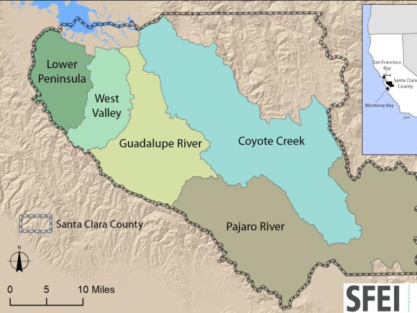 Santa Clara Valley Water District Priority D5 Project's Watershed Condition Assessments (2010 to present) (Project)
https://www.valleywater.org/project-updates/2012-d5-ecological-data-collection-and-analysisSFEI and the Santa Clara Valley Water District's (Valley Water) Priority D-5 Project have been conducting baseline ecological condition assessments in Santa Clara County, CA to characterize the distribution and abundance of stream and wetlands in five major watersheds, and to assess the overall ecological conditions of streams in the watersheds based on the California Rapic Assessment Method for streams (CRAM). The surveys employ the state's recommended Wetland and Riparian Area Monitoring Plan's watershed aproach that includes the use of GIS-base maps of aquatice resources (BAARI), and spatially-balanced ambient stream condition surveys using CRAM.
 Tahoe WRAMP Demonstration: Watershed Assessment (Project)
The Tahoe WRAMP Watershed Demonstration Project transferred statewide wetland monitoring and assessment tools to Sierra Nevada environmental agencies and organizations by conducting a pilot study that evaluated the distribution and abundance of wetlands, and the overall ecological condition of streams in two watersheds within the Lake Tahoe Basin.
 Suisun Landscapes (Project)
As the largest brackish marsh on the West Coast, Suisun Marsh is a unique transitional landscape between the Bay and the Delta portions of the Estuary. The Marsh has long been managed for recreational hunting and native biodiversity, yet it is threatened by an uncertain future under climate change. Sea level rise and increasing salinity pose significant threats to the current structure and uses of the Marsh. Likely impacts include conversion of wetlands to open water, changes in species composition, increased flood risk, and drainage challenges in managed wetlands.
 Russian River Watershed Projects at the San Francisco Estuary Institute (Project)
Our projects in the Russian River Watershed help us to understand our past, understand our present, and envision our future. Learn more about what SFEI is doing in partnership with others to advance our scientific understanding of this valuable landscape.
 Baylands Ecosystem Habitat Goals Project (Project)
SFEI's Letitia Grenier served as lead scientist of the Baylands Ecosystem Habitat Goals Project, which yielded a report called The Baylands and Climate Change: What We Can Do. The report is an update to the 1999 Baylands Ecosystem Habitat Goals, which for the first time set comprehensive restoration goals for the San Francisco Bay estuary. Produced by a collaborative of 21 management agencies working with a multi-disciplinary team of over 100 scientists, it synthesizes the latest science—particularly advances in the understanding of climate change and sediment supply—and incorporates projected changes through 2100 to generate new recommendations for achieving and sustaining healthy baylands ecosystems.

 South Baylands Mercury Project (SBMP) (Project)
We have developed biosentinel species indicators for wetlands to help the SBMP management team make decisions relative to mercury risk about where and how to restore salt ponds to wetlands. 2008 was the third and last year of a project to characterize and monitor bio-available mercury and its uptake into local food webs of the South Bay managed ponds and intertidal habitats, focusing initially on Pond A8 and Alviso Slough. Results indicated that this approach can be used to guide management decisions about wetlands restoration locations.
 "A Delta Renewed" report released at the 2016 Bay-Delta Science Conference (News)
The San Francisco Estuary Institute (SFEI) released A Delta Renewed – A Guide to Science-Based Ecological Restoration in the Sacramento-San Joaquin Delta.
 Announcing the release of Re-Oaking Silicon Valley: Building Vibrant Cities with Nature (News)
Could restoring lost ecosystems to cities play a role in building ecological resilience across landscapes? In Re-oaking Silicon Valley, a new report by SFEI, we explore this opportunity in our region. Both beautiful and functional, native oaks can be excellent choices for streetscapes, backyards, and landscaping. Requiring little water after establishment, oaks can save money by reducing irrigation requirements while sequestering more carbon than most other urban trees common to our region.
 North Bay Mercury Biosentinel Monitoring (Project)
In 2011-2014 SFEI and UC Davis developed and implemented a multi-species biosentinel monitoring approach as an effective and efficient way of monitoring methylmercury exposure in wetland restoration projects across the North Bay. The monitoring design for this project was developed with input from a Science Advisory Group (SAG) of regional and national experts and input from local stakeholders, in order to build a design that would address questions of management concern.
- 1 of 2
- next ›