Home
  • About
    • About Us
    • Our Staff
    • Board of Directors
      • Meetings
    • Diversity, Equity, Inclusion, and Justice
    • Operations Team
    • Our Partners
    • Employment Opportunities
    • RFPs
    • Newsletter
    • Calendar
  • Programs & Projects
    • All
    • Clean Water
      • Regional Monitoring Program for SF Bay
    • Environmental Informatics
    • Resilient Landscapes
      • Historical Ecology
      • Shoreline Resilience
      • Delta Science & Management
      • Wetland Monitoring & Assessment
      • Watershed Science & Management
      • Terrestrial Ecology
      • Urban Nature Lab
  • Library
  • Data Center
    • Shallow Groundwater Mapping: Alameda, Marin, San Francisco, and San Mateo Counties
  • Search
  • Support SFEI

Preparing for the Storm

Home


Preparing for the Storm

Catalyzed by the extensive damages caused by the Winter 2016-2017 storms and the opportunity to align flood response with major habitat improvement, Preparing for the Storm is an innovative public-private partnership to improve watershed health and resilience in the Alameda Creek watershed.

The team of scientists, planners, and managers is establishing integrated science and tools to improve water quality, habitat, and flood benefits along Arroyo de la Laguna and Arroyo Mocho. The grant leverages flood-related funding to implement high-priority, multi-benefit projects. These and other projects informed by this work will re-establish floodplain and riparian habitat including rare Sycamore Alluvial Woodland habitat, reduce flood risks, advance regional green stormwater infrastructure planning, and encourage the regular beneficial reuse of coarse sediment derived from flood control channels, and resolve water quality and sediment erosion hotspots. Supporting the establishment of a proactive, process-based approach to address the dual challenges of climate change and urbanization, Preparing for the Storm provides a regional model for enhancing hydrological and ecosystem resilience.

Preparing for the Storm is an exciting partnership between Zone 7 Water Agency, the San Francisco Estuary Institute, H.T. Harvey & Associates, and the San Francisco Bay Joint Venture, with valuable contributions from the City of Dublin, City of Pleasanton, City of Livermore, and Castlewood Country Club. The project was funded by the San Francisco Bay Water Quality Improvement Fund, EPA Region IX.

Project Components

  • Urban Greening
  • Coarse Sediment Reuse
  • Water Quality and Habitat
  • Sycamore Alluvial Woodland
  • Implementation Projects
  • Outreach

Urban Greening

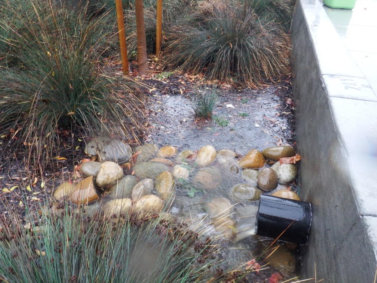
This effort is intended to provide planning-level regional guidance for placement of green stormwater infrastructure (GSI) in Livermore-Amador Valley. This work, presented in the report “Green Stormwater Infrastructure Planning-level Analysis for Livermore-Amador Valley”, identifies potential GSI locations and quantifies contaminant load and stormwater runoff volume reduction benefits through the application of GreenPlan-IT, a planning tool developed by the San Francisco Estuary Institute and regional partners. Addressing regional challenges to address water quality and flooding concerns requires common sources of information for identifying opportunities for high-priority, multi-benefit stormwater projects. Achieving the goals and requirements of the San Francisco Bay Municipal Regional Stormwater Permit through GSI implementation by cities can also serve stream management goals for flood protection, adequate water supply, and healthy habitats. An intended outcome of this work is to enhance communication and coordination between Zone 7 and the cities of Dublin and Pleasanton. 

Uses of the results from this application of GreenPlan-IT include: 1) identifying priority subcatchments and suitable locations for GSI at a multi-jurisdictional scale; 2) supporting Zone 7 and city communication and collaboration to leverage funding for multibenefit projects; and 3) informing future planning efforts, including GSI plans and the Zone 7 Flood Master Plan. Ultimately, the urban greening analysis by the Preparing for the Storm partnership is intended to help enhance stream and watershed resilience, reduce peak flows, and improve water quality.

Resources

View and download the report
Download analysis results maps and tables
Learn more about GreenPlan-IT and download the toolkit

For more information and to request input data files to re-run the analysis, contact [email protected]

Historic and current regional management of watersheds and channels for water supply and flood control across the San Francisco Bay Area has cut off much of the coarse sediment that was historically delivered to the Bay. Future projections indicate that sediment supply will not meet the demand from extant and restored tidal marshes to keep up with sea level rise.

As part of the Preparing for the Storm grant, SFEI, the San Francisco Bay Joint Venture, and Zone 7 Water Agency have led an effort to support the development of a successful regional coarse sediment reuse strategy. Development of such a strategy requires understanding of logistical and regulatory hurdles and identification of key strategies for breaking down barriers. One potential solution for meeting the sediment demand along the Bay margin is to utilize coarse sediment that is removed from flood control channels by public agencies. To-date, very little of this sediment that is removed is beneficially reused for restoration along the Bay shoreline. The current economic and regulatory framework around sediment removal presents many challenges, barriers and lack of incentives for agencies to reuse their sediment.

This work represents a step forward towards beneficially reusing coarse flood control channel sediment by outlining reuse challenges, and identifying incentives for participation and potential solutions. It involves four primary components: 1) virtual workshop convened to engage a large and diverse set of stakeholders from the region to gain knowledge and feedback from their experience in removing, transporting, reusing, and permitting coarse sediment, 2) production of a strategy memo, “Towards a Coarse Sediment Strategy for the Bay Area”, and 3) support of the SediMatch Program (see factsheet here), including an update and expansion of the SediMatch webtool to better address coarse sediment. 

Breaking down challenges and barriers to coarse sediment reuse will require cooperation and involvement from the entire community of stakeholders, as well as the utilization of a range of strategies.

View and download the report


Meeting human and ecological needs within San Francisco Bay’s watersheds is increasingly challenged by flooding, water quality degradation, and habitat loss, exacerbated by intensified urbanization and climate change. Addressing these challenges requires implementing multi-benefit strategies through new partnerships and increased coordination across the region’s diverse landscapes. Actions to improve water quality and enhance habitat for biodiversity in our highly developed and managed landscapes can help the region as a whole to build resilience to withstand current pressures and future change.

As part of the Preparing for the Storm grant, the analysis and technical report, “Wildlife Habitat and Water Quality Enhancement Opportunities at Castlewood Country Club,” presents a synthesis of water quality and habitat improvement opportunities for a golf course of Castlewood Country Club (“Castlewood”). These opportunities at Castlewood stand to contribute to improved resilience within the region. Castlewood borders the Arroyo de la Laguna, the major creek and riparian corridor draining Livermore Valley, which is experiencing substantial changes to its channel morphology (incision and widening, leading to bank erosion and bank failures). Likely further development upstream and climate change amplify the importance of enhancing conditions at Castlewood.

In recent years, Castlewood has worked on sustainability measures and there is interest in continuing these efforts and achieving recognition as environmental stewards. The identified opportunities from this effort are intended to support informed management decisions that will improve the ability of Castlewood’s Valley Course to protect water quality and enhance habitat for native wildlife.

View and download the report


Sycamore alluvial woodland (SAW) is a rare and important habitat type, not only for riparian species, but because of the unique stream conditions it requires and supports, which also limits restoration opportunities. It is recognized to be relatively resilient to climate change because of its tolerance for extreme drought and flood. The Valley’s streams historically supported wide braided channels characterized by sycamore trees, and open spaces and parks represent rare opportunities to recover SAW.

As part of Preparing for the Storm, this effort will build an understanding of the SAW characteristics and conditions in the Valley, draw on other SAW studies in the region, and identify SAW restoration strategies. Part of this calculus includes understanding sediment and hydrological requirements of SAW including analysis of soils, hydrology, and geomorphology. This information will assist Zone 7, park districts and other landowners (such as local vineyards) by providing guidance for SAW restoration and mitigation activities. 

Please check back for more information.

Resources

Alameda Creek Watershed Forum

  • View and download associated presentation
  • View and download poster for Contra Costa Watershed Symposium, December 2019

Using the science understanding and tools developed in other tasks, Zone 7 will work with other streamside property owners (e.g., Livermore Area Regional Park District) to create sustainable aquatic and riparian habitat improvements.

Please check back for more information.

The project team will conduct participatory outreach in collaboration with the Living Arroyos watershed stewardship program, involving volunteers in the implementation projects. Project results will be presented to key stakeholder audiences through local and regional workshops, seminars, and conferences (e.g., Contra Costa Watershed Forum). 

Please check back for more information.

Preparing for the Storm

Dates: 
2017 to 2021
Partners: 
Alameda County Flood Control & Water Conservation District, Zone 7
San Francisco Bay Join Venture
H.T. Harvey & Associates
City of Dublin
City of Pleasanton
City of Livermore
Castlewood Country Club
Funders: 
US EPA
Associated Staff: 
Ruth Askevold
Letitia Grenier
Cristina Grosso
Kendall Harris
Pete Kauhanen
Lester McKee
Katie McKnight
Sarah Pearce
Ellen Plane
Alison Whipple
Tan Zi
Julie Beagle
Gloria Desanker
Amy Richey
Jing Wu
Key Materials: 
Green Stormwater Infrastructure Planning-level Analysis for Livermore-Amador Valley
Sycamore Alluvial Woodland Presence and Distribution
Towards a Coarse Sediment Strategy for the Bay Area
Wildlife Habitat and Water Quality Enhancement Opportunities at Castlewood Country Club
Programs and Focus Areas: 
Clean Water Program
Design and Communications
Geographic Information Systems
Software Engineering
Resilient Landscapes Program
Shoreline Resilience
Watershed Science & Management
Urban Nature Lab

Related Projects, News, and Events:

Flood Control 2.0 Wins an Outstanding Environmental Project Award! (News)

The Flood Control 2.0 project team was presented with an Outstanding Environmental Project Award at the 13th Biennial State of the Estuary Conference in Oakland, CA. The award is given by the Friends of the San Francisco Estuary to projects that benefit the San Francisco-Bay Delta Estuary and its watersheds.

Flood Control 2.0 (Project)

Flood Control 2.0 is an ambitious regional effort aimed at helping restore stream and wetland habitats, water quality, and shoreline resilience around San Francisco Bay. The project leverages local resources from several forward-looking flood control agencies to redesign major flood control channels so that they provide both future flood conveyance and ecological benefit under a changing climate. This timely project will develop a set of innovative approaches for bringing environmental benefits and cost-savings to flood protection efforts at the mouths of creeks that drain to San Francisco Bay.

SediMatch Web Tool (Project)

SediMatch is a web tool for matching restoration projects that need sediment with navigational and flood protection dredging projects and other "sediment suppliers" throughout the region to meet current and future sediment supply needs.

“Towards a Coarse Sediment Strategy for the Bay Area” completed! (News)

The release of “Towards a Coarse Sediment Strategy for the Bay Area” represents a step forward towards beneficially reusing coarse flood control channel sediment by outlining reuse challenges, and identifying incentives for participation and potential solutions.

Sign up for our
Newsletter

Phone: 510.746.7334
Fax: 510.746.7300
[email protected]

4911 Central Ave
Richmond, CA 94804


Copyright 2018 SFEI|ASC.
All rights reserved.