Lindsey Sim

Lindsey Sim, MS
Geospatial Software Engineer
Environmental Informatics Program
Geographic Information Systems
Software Engineering
510-746-7333
Lindsey joined SFEI in 2015 as a Geospatial Software Engineer for the Environmental Informatics team. She received her Bachelor's at UC Santa Barbara and master’s at Oregon State University, both in geography with emphases in geographic information systems (GIS) and remote sensing. Previously she worked on deepwater and offshore oil spill modeling for the US Department of Energy. She has experience in spatial analysis, numerical modeling, web-GIS and web-mapping, web and graphic design, remote sensing, cartography, GIS-programming, and data visualization.
At SFEI, Lindsey provides expertise in geospatial applications, both for GIS and web-application development. She has served as technical lead for a number of web applications and GIS tools for a variety of applications including fish contaminant data, satellite detection of harmful algal blooms, and microplastic pollution.
Related Projects, News, and Events
 Baylands Habitat Map 2020 (Project)
The Baylands Habitat Map 2020 (BHM 2020) updates the existing map of tidal marsh, tidal flats and diked baylands and incorporates the many changes in baylands distribution and abundance that have occurred over the last two decades. It also includes new information about land use and infrastructure that affects baylands restoration and management constraints and opportunities.
 Building a framework for an integrated HAB detection and monitoring system in San Francisco Estuary (Project)
Over the last decade, harmful algal blooms (HABs) have emerged as one of the highest-priority water quality management issues in the San Francisco Estuary, which includes the San Francisco Bay (Bay) and Sacramento-San Joaquin River Delta (Delta). Although major HAB events in the Bay have historically been rare, recent studies have determined that multiple HAB species and their toxins are frequently detected, highlighting the potential for major HAB risks.
 Mapping Outside the Box: Visualizing Bay Landscapes in New Dimensions (News)
The most recent meeting of the San Francisco Estuary Geospatial Workgroup featured Pete Kauhanen and Lindsey Sim of SFEI's Environmental program. This meeting focused on emerging technologies for visualizing the changing Bay around us. Presenters discussed new data, tools, and approaches that are helping inform regional natural resource management.
 Enhanced Landscape Profile Modes in EcoAtlas deliver new insights (News)
EcoAtlas is a mapping and geographic data visualization tool that continues to evolve to meet emerging needs. The toolset now includes new data layers and summaries to support the watershed planning, tracking, and reporting needs for the state. Within EcoAtlas, the Landscape Profile Tool provides easy access to summaries and data visualizations on watershed characteristics, ecological condition, habitat connectivity, and coastal habitats for an area of interest.
 New $3 million grant to support harmful algae monitoring in the San Francisco Estuary (News)
NOAA recently announced that it is awarding a $3-million grant, through its Monitoring and Event Response Research Program (MERHAB) to support the development of a harmful algal bloom (HAB) monitoring program for the San Francisco Estuary. The project, led by scientists at the San Francisco Estuary Institute (SFEI), US Geological Survey, and California Department of Water Resources (DWR), will leverage on-going research and monitoring activities in the Bay and Delta to build a robust system-wide HAB monitoring program for the Estuary.
 Suisun Landscapes (Project)
The largest brackish marsh on the West Coast, Suisun Marsh is a unique transitional landscape between San Francisco Bay and the Sacramento-San Joaquin Delta. The Marsh supports high ecological diversity and has long been managed for recreational hunting and native species support, yet it is threatened by an uncertain future under climate change. Effective adaptation in Suisun will require coordinated, science-based planning by agencies and private landowners.
 Next Generation Urban Greening (Project)
SFEI is working with partners across the Bay Area to design tools to help cities achieve biodiversity, stormwater, and climate benefits through multifunctional green infrastructure.
The Riparian Zone Estimator Tool (RipZET) is a decision support tool developed by the San Francisco Estuary Institute and Aquatic Science Center for the California Riparian Habitat Joint Venture and the California Water Resources Control Board to assist in the visualization and characterization of riparian areas in the watershed context.
 Landscape Scenario Planning Tool (Project)
This project is a tool for planning scenarios of landscape-scale restoration. The tool is designed to inform ongoing and future restoration planning efforts. In particular, this tool will help inform implementation of restoration objectives as described in the Delta Plan, as well as the ongoing Ecosystem Amendment to Chapter 4.
 Introducing the Landscape Scenario Planning Tool Version 2.0 (News)
In partnership with the Delta Stewardship Council, the San Francisco Estuary Institute has developed version 2.0 of the Landscape Scenario Planning Tool, a GIS-based analysis toolkit to evaluate user-designed land use and restoration scenarios for the Sacramento-San Joaquin Delta and Suisun Marsh. This free mapping toolbox brings together ten years of science-based research and peer-reviewed methods for California’s Delta-Suisun region.
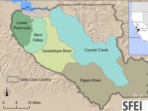 Santa Clara Valley Water District Priority D5 Project's Watershed Condition Assessments (2010 to present) (Project)
https://www.valleywater.org/project-updates/2012-d5-ecological-data-collection-and-analysisSFEI and the Santa Clara Valley Water District's (Valley Water) Priority D-5 Project have been conducting baseline ecological condition assessments in Santa Clara County, CA to characterize the distribution and abundance of stream and wetlands in five major watersheds, and to assess the overall ecological conditions of streams in the watersheds based on the California Rapic Assessment Method for streams (CRAM). The surveys employ the state's recommended Wetland and Riparian Area Monitoring Plan's watershed aproach that includes the use of GIS-base maps of aquatice resources (BAARI), and spatially-balanced ambient stream condition surveys using CRAM.
 Coastal Wetlands, Beaches and Watersheds Inventory (Project)
The Ocean Protection Council (OPC) and SFEI will develop an inventory of the wetlands and other surface waters of all California’s coastal HUC-8 watersheds, including the inland Delta of the San Francisco Estuary, to help implement the OPC’s 2020-2025 Strategic Plan. The inventory will include a dashboard and other online tools that enable the OPC and the public to track progress towards multiple O
 Get on the curve: Habitat Development Curves help determine the performance of on-the-ground projects (News)
How do you know if the ecological conditions of your wetland project are aligned with expected rates of improvement?
 Russian River Regional Monitoring Program: Comprehensive Basemap of Surface Waters and Riparian Areas (Project)
This project will build on existing projects funded by the CA State Water Board, Ocean Protection Council, Sonoma Ecology Center, and Sonoma County to produce a basemap of aquatic resources, using the updated Standard Operating Procedures (SOP) of the California Aquatic Resource Inventory (CARI), including at-risk waters and their riparian areas, to support the Russian River Regional Monitoring Program (R3MP). The main tasks of the project are to:
") Vernal Pool Habitat Restoration and Protection CRAM Tools for the Central Valley, CA (Project)
Vernal Pool Habitat Restoration and Protection CRAM Tools for the Central Valley, CA (Project)
The California Wetland Program Plan (WPP) seeks to strengthen protection for wetlands in many ways, including building capacity to track the net benefits of wetland policies and programs by employing aspects of the State’s Wetlands and Riparian Area Monitoring Plan (WRAMP).
 Microplastics and Harmful Algal Blooms in California's waters (News)
By May 1, 2017, in time for harmful algal bloom season, a new feature will appear on California's Harmful Algal Bloom portal (http://www.mywaterquality.ca.gov/habs/) that displays satellite imagery designed to detect emerging and historical blooms. Using data and algorithms provided by NOAA's National Centers for Coastal Ocean Science, the San Francisco Estuary Institute developed a new tool under the guidance of California's Bio-accumulation Oversight Group.
Delta Landscapes Scenario Planning Tool (Project)
This project is a tool for planning scenarios of landscape-scale restoration of the Delta. The tool is designed to inform ongoing and future restoration planning efforts in the Delta. In particular, this tool will help inform implementation of restoration objectives as described in the Delta Plan, as well as the ongoing Ecosystem Amendment to Chapter 4.
 New Delta Habitat Map! (News)
The Delta Aquatic Resource Inventory (DARI) is a map of surface waters, wetlands and other aquatic resources in the Sacramento-San Joaquin Delta. A similar mapping approach used to create the Bay Area Aquatic Resource Inventory (BAARI) was applied to complete a consistent map across the larger San Francisco Estuary. Both DARI and BAARI are integrated into the California Aquatic Resource Inventory (CARI), which serves as the basemap in EcoAtlas.
 SARs-CoV-2 Monitoring in Wastewater (News)
18 months of innovative data visualization to inform local, regional, and state public health departments.
SFEI’s Software Engineering Manager Gemma Shusterman led the development of a new data dashboard, designed to track the spread of COVID-19 in our region. With funding from the Catena Foundation, SFEI’s Environmental Informatics program supported the groundbreaking scientific genetic sequencing data produced by our close partner, the University of California’s Berkeley Water Center. Together, SFEI and the Berkeley Water Center matched science with technology to produce actionable, timely information in support of smart public health decisions.
 Big updates from Hidden Nature SF, including new interactive content! (News)
Hidden Nature SF seeks to uncover the natural history of San Francisco’s past landscape. At the heart of the project is the field of historical ecology, which uses interdisciplinary science and visualization techniques to synthesize historical archival data into a completely new perspective on the familiar city. Drawing on hundreds of old maps, photographs, and textual documents, we are reconstructing and mapping the ecosystems and waterways that existed in San Francisco prior to Spanish colonization.
- 1 of 3
- next ›