Vernal Pool Habitat Restoration and Protection CRAM Tools for the Central Valley, CA
")
The California Wetland Program Plan (WPP) seeks to strengthen protection for wetlands in many ways, including building capacity to track the net benefits of wetland policies and programs by employing aspects of the State’s Wetlands and Riparian Area Monitoring Plan (WRAMP). The WRAMP framework was initially developed by the California Wetland Monitoring Workgroup (CWMW) of the California Water Quality Monitoring Council (WQMC). The framework recommends the application of systematic and standardized methods to support aquatic resource mapping, wetland condition assessment, public data access to support mitigation planning, and project performance tracking.
This U.S. Environmental Protection Agency (EPA) Region 9 Wetland Program Development Grant focused on developing foundational environmental datasets that support a regional approach to protect and restore vernal pool habitats in California’s Central Valley by applying standardized vernal pool mapping methods and the California Rapid Assessment Method for streams and wetlands (CRAM). Specifically, project outputs provide a landscape context for vernal pool wetland project evaluations and ecological condition assessment tools (employing CRAM) that can support mitigation project planning and performance tracking as outlined in the 401 Certification Program’s State Wetland Definition and Procedures for Discharges of Dredged or Fill Material to Waters of the State (or Procedures, SWRCB Rev. April 2021).
Major Project Tasks:
- Carol W. Witham (consultant and vernal pool ecologist) updated the vernal pool habitat map for the Central Valley (geospatial dataset) employing 2018 NAIP imagery. This allowed Carol to evaluate changes in the distribition of vernal pool habitat since it was originally mapped in 2005. Click here for access to her report the geodatabase
- SFEI and Vollmar Natural Lands Consulting (Vollmar) employed CRAM to survey and characterize the overall ecological conditions of vernal pool systems across the Central Valley region. The output of the Generalized Random Tesselation Statified (GRTS) survey design and field assessments is a cumulative distribution function estimate (or CDF) curve that esitmates the proportions of vernal pool habitat area wihtin the Central Valley that has a specific CRAM conditon score or lower.
- SFEI and Vollmar also employed CRAM to assess vernal pool mitigation projects of variable ages in the Central Valley region and develop an initial habitat development curve (HDC) that can be used to track wetland development over time.
Project outputs have been uploaded to EcoAtlas for public access. EcoAtlas is an interactive data access and summary tool that implements the states WRAMP Framework, which recommends that resource managers use of standardized monitoring methods and webservices to support transparency and public access to ecological monitoring and geospatial data, and integrate the data to support landscape based ecological profiles to characterize the amount, distribution and condition of streams and wetlands in California.
- The updated map of vernal pool habitats has been integrated into a recently updated version of the California Aquatic Resources Inventory (CARI) and uploaded to EcoAtlas as the base map of surface waters. The CARI streams and wetlands (including the vernal pool habitats in the Central Valley) can be explored and summarized using the Landscape Profile tool in EcoAtlas.
- The CRAM vernal pool complex CDFs are accessible through EcoAtlas' Landscape Profile tool. From EcoAtlas' main page select "Map" or click on the region of interest on the map. Next select the 'Show Tools' button at the top right corner of the screen (select "Landscape Profiles" and then the "Condition Profile"). EcoAtlas users can zoom into a project site that has been assessed using CRAM and see the project’s CRAM scores overlaid onto the regional CDF curve. This allows users to compare project scores relative to ambient conditions for the Central Valley region as a whole.
- The CRAM HDC for vernal pool complex projects has been uploaded to EcoAtlas’s Project Tracker module along with existing HDCs for estuarine and depressional wetlands. From EcoAtlas' main page select "Projects" and type in (or select) the project name of interest. A separate "Habitat Development Curves" tab within the project page allows the user to see a project’s CRAM scores overlaid on the corresponding HDC to compare project scores to the expected development curve. However, please note that the project must have a project completion date and CRAM assessments located within the project's footprint in order to be plotted on the curve. The project end-date serves as the time-zero to plot the CRAM scores along the x-axis on the curve.
Excel files of the HDC CRAM sites and CDF estimate outputs can be downloaded HERE.
Dates:
2019 to 2022
Partners:
Carol W. Witham
Funders:
U.S. EPA Region 9
Associated Staff:
Joseph Morgan (EPA Region 9)
Associated Data:
Programs and Focus Areas:
Environmental Informatics Program
Data Services
Geographic Information Systems
Information Technology Systems
Resilient Landscapes Program
Wetland Monitoring & Assessment
Related Projects, News, and Events:
 Santa Clara Valley Water District Priority D5 Project's Watershed Condition Assessments (2010 to present) (Project)
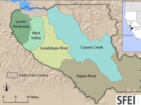
https://www.valleywater.org/project-updates/2012-d5-ecological-data-collection-and-analysisSFEI and the Santa Clara Valley Water District's (Valley Water) Priority D-5 Project have been conducting baseline ecological condition assessments in Santa Clara County, CA to characterize the distribution and abundance of stream and wetlands in five major watersheds, and to assess the overall ecological conditions of streams in the watersheds based on the California Rapic Assessment Method for streams (CRAM). The surveys employ the state's recommended Wetland and Riparian Area Monitoring Plan's watershed aproach that includes the use of GIS-base maps of aquatice resources (BAARI), and spatially-balanced ambient stream condition surveys using CRAM.
 Tahoe WRAMP Demonstration: Watershed Assessment (Project)
The Tahoe WRAMP Watershed Demonstration Project transferred statewide wetland monitoring and assessment tools to Sierra Nevada environmental agencies and organizations by conducting a pilot study that evaluated the distribution and abundance of wetlands, and the overall ecological condition of streams in two watersheds within the Lake Tahoe Basin.
 Get on the curve: Habitat Development Curves help determine the performance of on-the-ground projects (News)
How do you know if the ecological conditions of your wetland project are aligned with expected rates of improvement?
 EcoAtlas (Project)
EcoAtlas is a set of tools for generating, assembling, storing, visualizing, sharing, and reporting environmental data and information.
 Santa Rosa Plain Wetlands Profile: A Demonstration of WRAMP (Project)
The Santa Rosa Plain WRAMP project demonstrated the use of the State’s standardized monitoring and assessment tools in a North Coast watershed setting and described how the results can support watershed based management and planning decisions to protect and manage the state’s wetlands at a landscape scale.