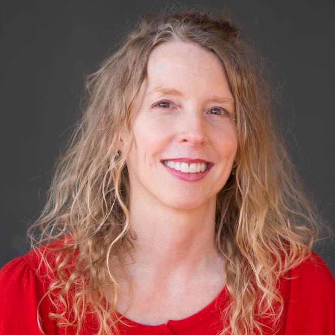
Cristina Grosso
Cristina Grosso, MA
Program Managing Director
Environmental Informatics Program
Data Services
Geographic Information Systems
Software Engineering
Carbon, Ecosystems & Climate
510-746-7371
Cristina Grosso is the Managing Director for SFEI’s Environmental Informatics Program. She earned a B.S. in Mathematics from Vanderbilt University and a M.A. in Geography with an emphasis in Resource Management and Environmental Planning from San Francisco State University. Cristina manages the development of tools for uploading and visualizing data in EcoAtlas, the California Rapid Assessment Method for Wetlands, and the Regional Monitoring Program for Water Quality. She manages the San Francisco Bay-Delta Regional Data Center and works with the State’s other data centers to ensure monitoring data are comparable with the Surface Water Ambient Monitoring Program (SWAMP) and the California Environmental Data Exchange Network (CEDEN).
Related Projects, News, and Events
 Recent workshop in the Lahontan region establishes an implementation roadmap for watershed-based decision support tools (News)
SFEI representatives Cristina Grosso and Josh Collins helped to foster the use of EcoAtlas and related tools in the Lahontan region during a recent workshop. The objective of the workshop was to train interested parties inside and outside of the Tahoe Basin on EcoAtlas’ watershed-based decision support tools. The workshop began with a presentation on the applications of watershed-based decision support tools in the regulatory context. A Technical Demo Session and Open Lab provided hands-on training for EcoAtlas’ planning (CARI/TARI, CARI Editor), tracking (Project Tracker), and visualization tools (Landscape Profile Tool).
 USGS StreamStats API available in EcoAtlas (News)
How can someone click on a map and almost immediately determine the upstream catchment area to that designated point? StreamStats is a web service provided by the US Geological Survey to perform that critical function.
The service can be seamlessly incorporated into web maps to enhance their catchment-finding abilities. In July 2015, USGS released a new version of their StreamStats service, which SFEI recently incorporated into EcoAtlas.
 New Trends Charts and Data on Safe To Eat Portal (News)
Fish and shellfish are nutritious and good for you to eat. But some fish and shellfish may absorb toxic chemicals from the food they eat and the water in which they live. Some of these chemicals accumulate over time in the fish and shellfish - and in the people who eat fish and shellfish. Although the chemical levels are usually low, it is a good idea to learn about advisories and monitoring in water bodies where you fish, and for fish or shellfish you eat.
 EcoAtlas: New Map Enhancements (News)
The latest release of EcoAtlas (v4.1) includes two new map enhancements:
 The launch of the SF Bay Nutrients Visualization Tool (News)
This visualization tool facilitates intuitive comparison of continuous data from around the Bay, and across a variety of analytes, to demonstrate the potential for collaborative monitoring across programs.
 Central Valley Watershed Monitoring Directory (Project)
The Central Valley Watershed Monitoring Directory was built to promote and facilitate improved coordination of water monitoring across the basin and serves to: 1) Provide an up-to-date online directory for water quality monitoring programs in the Central Valley Basin; 2) Make it easier and less time consuming for regulatory agency staff and other monitoring groups and data users to find and track information about ongoing surface water monitoring activities in the basin; 3) Provide a low-maintenance, interactive online resource that can b
 CD3: New Download Feature (News)
This release of CD3 features an advanced download tool for accessing all data for a project and the ability to dynamically generate Sum of PCBs. Detailed instructions for using the tool's different features are provided in a pop-up box for easy reference. Visit cd3.sfei.org to try out this new functionality!
 Web Services Available for CRAM and Wetland Projects (News)
Web services provide a standard way to access geo-referenced data online. SFEI now provides web services for the California Rapid Assessment Method (CRAM) Assessment Areas and California Wetland Projects data layers.Although potential uses are numerous, typically web services allow one machine to exchange data with another for timely, automated, and efficient sharing of information. Different service types provide different levels of access to the data, including serving image tiles of the data or the features and attributes themselves.
 Environmental Data Upload and Visualization Tools presented at the 2010 NWQMC Conference (News)
Cristina Grosso presented some of SFEI's environmental data upload and visualization tools at the National Water Quality Monitoring Council's National Monitoring Conference in Denver, CO in April. She highlighted SFEI's data upload tools (online Data Checker and field data entry forms) and visualization tools (Web Query Tool, California Wetlands Portal, and Central Valley Monitoring Directory) in the session "Using Data Sharing as a Pathway to Collaboration".
- ‹ previous
- 5 of 5

