Announcing SFEI's first binational study: The Tijuana River Valley Historical Ecology Investigation

Mar 28, 2017
A new report shows how the Tijuana River Valley, which straddles the boundary between Southern California and northern Mexico, looked and functioned prior to the existence of the border wall, the city of Tijuana, and the state of California.
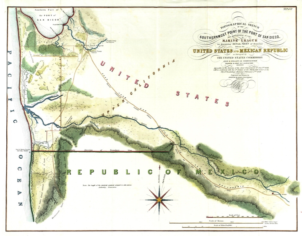
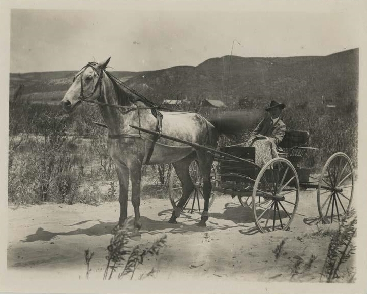
Synthesizing history and contemporary natural science, the Tijuana River Valley Historical Ecology Investigation—funded by the California State Coastal Conservancy—draws upon hundreds of historical maps, photographs, and traveler’s accounts to reveal a forgotten landscape. The result is a portrait of the borderland’s shared ecological history that provides today's scientists, land managers, policy makers, and residents of the valley with information to help restore and effectively manage the valley well into the future.
"The Tijuana River Valley Historical Ecology Investigation enriches our temporal perspective and helps us better understand the ebb and flow of environmental changes that have taken place," says Brian Collins, manager of the Tijuana Slough National Wildlife Refuge. "This study is an invaluable resource to managers that gives roots to the historical record as we work to achieve a present day and future history of restored habitat functionality, recovered wildlife communities, and better environmental health for this binational watershed."
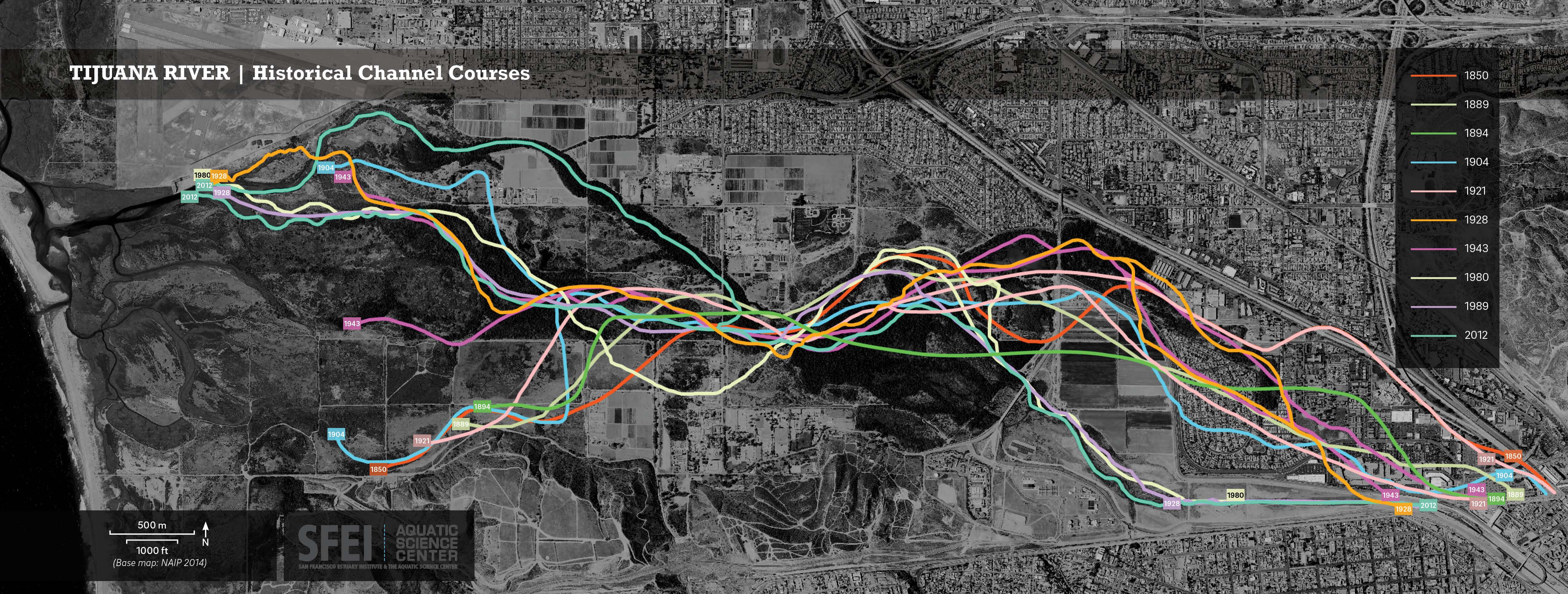
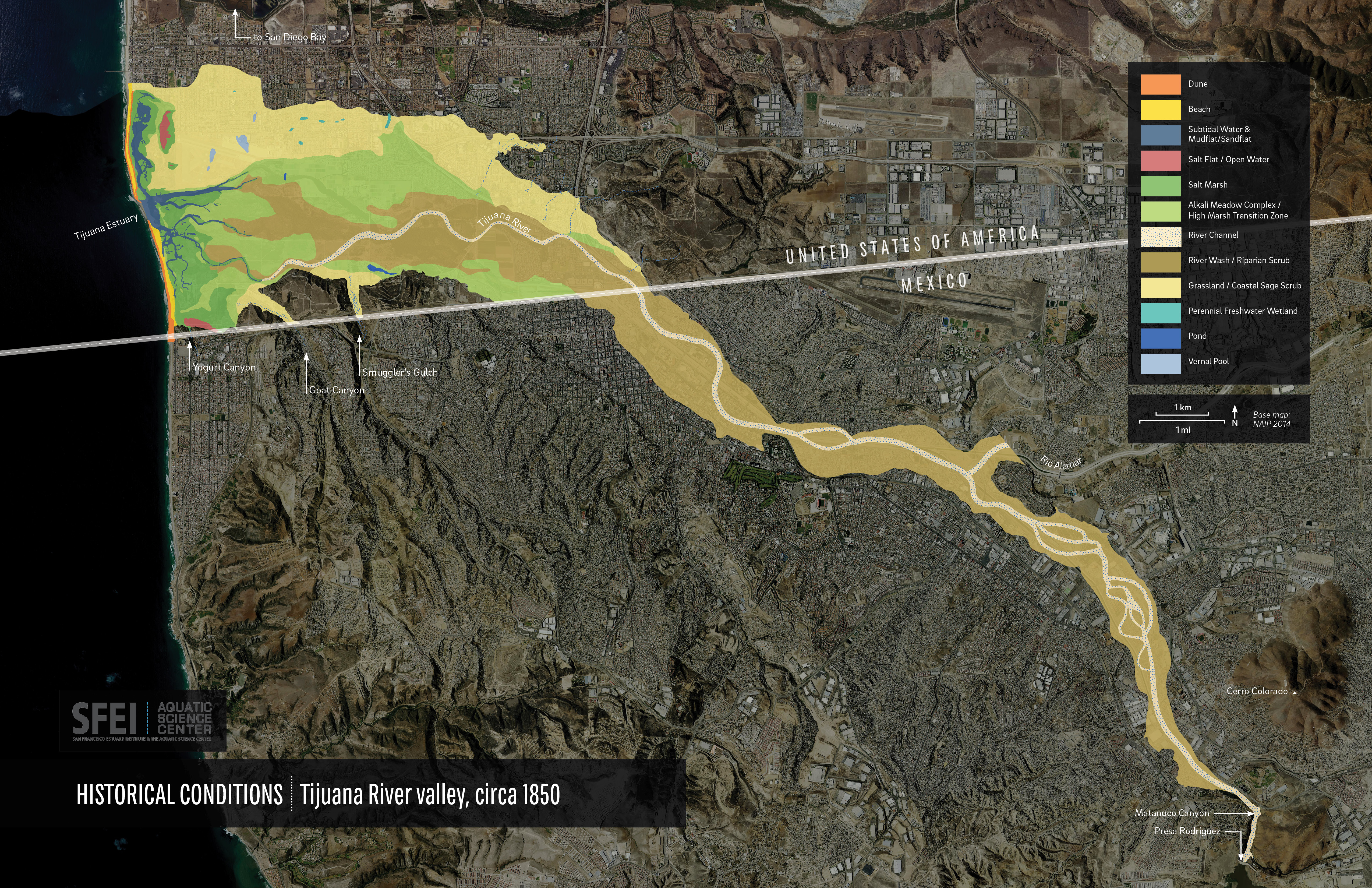
The richly-illustrated report highlights the diversity and dynamism of the historical landscape. Though the Tijuana River is now mostly confined to a narrow concrete channel in Mexico, it was once a broad expanse of sand and willows that reached close to a mile in width. The river was usually dry, but occasionally carried tremendous floods that had the power to uproot vegetation and reshape the valley floor. In one graphic, the report’s authors illustrate a dozen different paths that the river has taken from the border to the sea since the mid-1800s. In another they show how the extent of salt marsh, which is critical for supporting the endangered light-footed Ridgway’s rail, has declined by more than 40 percent. A list of more than a dozen kinds of animals that were once found in the valley but have not recently been observed (including pronghorn antelope, California condors, and sagebrush-loving Bell’s sparrows) further points to the depth and impact of changes in the landscape over time.
"The historical reconstruction presented in the report does not provide a simple blueprint for the future valley," write the authors of the report. "It will not be possible—or necessarily even desirable—to recreate the landscape that once existed." However, by understanding what the landscape looked like and how it functioned in the past, as well as how it has changed over time, they hope to help readers envision its future potential.
The report and other associated materials are freely available for download at www.sfei.org/projects/tijuana. For more information please contact Sam Safran, the report’s lead author and an Associate Environmental Scientist at SFEI ([email protected]); Jeff Crooks, report author and the Research Coordinator at the Tijuana River National Estuarine Research Reserve ([email protected]); Robin Grossinger, report author and co-director of SFEI’s Resilient Landscapes program ([email protected]); or Greg Gauthier, the project’s manager at the California State Coastal Conservancy ([email protected]).

For additional project-related graphics, please see the Tijuana River Valley Historical Ecology Investigation Flickr photo album. Border fence photo by Tony Webster.
Associated Staff:
Other Contributors:
Jeff Crooks, TRNERR
Julio Lorda, UABC
Travis Longcore, USC
Danielle Bram, CSU Northridge
Shawna Dark, CSU Long Beach
Eric Stein, SCCWRP
Related Projects, News, and Events:
 Tijuana River Valley Historical Ecology Investigation (Project)
The Tijuana River Valley Historical Ecology Investigation synthesized hundreds of historical maps, photographs, and texts to reconstruct the the ecological, hydrological, and geomorphic conditions of the valley prior to major European-American landscape modification.