Tahoe WRAMP Demonstration: Mapping Standards
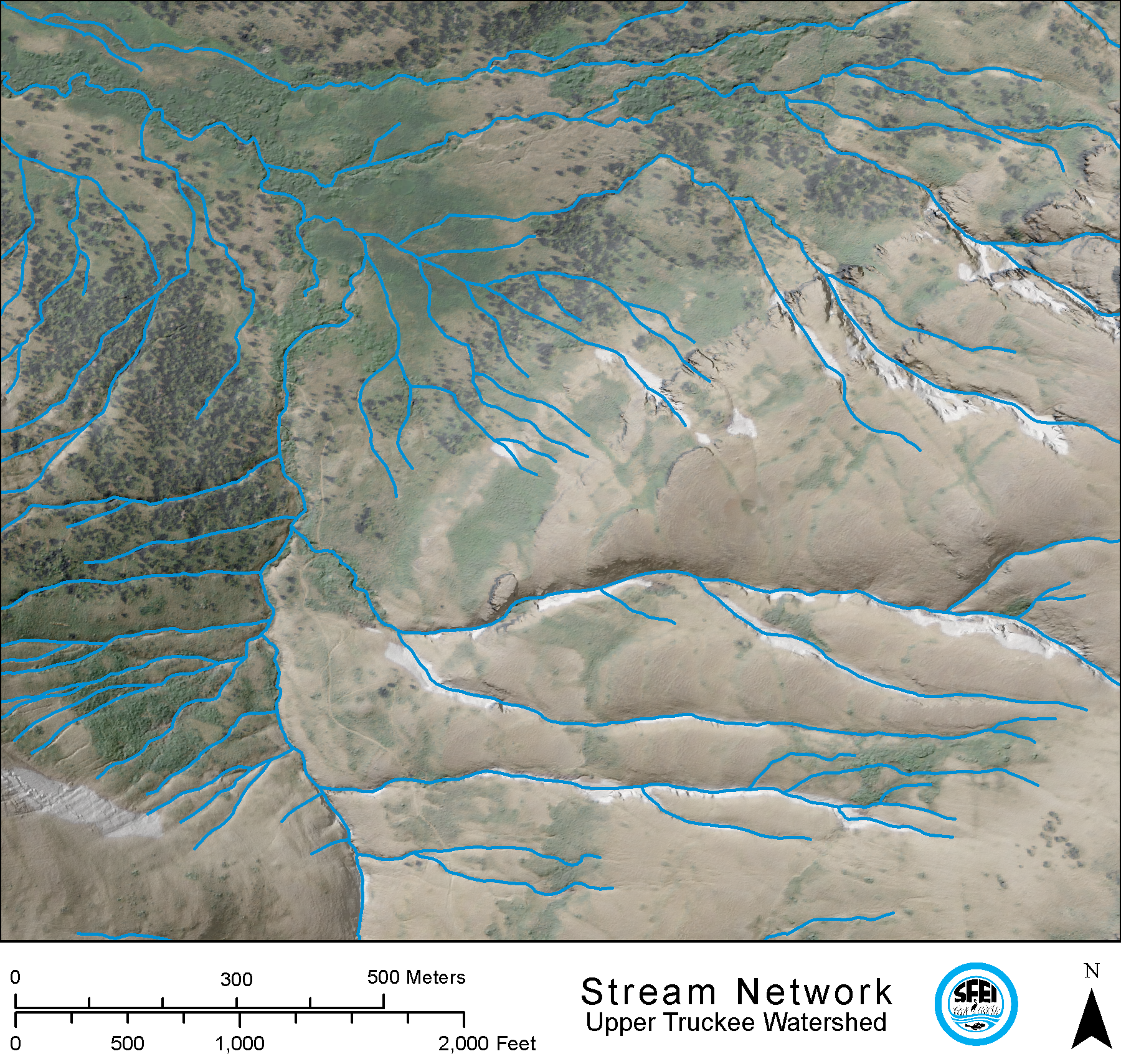
The California Tahoe Conservatory and Tahoe Regional Planning Agency in partnership with SFEI and the Lahontan Regional Water Board demonstrated the WRAMP monitoring and assessment methods in two Lake Tahoe Basin watersheds: Third Creek and Upper Truckee River. This included  developing detailed and standardized maps of the aquatic resources within the two watersheds, based on BAARI's mapping standards, which led to developing and adding new mapping methods to accommodate new wetland types such as wet meadows. The maps were completed in 2012 and incorporated into EcoAtlas. For more information about the demonstration project visit the project website.
View TARI online at EcoAltas or download the GIS dataset for Third Creek and Upper Truckee River watersheds from the project website here.
Mapping procedures and standards can be found here.
Dates:
2010 to 2013
Partners:
Associated Staff:
Project Site:
Programs and Focus Areas:
Environmental Informatics Program
Geographic Information Systems
Resilient Landscapes Program
Wetland Monitoring & Assessment
Primary Project
 California Aquatic Resource Inventory (CARI)
The California Aquatic Resources Inventory (CARI) is a Geographic Information System (GIS) based map of wetlands, streams, and riparian areas within California that is hosted online through EcoAtlas.
 Tahoe WRAMP Demonstration: Watershed Assessment
The Tahoe WRAMP Watershed Demonstration Project transferred statewide wetland monitoring and assessment tools to Sierra Nevada environmental agencies and organizations by conducting a pilot study that evaluated the distribution and abundance of wetlands, and the overall ecological condition of streams in two watersheds within the Lake Tahoe Basin.
Related Projects, News, and Events:
 Lahontan EcoAtlas Development (Project)
This project will create an EcoAtlas user community for the Lahontan region of the Sierra Nevada to develop capacities within the region to apply EcoAtlas through existing local, regional, state, and federal programs to track projects and summarize map-based and rapid assessment information at the watershed scale.