

Flood control managers and regulatory agencies are calling for a new overall approach for channel management with the recognition of environmental impacts associated with current flood risk management activities, the high cost of maintaining aging infrastructure, the challenges associated with maintaining flood conveyance in the face of a rising sea level, and the high value of dredged sediment.
Flood Control 2.0 is an innovative regional project that seeks to integrate habitat improvement and flood risk management at the Bay interface. The project focuses on helping flood control agencies and their partners create landscape designs that promote improved sediment transport through flood control channels, improved flood conveyance, and the restoration and creation of resilient bayland habitats. In addition, the project focuses on beneficial reuse options for dredged sediment from highly constrained flood control channels with limited restoration opportunities. Through a series of coordinated technical, economic, and regulatory analyses, Flood Control 2.0 addresses some of the major elements associated with multi-benefit channel design and management at the Bay interface and will provide critical information that can be used to develop long-term solutions that benefit people and habitats.
The project findings have been synthesized into this online “toolbox.” The toolbox includes channel classifications and relevant management concepts (e.g., creek-bayland connection, beneficial reuse of sediment), multi-benefit landscape “visions” at the Bay interface for selected channels, a “marketplace” for baylands restoration practitioners to find available dredged sediment (SediMatch), regulatory guidance documents with case studies for the regulatory issues associated with flood control project elements (e.g., impacts to existing wetlands), and benefit-cost analyses of current flood management measures and proposed multi-benefit measures. In combination with other regional plans (e.g., Baylands Ecosystem Habitat Goals Science Update), this project provides information to flood control managers and the restoration community for planning sustainable, long-term, multi-benefit redesign projects given landscape, regulatory, and economic challenges.
Flood Control 2.0 was funded by the San Francisco Bay Water Quality Improvement Fund, EPA Region IX.
- Project Leads
- Regional Science Advisory Team
-
- Peter Baye - Independent consultant, coastal ecology and botany
- Letitia Grenier - SFEI, wildlife ecology and conservation biology
- Jeff Haltiner - ESA, Senior Hydrologist and Technical Advisor, hydrology
- Robert Leidy - US EPA, fisheries biology and stream ecology
- Jeremy Lowe - SFEI (formerly with ESA), coastal geomorphology and climate adaptation
- Barry Hecht - Balance Hydrologics, geomorphology, hydrology
- Leonard Sklar - San Francisco State University, geomorphology, hydrology
- National Science Advisory Team
-
- Pinar Balci - Director, Bureau of Environmental Planning and Analysis, NYC Department of Environmental Protection
- F. Douglas Shields, Jr. - Senior Civil Engineer, CBEC
- Derek Booth - Adjunct Professor, UCSB
- Charles “Si” Simenstad - Research Professor, University of Washington
Project Components
Channel Analysis
Developing multi-benefit approaches for flood control channel management around the Bay begins with an understanding of how the channels’ physical features and processes have changed since the onset of intensive development in the mid-19th century. The channel analysis conducted as part of Flood Control 2.0 focused on assessing changes to channel morphology and sediment delivery and deposition dynamics, and developing management concepts aimed at restoring historical processes and benefitting both habitat and flood management.

This report presents detailed results from the F-T interface and sediment dynamics analyses and synthesizes the findings into high level management concepts for 33 major flood control channels. The concepts focus on opportunities for improving sediment delivery to bayland habitats (both natural and mechanical) within the context of improving flood risk management. The report concludes with recommendations for data collection efforts and quantitative analysis that would help with the development of multi-benefit management strategies.

Data: How Creeks Meet the Bay: Changing Interfaces
San Francisco Bay’s connections to local creeks are integral to its health. The ways in which the fluvial-tidal (F-T) interface has changed over the past 150 years affect flooding dynamics, ecosystem functioning, and resilience to a changing climate. This map illustrates the historical and contemporary F-T interface types for 353 channels that drain to San Francisco Bay.

Data: How Creeks Meet the Bay: Current Sediment Dynamics
Flood control channels that drain watersheds and empty to the Bay provide a variety of societal and environmental services but often require sediment removal to maintain flood conveyance capacity. This map provides key information on the supply of sediment to 33 major flood control channels around the Bay and the amount of sediment storage and removal over the past 50+ years. This information is intended to help clarify the amount of sediment trapped in flood control channels that could be used to restore baylands and support long-term bayland resilience as sea level continues to rise.
Data: Current Sediment Dynamics Database
This database provides detailed sediment information for 33 major flood control channels shown on the Current Sediment Dynamics map.
Implementation Projects
Flood Control 2.0 scientists worked with local flood control agencies to develop information for flood control channel redesign projects (or implementation projects) that can be used to incorporate habitat benefits into flood risk management. This effort focused on three flood control channels at the Bay interface: lower San Francisquito Creek (San Mateo County), lower Novato Creek (Marin County), and lower Walnut Creek (Contra Costa County).

Report: Resilient Landscape Vision for Lower Walnut Creek: Baseline Information & Management Strategies
This report provides a long-term landscape vision for lower Walnut Creek that incorporates habitat restoration actions into flood risk management. The vision, developed in coordination with a team of regional science experts, provides detailed information on landscape change over the past 150 years and highlights opportunities for restoring and sustaining tidal and freshwater wetland habitats around lower Walnut Creek while supporting a high level of flood protection under rising San Francisco Bay water levels. It provides Contra Costa County Flood Control & Water Conservation District and other local partners with several “nature-based” adaptation options that can benefit people and habitats.

Data: Walnut Creek Historical Ecology GIS Data
This dataset includes reconstructed habitat types and ecological characteristics of lower Walnut Creek and the surrounding landscape, representing average dry-season conditions prior to substantial Euro-American modification (~late 1700s-late 1800s).

This report provides a long-term landscape vision for lower Novato Creek that incorporates habitat restoration actions into flood risk management. The vision, developed in coordination with a team of regional science experts, highlights opportunities for restoring and sustaining vital tidal wetland habitats around lower Novato Creek while supporting a high level of flood protection under rising San Francisco Bay water levels. It provides Marin County Flood Control & Water Conservation District and other local partners with several “nature-based” adaptation options that can benefit people and habitats.

Report: Novato Creek Historical Ecology Study
This report provides a high level overview of the physical and ecological changes to lower Novato Creek and the surrounding baylands over the past 150 years through an analysis of changes in key landscape features (or landscape metrics). The results presented provide the baseline information used to develop the Novato Creek Baylands Vision and can be used in the future to help develop appropriate habitat restoration targets.

Data: Novato Creek Historical Ecology GIS Data
This dataset includes reconstructed habitat types and ecological characteristics of the Novato Creek Baylands, representing conditions prior to substantial Euro-American modification (~late 1700s-late 1800s).

Report: San Francisquito Creek Baylands Landscape Change Metrics Analysis
This report provides a high level overview of the physical and ecological changes to lower San Francisquito Creek and the surrounding baylands over the past 150 years through an analysis of changes in key landscape features (or landscape metrics). The results from this study are intended to provide baseline information that can be used to help with developing restoration and flood control redesign alternatives and appropriate habitat restoration targets.
Regulatory Analysis
In working with flood protection managers, concerns were raised regarding the regulatory process that each project must undergo to receive permits. The permitting process in the San Francisco Bay region is complex, time consuming and involves multiple agencies. The BCDC team examined the permitting process using case studies of four flood protection projects in four different regions of the Bay; stages of permitting; project complexity and settings. Methods included interviews of staff; examination of the permit records; attending meetings and conferences on the subject; and reviewing planning documents, laws, policies and regulations.

This report describes the current flood protection system in the Bay Area in terms of its status and need for maintenance and repair. The report also discusses the need to reinvent the flood control system and the need promote species and habitat recovery and adapt to the dynamic changes associated with climate change. It gives an overview of the regulatory framework in the region and analyzes the challenges and issues inherent to flood protection projects in sensitive habitats. It concludes with recommendations aimed at improving flood protection projects and the permitting process. The report synthesizes the findings from four flood protection project case studies: Napa River’s Living River Project, Lower San Francisquito Creek’s realignment and restoration , Novato Creek’s future vision , and Lower Walnut Creek’s deauthorization from the federal flood protection program.

Report: Regulatory Guidance Report
Using the lessons learned from the project case studies and the regulatory analysis report, this document makes recommendations for both regulatory and resource agencies and flood protection managers on how to improve the current regulatory situation. Recommendations include short and long term actions that can be undertaken by those wanting to improve the process.
Economic Analysis
The San Francisco Estuary Partnership (SFEP) contracted with Integrative Economics to conduct an economic analysis of Flood Control 2.0 strategies. The analysis compared benefits and costs of “traditional” flood management approaches to a suite of new approaches that incorporate tidal ecosystem restoration to achieve multiple benefits, in addition to flood protection. The analysis focused on lower Novato Creek and lower Walnut Creek, highlighting the benefits, costs, and long-term resilience of current flood management approaches (e.g., levee improvements, channel dredging,) and Flood Control 2.0 strategies, and quantifying the multiple economic values provided by the landscape. Integrative Economics then produced a Benefit-Cost Analysis Spreadsheet Model and Guidebook to enable users to conduct similar analyses for other channels around San Francisco Bay and beyond.

Report: Lower Novato Creek Benefit-Cost Assessment
This report provides a comparison of the benefits and costs of “traditional” flood control approaches to a suite of new approaches that incorporate tidal ecosystem restoration to achieve multiple benefits in addition to flood protection. The traditional approaches include upgrading levees and detention basins to address rising sea levels and a predicted increase in storm severity. In contrast, the Flood Control 2.0 approach employs a suite of activities intended to increase tidal marsh habitat and provide additional environmental benefits, including wastewater assimilation, recreation, and aesthetic values by reconnecting the creek with its historical floodplain.

Report: Lower Walnut Creek Benefit-Cost Assessment
This report provides a comparison of the benefits and costs of “traditional” flood control approaches to a suite of new approaches that incorporate tidal ecosystem restoration to achieve multiple benefits in addition to flood protection. The traditional approaches include channel dredging and upgrading levees to address rising sea levels and a predicted increase in storm severity. In contrast, the Flood Control 2.0 approach employs a suite of activities intended to increase tidal and freshwater marsh habitat and provide additional environmental benefits, including wastewater, recreation, and aesthetic values by reconnecting the creek with its historical floodplain.

Report: Benefit-Cost Assessment Guidebook
This report provides: 1) guidelines for conducting benefit-cost analyses on channel redesign and restoration projects based on general principles of economic analysis for water resources projects and the analyses conducted on lower Novato Creek and lower Walnut Creek; and 2) a user guide for a spreadsheet model that valuates benefits and costs for different landscape management scenarios.

Tool: Benefit-Cost Assessment Spreadsheet Model
A spreadsheet model developed by Integrative Economics that valuates benefits and costs for different landscape management scenarios based on user-defined values for a variety of variables. This tool was used to compare the benefits and costs of traditional flood control approaches to the Flood Control 2.0 vision concepts for lower Novato Creek and lower Walnut Creek.
Sedimatch
SediMatch is a collaborative program of the San Francisco Bay Joint Venture (SFBJV), the San Francisco Bay Conservation and Development Commission (BCDC), the San Francisco Estuary Institute (SFEI), the San Francisco Estuary Partnership (SFEP), and others to bring together the wetland habitat restoration, flood control, and dredging communities to discuss challenges and find mutually beneficial strategies to increase reuse of dredged sediment at habitat restoration sites. Sedimatch aims to: 1) create healthy habitats while maximizing beneficial reuse of sediment; 2) develop an easily accessible database where sediment needs can be matched with surplus sediment; and 3) provide opportunities for collaboration. These three goals combined will help our region keep up with sea level rise and create resilient shorelines.

Tool: SediMatch
As part of the SediMatch program, the SFBJV, SFEI and BCDC have developed an online tool (database and web interface) to match available sediment from channel dredging efforts with restoration projects and opportunities for beneficial re-use. This new tool will be populated with information provided by SFBJV partners, including restoration project managers, flood protection managers and navigation dredging projects from the Dredged Material Management Office database. The database and tool will eventually be housed on the existing SFBJV and Delta Conservancy Habitat Project Tracking System within EcoAtlas (Project Tracking System).
Podcasts
These podcasts provide personal perspectives on the historical ecology, concepts, and projects of Flood Control 2.0. Robin Grossinger of SFEI introduces listeners to how flood control channels can be redesigned to more realistically mimic natural stream processes and ways that sediment can move through the flood control channels and stream systems to help build marshes as these channels enter San Francisco Bay. Flood Control 2.0 facilitated the visioning of the future of 3 flood control channels - San Francisquito Creek, Novato Creek, and Walnut Creek. Listeners will hear from each of the project managers about their future visions and lessons learned.

What is Flood Control 2.0? (Robin Grossinger, Senior Scientist at the San Francisco Estuary Institute

What is the Role Sediment Plays in Our Environment? (Brenda Goeden, Sediment Program Manager at the San Francisco Bay Conservation and Development Commission)

Where Has All the Sediment Gone? (Brenda Goeden, Sediment Program Manager at the San Francisco Bay Conservation and Development Commission)

Lower Novato Creek Redesign Project (Liz Lewis, Principal Planner with the Marin County Department of Public Works)

Flood Control 2.0 Implementation Project: Lower Walnut Creek (Paul Detjens, Senior Civil Engineer with the Contra Costa County Flood Control & Water Conservation District)













Over the past 200 years, many of the channels that drain to San Francisco Bay have been modified for land reclamation and flood management. The local agencies that oversee these channels are seeking new management approaches that provide multiple benefits and promote landscape resilience.
San Francisco Bay’s connections to local creeks are integral to its health. These fluvial-tidal (F-T) interfaces are the points of delivery for freshwater, sediment, contaminants, and nutrients.
This report explores the potential for integrating ecological functions into flood risk management on lower Novato Creek.
Lower Walnut Creek (Contra Costa County, CA) and its surrounding landscape have undergone considerable land reclamation and development since the mid-nineteenth century.
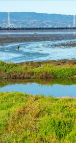
Flood Control 2.0 Wins an Outstanding Environmental Project Award!
The Flood Control 2.0 project team was presented with an Outstanding Environmental Project Award at the 13th Biennial State of the Estuary Conference in Oakland, CA.
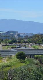
SFEI and several agency partners recently completed a multi-year, EPA funded project called Flood Control 2.0. The goal of the project was to develop information that is useful for integrating habitat restoration into flood management at the Bay edge. Project outputs are now available at floodcontrol.sfei.org.

How Creeks Meet the Bay: Current Sediment Dynamics
The transition zones between our watersheds and the Bay are often occupied by flood control channels that provide a variety of societal and environmental services but often require sediment removal to maintain flood conveyance capacity.
Lower Novato Creek Vision Just Released!
SFEI recently released a resilient landscape vision for lower Novato Creek that incorporates habitat restoration actions into flood risk management.
National science experts gather to discuss Flood Control 2.0
A panel of nationally and internationally renowned scientists gathered in the Bay Area at the beginning of June 2015 to provide feedback on the EPA-funded Flood Control 2.0 project.
Novato Creek Baylands Historical Ecology Study report now available
SFEI recently completed an historical ecology study of lower Novato Creek in Marin County.
Flood Control 2.0 in Bay Nature
The April 2015 issue of Bay Nature features an article about Flood Control 2.0, an ambitious project being co-led by SFEI to develop a framework for designing resilient, multi-benefit flood control channels at the interface with the San Francisco Bay shoreline.