
The Institute has been making use of drones for a number of projects over the past few years. However, recently, within Environmental Informatics, SFEI has been using UAV (unmanned aerial vehicles) in innovative ways.
Under a project funded by the California Ocean Protection Council, and in partnership with the State Water Board, SFEI and the Southern California Coastal Water Research Project (SCCWRP) has been utilizing drones, paired with machine learning algorithms, to survey and detect trash within riparian areas. Surveys or areas that can take hours to conduct on foot can be flown with the SFEI drone in 10 minutes. The resulting aerial imagery is then fed into a machine learning algorithm that is being trained to detect and count the trash in the area at a scale and speed impossible until recently .
Building on the progress made with the UAV trash detection methodology, SFEI and SCCWRP are now working with the Tobacco Control Program to investigate detecting and monitoring tobacco related products and waste that has been discarded into our environment.
Another project, funded by the Zone 7 Water Agency, illustrates the applicability to UAV-based imagery to restoration projects. This particular UAV project, on Arroyo de la Laguna, provides Zone 7 both high resolution imagery and refined elevation data that will be used for both monitoring vegetation and changes in geomorphology over the next three years.
Drones are becoming increasingly recognized as a useful tool for environmental monitoring and data collection, with SFEI leading the charge into innovative, new projects.



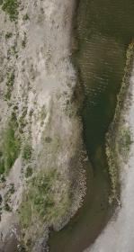
Vision from the Skies: Using UAS Surveys to Monitor a Key Restoration Project
At the McCosker Creek Restoration site, 3,000 linear feet of creek channel that previously had been flowing through underground culverts since the 1950s was daylighted and reconstructed. In addition, invasive and non native plants were removed and replaced with over 5,000 native plants.