Library
Our library features many hundreds of entries.
To search among them, click "Search" below to pull down options, including filtering by document type, author, year, and keyword.
Find these options under "Show only items where." Or you can also sort by author, title, type, and year clicking the headings below.
2019. Characterization of Sediment Contamination in South Bay Margin Areas. SFEI Contribution No. 962. San Francisco Estuary Institute: Richmond, CA.
The Bay margins (i.e., mudflats and adjacent shallow areas of the Bay) are important habitats where there is high potential for wildlife to be exposed to contaminants. However, until recently, these areas had not been routinely sampled by the Regional Monitoring Program for Water Quality in San Francisco Bay (RMP) due to logistical considerations. In 2015, the RMP conducted a spatially-distributed characterization of surface sediment contamination and ancillary characteristics within the RMP-defined Central San Francisco Bay margin areas. This was repeated in 2017 within South Bay, which for this report refers to the area collectively encompassing Upper South Bay (usually just called the “South Bay” segment in the Bay RMP, “Upper” added here to distinguish from the combined area), Lower South Bay, and “Extreme” Lower South Bay (previously named “Southern Sloughs”) margin areas.
Ambient margins data in South Bay provide a context against which the severity of contamination at specific sites can be compared. The baseline data could also be useful in setting targets and tracking improvements in watershed loads and their nearfield receiving waters, or for appropriate assessment of re-use or disposal of dredged sediment. These spatially distributed data also provide improved estimates of mean concentrations and contaminant inventories in margins. Based on data from this study, contamination in the margin areas accounts for 35% of PCB mass in the upper 15 cm of surface sediments in South Bay, which is approximately proportional to the relative area of the margin (34% of the region). In contrast, margins only contain 30% of the mercury mass in South Bay, somewhat less than their proportional area.
2024. 2024 Quality Assurance Program Plan for The Regional Monitoring Program for Water Quality in San Francisco Bay. SFEI Contribution No. 1169. San Francisco Estuary Institute: Richmond, CA.
2020. Conceptual Model to Support PCB Management and Monitoring in the Steinberger Slough/Redwood Creek Priority Margin Unit. SFEI Contribution No. 1009. San Francisco Estuary Institute: Richmond, CA.
2015. 2014 RMP Sediment Samples Quality Assurance Report. San Francisco Estuary Institute: Richmond, CA.
2018. Current Knowledge and Data Needs for Dioxins in San Francisco Bay. SFEI Contribution No. 926. San Francisco Estuary Institute : Richmond, CA.
2019. 2018 RMP Sediment Data Quality Assurance Report. San Francisco Estuary Institute: Richmond, CA.
In 2018, sediment samples were collected from 27 stations (7 historical sites, with the rest from the GRTS random draw panels) for the Regional Monitoring Program for Water Quality in San Francisco Bay. The details of the cruise and sample collection methods are described in the RMP Quality Assurance Program Plan, cruise plans, cruise reports, and field sampling reports. These documents are available from the SFEI website (http://www.sfei.org/content/status-and-trends-monitoring-documents).
2019. 2018 RMP Tissue Data Quality Assurance Report. San Francisco Estuary Institute: Richmond, CA.
In 2018, bivalve tissue samples were collected from six Bay/Delta stations and a reference site for the Regional Monitoring Program for Water Quality in San Francisco Bay. Bird egg tissue samples were collected from two sites for cormorants, and four sites for terns. General descriptions of the sample collection methods are provided in the RMP Quality Assurance Program Plan, cruise plans, cruise reports, and sampling reports. These documents are available from the SFEI website (http://www.sfei.org/content/status-and-trends-monitoring-documents)
2005. Castro Valley Atmospheric Deposition Study. SFEI Contribution No. 430. Brake Pad Partnership.
2008. Mercury and Methylmercury Processes in North San Francisco Bay Tidal Wetland Ecosystems. SFEI Contribution No. 449. San Francisco Estuary Institute: Oakland, CA.
2019. Evaluation of PCB Concentrations, Masses, and Movement from Dredged Areas in San Francisco Bay. SFEI Contribution No. 938. San Francisco Estuary Institute: Richmond, CA.
2014. 2014 Quality Assurance Program Plan for the Regional Monitoring Program for Water Quality in San Francisco Bay. SFEI: Richmond, CA.
2006. Quality Assurance Project Plan for the Regional Stormwater Monitoring and Urban BMP Evaluation.
2005. Fate of Contaminants in Sediment of San Francisco Estuary: A Review of Literature and Data - Final Report. SFEI Contribution No. 394. San Francisco Estuary Institute: Oakland.
2016. Simple Mass Budget Model to Evaluate Long Term PCB Fate in the Emeryville Crescent Sub-embayment.
2003. San Francisco Bay Ambient Monitoring Interim Report. SFEI Contribution No. 751.
2023. Re-evaluation of the Floating Percentile Method for Deriving Dredged Sediment Screening Guidelines. SFEI Contribution No. 1143. San Francisco Estuary Institute: Richmond, California.
This document summarizes a study conducted for the Regional Monitoring Program for Water Quality in San Francisco Bay (RMP) to re-evaluate the use of the Floating Percentile Method
(FPM) to derive sediment screening guidelines for dredged material reuse in the San Francisco Bay Region. The Long Term Management Strategy (LTMS) has a goal to use at least 40% of the sediment dredged from San Francisco Bay for beneficial reuse (USACE, 1998). The suitability of dredged sediment for beneficial reuse is in part determined by concentrations of toxic pollutants.The San Francisco Regional Water Quality Control Board (SFB-RWQCB) issued draft screening criteria in 2000 to categorize the suitability of sediment for reuse as either “surface” sediment, that may be placed near the surface for re-use in wetlands, or “foundation” sediment, that is buried under sediment that meets surface criteria. Contaminant concentration guidelines for surface sediment are lower than foundation sediment, based on the assumption that biota are more likely to be exposed to surface sediment than deeper foundation sediment.
2015. 2015 Updated Ambient Concentrations of Toxic Chemicals in San Francisco Bay Sediments. SFEI Contribution No. 749.
2011. Age Estimates and Pollutant Concentrations of Sediment Cores from San Francisco Bay and Wetlands. San Francisco Estuary Institute: Richmond, CA.
2015. 2015 Quality Assurance Program Plan for the Regional Monitoring Program for Water Quality in San Francisco Bay. San Francisco Estuary Institute: Richmond, CA.
2016. 2016 Updated ambient concentrations of toxic chemicals in San Francisco Bay area sediments. San Francisco Estuary Institute: Richmond, CA.
2019. Conceptual Model to Support PCB Management and Monitoring in the San Leandro Bay Priority Margin Unit - Final Report. SFEI Contribution No. 928. San Francisco Estuary Institute: Richmond, CA.
The goal of RMP PCB special studies over the next few years is to inform the review and possible revision of the PCB TMDL and the reissuance of the Municipal Regional Permit for Stormwater, both of which are tentatively scheduled to occur in 2020. Conceptual model development for a set of four representative priority margin units will provide a foundation for establishing an effective and efficient monitoring plan to track responses to load reductions, and will also help guide planning of management actions. The Emeryville Crescent was the first PMU to be studied in 2015-2016. The San Leandro Bay PMU is second (2016-2018), Steinberger Slough in San Carlos is third (2018), and Richmond Harbor will be fourth (2018-2019).
This document is Phase Three of a report on the conceptual model for San Leandro Bay. A Phase One report (Yee et al. 2017) presented analyses of watershed loading, initial retention, and long-term fate, including results of sediment sampling in 2016. A Phase Two data report (Davis et al. 2017) documented the methods, quality assurance, and all of the results of the 2016 field study. This Phase Three report is the final report that incorporates all of the results of the 2016 field study, and includes additional discussion of the potential influence of contaminated sites in the
watershed, the results of passive sampling by Stanford researchers and a comparative analysis of long-term fate in San Leandro Bay and the Emeryville Crescent, a section on bioaccumulation, and a concluding section with answers to the management questions that were the impetus for the work.
2019. 2019 Quality Assurance Program Plan for the Regional Monitoring Program for Water Quality in San Francisco Bay. SFEI Contribution No. 966. San Francisco Estuary Institute: Richmond, CA.
2021. Holistic Assessment of Microplastics and Other Anthropogenic Microdebris in an Urban Bay Sheds Light on Their Sources and Fate. Environmental Science and Technology Water . SFEI Contribution No. 1060.

The physical and chemical properties of microplastics and their environmental distributions may provide clues about their sources and inform their fate. We demonstrate the value of extensive monitoring of microplastics in an urban bay, San Francisco Bay. Surface water, fish, sediment, stormwater runoff, and treated wastewater were sampled across the bay and adjacent national marine sanctuaries (NMS). We found microplastics and other anthropogenic microdebris (“microdebris”) in all sample types. Concentrations were higher in the bay than in the NMS, and within the bay, concentrations were higher during the wet season than during the dry season. The fate of microdebris varied depending on their morphologies and densities: fibers were dominant in fish, black rubbery fragments were common in sediment, as were fibers, while buoyant fragments and fibers were widely observed in surface waters. Notably, we found large amounts of black rubbery fragments, an emerging contaminant, in stormwater. Moreover, stormwater was a significant pathway of microdebris, with concentrations roughly 140 times greater than those found in wastewater, which was dominated by fibers. Overall, we demonstrate the value of multimatrix regional monitoring to evaluate the sources and fate of microplastics, which can inform effective mitigation for other urban bays around the world.
2021. Green Stormwater Infrastructure Planning-level Analysis for Livermore-Amador Valley. SFEI Contribution No. 1063. San Francisco Estuary Institute: Richmond, Calif.
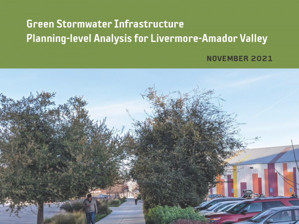 This effort is intended to provide planning-level regional guidance for placement of green stormwater infrastructure (GSI) in Livermore-Amador Valley. This work identifies potential GSI locations and quantifies contaminant load and stormwater runoff volume reduction benefits through the application of GreenPlan-IT, a planning tool developed by the San Francisco Estuary Institute and regional partners. Ultimately, the urban greening analysis presented in this report is intended to help enhance stream and watershed resilience, reduce peak flows, and improve water quality.
2021. San Francisco Bay Regional Watershed Modeling Progress Report, Phase 1. SFEI Contribution No. 1038. San Francisco Estuary Institute: Richmond, CA.
2023. Stevens Creek Reservoir – Forecast Informed Reservoir Operation (FIRO) Phase One Report. . SFEI Contribution No. 1120. Prepared for SCV Water District.
2021. Trees and Hydrology in Urban Landscapes. SFEI Contribution No. 1034. San Francisco Estuary Institute: Richmond, CA.
 Effective implementation of urban greening strategies is needed to address legacies of landscape change and environmental degradation, ongoing development pressures, and the urgency of the climate crisis. With limited space and resources, these challenges will not be met through single-issue or individual-sector management and planning. Increasingly, local governments, regulatory agencies, and other urban planning organizations in the San Francisco Bay Area are expanding upon the holistic, portfolio-based, and multi-benefit approaches.
This effort, presented in the Trees and Hydrology in Urban Landscapes report, seeks to build links between stormwater management and urban ecological improvements by evaluating how complementary urban greening activities, including green stormwater infrastructure (GSI) and urban tree canopy, can be integrated and improved to reduce runoff and contaminant loads in stormwater systems. This work expands the capacity for evaluating engineered GSI and non-engineered urban greening within a modeling and analysis framework, with a primary focus on evaluating the hydrologic benefit of urban trees. Insights can inform stormwater management policy and planning.
2022. San Francisco Bay Watershed Dynamic Model (WDM) Progress Report, Phase 2. SFEI Contribution No. 1091. San Francisco Estuary Institute: Richmond, California.
The San Francisco Bay total maximum daily loads (TMDLs) call for a 50% reduction in mercury (Hg) loads by 2028 and a 90% reduction in PCBs loads by 2030. In support of these TMDLs, the Municipal Regional Permit for Stormwater (MRP) (SFBRWQCB, 2009, SFBRWQCB, 2015, SFBRWQCB, 2022) called for the implementation of control measures to reduce PCBs and Hg loads from urbanized tributaries. In addition, the MRP has identified additional information needs associated with improving understanding of sources, pathways, loads, trends, and management opportunities of pollutants of concern (POCs). In response to the MRP requirements and information needs, the Small Tributary Loading Strategy (STLS) was developed, which outlined a set of management questions (MQs) that have been used as the
guiding principles for the region’s stormwater-related activities. In recognition of the need to evaluate changes in loads or concentrations of POCs from small tributaries on a decadal scale, the updated 2018 STLS Trends Strategy (Wu et al., 2018) prioritized the development of a new dynamic regional watershed model for POCs (PCBs and Hg focused) loads and trends. This regional modeling effort will provide updated estimates of POC concentrations and loads for all local watersheds that drain to the Bay. The Watershed Dynamic Model (WDM) will also provide
a mechanism for evaluating the impact of management actions on future trends of POC loads or concentrations.
As a multi-use modeling platform, the WDM is being developed to include other pollutants, such as contaminants of emerging concern (CECs), sediment, and nutrients and to be coupled with a Bay fate model to form an integrated watershed-Bay modeling framework to address Regional Monitoring Program (RMP) management questions. As this model is developed, flexibility to link with other models will be an important consideration.