Napa Valley Historical Aerial Photomosaic Image from 1940-42
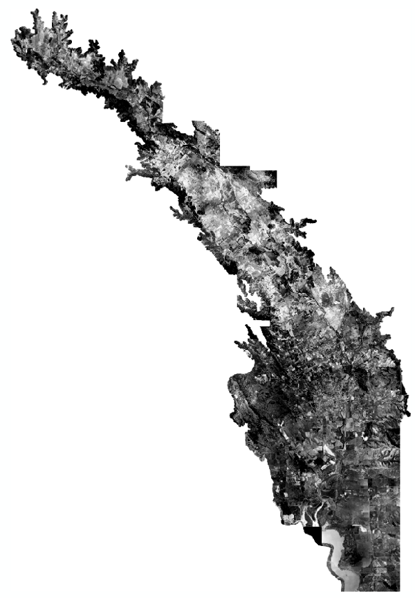
This historical aerial photography mosaic was used to develop a reconstruction of the historical landscape and prevailing conditions of Napa Valley. The early aerial photography from 1940 and 1942 was one of several data sources used to determine conditions prior to Euro-American modification. A small portion of one image from 1953 was used near St. Helena. The mosaic consists of early black and white aerial photography. 82 photographic prints covering the project area were obtained from the Napa County Resource Conservation District/Natural Resources Conservation Service.
Type of Data:
GIS imagery/raster
Programs and Focus Areas:
Resilient Landscapes Program
Historical Ecology