DARI RipZET Pilot, Vegetation Module, GIS Data
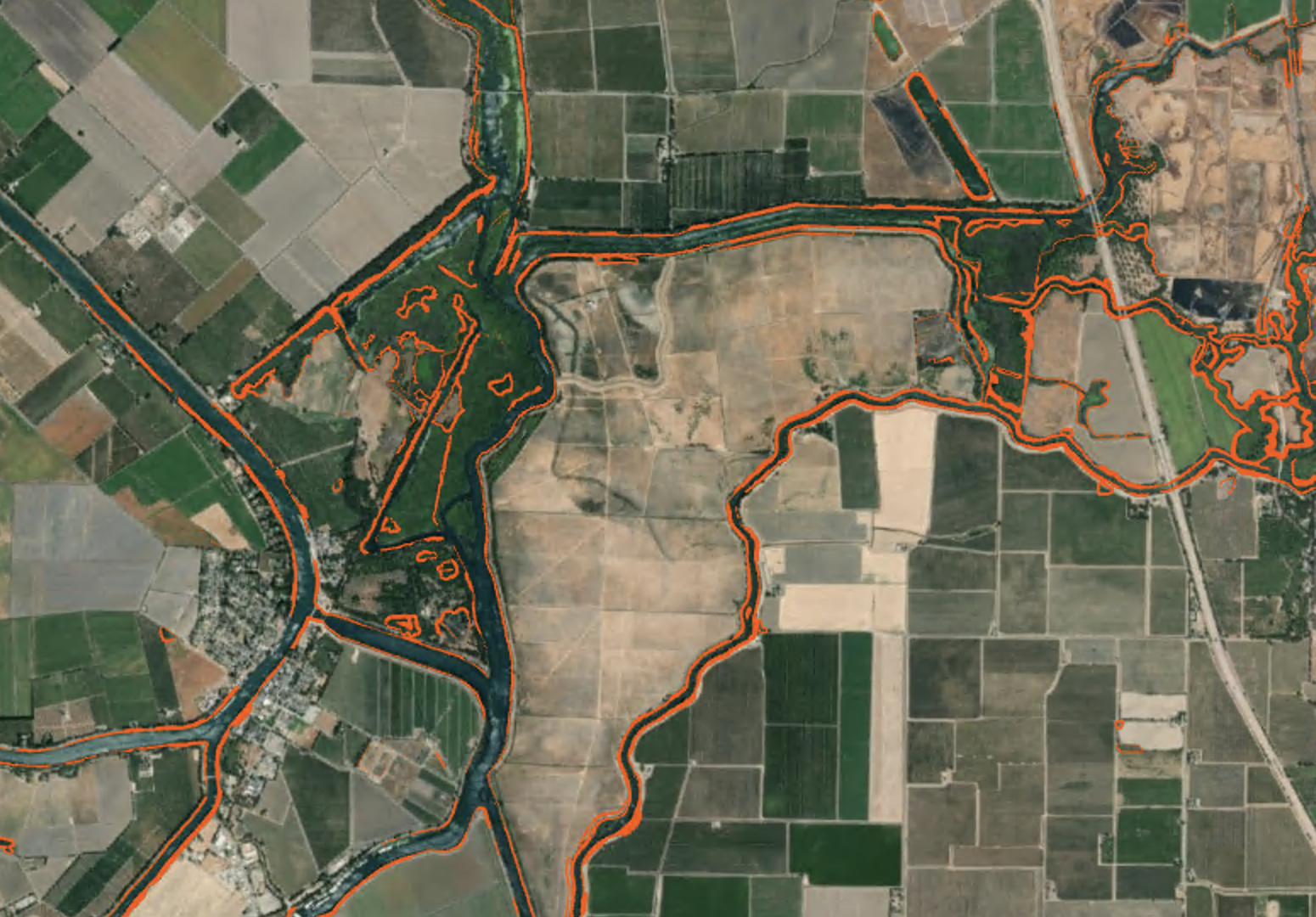
The completion of the Delta Aquatic Resource Inventory (DARI) dataset provides a basemap allowing the quantification of aquatic resources and related habitats within the Sacramento-San Joaquin River Delta (Delta). DARI maps all channels and wetlands, including woody wetlands such as wetlands vegetated with willows, and thus may partially capture riparian areas, however, it does not include polygons for riparian areas. Riparian areas are important to capture as their loss has affected water quality and habitat conditions and presented a number of challenges for resource managers related to water management and land use planning. Current approaches for restoring and protecting riparian areas are starting to focus on appropriate riparian functions or ecological services, including stream shading, bank stabilization, organic and inorganic material input, runoff filtration, floodwater storage, habitat for wildlife support, and groundwater recharge. Land use planners therefore need tools to help delineate and map the extent of “functional riparian width” as a means of ensuring appropriate riparian width in developed aquatic resources targeted for restoration and relatively undisturbed aquatic resources targeted for development. The Riparian Zone Estimation Tool (RipZET; www.sfei.org/projects/ripzet) is a GIS-based decision support tool that estimates existing functional riparian width, and their relation to associated riparian functions, based on physical characteristics along the edges of channels and other wetlands. Due to the importance of capturing riparian areas and the newly completed DARI dataset, it was deemed important to pilot the application of RipZET in the Delta to assess the usefulness of the product.
This layer should be used in conjunction with the DARI (v1.1) wetland layer and represents estimated riparian functional widths in 2018. The areas captured by this RipZET vegetation buffer output only include upland (non-wetland) areas that fall within the estimated riparian functional width.
Creation Date:
Wednesday, March 23, 2022
Last Updated:
Wednesday, March 23, 2022
Type of Data:
GIS vector dataset
Programs and Focus Areas:
Environmental Informatics Program
Geographic Information Systems
Associated Staff:
Funders:
Related Projects, News, and Events:
The Riparian Zone Estimator Tool (RipZET) is a decision support tool developed by the San Francisco Estuary Institute and Aquatic Science Center for the California Riparian Habitat Joint Venture and the California Water Resources Control Board to assist in the visualization and characterization of riparian areas in the watershed context.
 Delta Aquatic Resource Inventory (Project)
DARI is the Delta Aquatic Resources Inventory of surface waters, wetlands and other aquatic resources in the Sacramento-San Joaquin Delta (Delta). The goal of the DARI project is to develop a geospatial inventory of aquatic resources that will be used as a common base map for the Delta. A similar mapping approach used to create the California Aquatic Resource Inventory (CARI) will be applied to provide a map of the aquatic resources and their associated attributes.