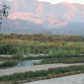
The Tijuana River Valley Historical Ecology Investigation—completed in January 2017—synthesized hundreds of historical maps, photographs, and texts to reconstruct the ecological, hydrological, and geomorphic conditions of the Tijuana River valley prior to major European-American landscape modification. How did the valley look and function before there was the state of California, the city of Tijuana, or an international border? What habitat types and wildlife were found there? How have these habitat types and the physical processes that shaped them changed over time? And finally, what can the valley’s ecological past tell us about its present and future? In answering these fundamental questions, the study has provided scientists, managers, and residents in the valley with information designed to support and inspire ongoing management and restoration activities.
The project's geographic scope encompassed the estuarine and alluvial portions of the Tijuana River watershed from the river mouth in southern San Diego County to the Rodriguez Dam in Tijuana, Mexico.
The report can be downloaded for free as a pdf. Printed copies of the report are also available through Amazon Books.






The Tijuana River Valley Historical Ecology Investigation addresses a regional data gap by reconstructing the landscape and ecosystem characteristics of the river valley prior to the major modifications of the late 19th and 20th centuries.

Announcing SFEI's first binational study: The Tijuana River Valley Historical Ecology Investigation
A new report shows how the Tijuana River Valley, which straddles the boundary between Southern California and northern Mexico, looked and functioned prior to the existence of the border wall, the city of Tijuana, and the state of California.