Gemma Shusterman

Gemma Shusterman, MS
Software Engineering Manager
Environmental Informatics Program
Software Engineering
510-746-7389
Gemma Shusterman is the Software Engineering Manager for the San Francisco Estuary Institute (SFEI). Gemma earned her BA in Computer Science with a minor in art from Mills College in Oakland and an MS in Media Arts and Sciences from the MIT Media Lab. She joined SFEI in 2014 after having previously worked at Sun Microsystems and Discover Magazine. Gemma and her team work closely with institute scientists to create engaging and meaningful data visualizations, tools, and interfaces.
Related Projects, News, and Events
 New Interactive Map Helps Delta Governments and Communities Plan for Adaptation by Understanding Flood Risks from Rising Sea Level and Storms (News)
The Adapting to Rising Tides program of the SF Bay Conservation & Development Commission (ART BCDC), Delta Stewardship Council (DSC) and the San Francisco Estuary Institute / Aquatic Science Center (SFEI) are unveiling the East Contra Costa Shoreline Flood Explorer. SFEI developed the new explorer as a complementary tool to the Bay Shoreline Flood Explorer to allow government organizations and communities in East Contra Costa County to access interactive online maps of local flood risks due to rising sea levels and storm events. These tools help to both highlight what our region could look like without intervention, and to encourage local and regional adaptive plans to minimize flood risks.
 BCDC GIS, Graphics, and Technological Services (Project)
The San Francisco Estuary Institute is working to provide support for the San Francisco Bay Conservation and Development Commission (BCDC) though Geographical Information Systems (GIS), Graphics, and Technological Services.
 SF Bay Nutrients Visualization Tool (Project)
This visualization tool facilitates intuitive comparison of continuous data from around the Bay, and across a variety of analytes, to demonstrate the potential for collaborative monitoring across programs.
 Safe to Eat Portal (Project)
Fish and shellfish are nutritious and good for you to eat. But some fish and shellfish may take in toxic chemicals from the water they live in and the food they eat. Some of these chemicals build up in the fish and shellfish - and in the humans that eat fish and shellfish - over time. Although the chemical levels are usually low, it is a good idea to learn about advisories and monitoring in water bodies where you fish, and for fish or shellfish you eat.
 Project Tracker assists with regional reporting (News)
More and more groups rely on Project Tracker to assist with their reporting. Why? Because Project Tracker standardizes project data across programs so it is easier to summarize information for reporting purposes. Especially in the Bay Area, it is the most comprehensive regional dataset for project information.
 SFEI Developed the Bay Shoreline Flood Explorer for BCDC’s ART program, with More to Come (News)
Over the past year, SFEI has been working with the Bay Conservation and Development Commission's (BCDC) Adapting to Rising Tides (ART) program to develop their new Bay Shoreline Flood Explorer. SFEI’s Environmental Informatics team has designed and developed this public-facing and relevant web tool to highlight threats posed by sea level rise. The tool’s sea-level-rise data was created by AECOM, supported by the Metropolitan Transportation Commission and the Bay Area Toll Authority, and funded with support from greenhouse gas reduction funds.
 Drones for the Environment (News)
The Institute has been making use of drones for a number of projects over the past few years. However, recently, within the Environmental Informatics program, SFEI has been using UAV (unmanned aerial vehicles) in particularly innovative ways.
 Dashboards track cumulative benefits on the landscape (News)
EcoAtlas dashboards are comprehensive views of qualified information provided by Project Tracker and the California Aquatic Resource Inventory (CARI). These dynamic visualizations help measure the cumulative benefits of public policies and programs for California's aquatic resources.
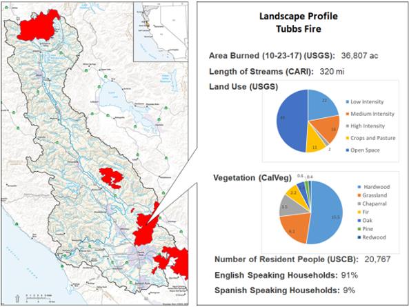 Russian River Watershed Atlas helps track and coordinate post-fire activities (News)
Fire recovery in the Russian River Watershed will benefit from a common online platform for compiling, visualizing, and interpreting many kinds of environmental data available from diverse federal, state, regional, and local sources. Providing such a platform is one objective of the Russian River Regional Monitoring Program (R3MP).
New Project Tracker online forms enhance EcoAtlas' regional capacity for habitat restoration project tracking, assessment and reporting. Partners can now upload and edit project information and approve projects for display on EcoAtlas. Project Tracker meets the important need of providing tools for partners to manage their projects and display information on EcoAtlas, a tool for visualizing the condition and extent of California's aquatic resources.
The key benefits of Project Tracker include:
 New data layers and Landscape Profile mode added to EcoAtlas (News)
New data layers and Landscape Profile mode have been added to EcoAtlas (ecoatlas.org), an online tool for visualizing the abundance, diversity, and condition of wetlands, along with the project activities that are affecting the landscape. Enhancements include:
 Lahontan EcoAtlas Development (Project)
This project will create an EcoAtlas user community for the Lahontan region of the Sierra Nevada to develop capacities within the region to apply EcoAtlas through existing local, regional, state, and federal programs to track projects and summarize map-based and rapid assessment information at the watershed scale.
 Find more data in CD3! (News)
The Contaminant Data Display and Download Tool is a public tool for accessing and visualizing contaminant data. All data are comparable to CEDEN, the California Environmental Data Exchange Network.
We are happy to announce the release of some new enhancements to CD3 including:
 Habitat Restoration Project Tracking (Project)
This project expands the current capabilities of the wetland project tracking system for the monitoring and assessment of California’s aquatic resources to meet the project tracking, assessment, and reporting needs for current and planned habitat restoration in the San Francisco Bay-Delta and Central Valley.
 Lahontan Water Board adopts Regional EcoAtlas Tools (News)
The Lahontan Water Board (Regional Water Board 6) has formally adopted EcoAtlas and the California Rapid Assessment Method (CRAM). This will enable the Water Board to visually track and assess the extent of project impacts on a watershed basis throughout the region.
Beginning August 1 of this year, 401 Certifications and Waste Discharge Requirements will require applicants to upload project information into EcoAtlas. Applicants will be encouraged to use CRAM in pre- and post- project assessments.
 CRAM Bar-Built Estuarine (BBE) module now available to expand the applicability of CRAM (News)
With funding from the State Coastal Conservancy, SFEI staff developed the eCRAM data entry forms for uploading BBE assessments into the CRAM database. Public assessments can be viewed on EcoAtlas' interactive map and downloaded using the CRAM filter tool.
 Evaluation of CRAM performance for assessing wetland stress, small wetlands, and wetland habitat development (Project)
Caltrans funded this wetlands research to fill important gaps in knowledge about the ability of the California Rapid Assessment Method (CRAM) to assess small wetlands, wetlands stress, and the rate at which wetland restoration projects develop into mature habitats. Caltrans proposed specific tasks based on the research priorities provided by the CRAM Commitee of the statewide California Wetlands Monitoring Workgroup.

 New eelgrass survey data available on EcoAtlas (News)
Eelgrass (Zostera marina and Z. pacifica) is recognized as an important ecological resource in nearshore open coast areas, shallow bays, and estuaries throughout coastal California. Access to regional maps and related monitoring reports for eelgrass is crucial to monitor the extent of eelgrass habitat and how it is changing over time, evaluate the effects of coastal development projects on eelgrass habitat, and inform interested stakeholders and the public about eelgrass distribution.
 California Wetlands Portal (Project)
The California Wetlands Portal, one of the State of California’s My Water Quality portals, is the common data management system for the State’s primary wetland protection policies and programs, including the 401 Certification and WDR Programs, the proposed Wetland and Riparian Protection Policy, and the State’s No-Net-Loss Policy.
- ‹ previous
- 3 of 4
- next ›