Library
Our library features many hundreds of entries.
To search among them, click "Search" below to pull down options, including filtering by document type, author, year, and keyword.
Find these options under "Show only items where." Or you can also sort by author, title, type, and year clicking the headings below.
2020. Expert review of the sediment screening guidelines for the beneficial reuse of dredged material in San Francisco Bay. SFEI Contribution No. 978. San Francisco Estuary Institute: Richmond, CA.
The beneficial reuse of dredged sediment is one strategy in a broader portfolio that is being developed for San Francisco Bay to help marshes adapt to rising sea level. Dredged sediment is currently being used in restoration projects around the Bay, but additional sediment is needed to meet the demand. The guidelines for determining if sediment is appropriate for beneficial reuse were developed twenty years ago. As part of assessing the role of dredged sediment in Bay restoration and adaptation strategies, the Regional Monitoring Program for Water Quality (RMP) and stakeholders recognized the need to revisit the beneficial reuse guidelines for dredged sediment. In September 2019, the RMP convened a workshop that included four technical experts to review the beneficial reuse guidelines. The experts were asked to answer three questions: 1) Are the current screening guidelines appropriate for beneficial reuse? 2) Is the current screening process appropriate and adequate? If not, what are your recommendations for improving it? and 3) How should bioaccumulation potential be addressed for the beneficial reuse of sediment? Based on the discussion of these three questions, six recommendations emerged from the workshop.
2020. Flame retardants and plastic additives in San Francisco Bay: Targeted monitoring of organophosphate esters and bisphenols. SFEI Contribution No. 925. San Francisco Estuary Institute: Richmond, CA.
2020. Integrating Planning with Nature: Building climate resilience across the urban-to-rural gradient. SFEI Contribution No. 1013.
2020. Livestock grazing and its effects on ecosystem structure, processes, and conservation. SFEI Contribution No. 1011. San Francisco Estuary Institute: Richmond, CA.
2020. Methods Matter: Methods for Sampling Microplastic and Other Anthropogenic Particles and Their Implications for Monitoring and Ecological Risk Assessment. Integrated Environmental Assessment and Management 16 (6) . SFEI Contribution No. 1014.
To inform mitigation strategies and understand how microplastics affect wildlife, research is focused on understanding the sources, pathways, and occurrence of microplastics in the environment and in wildlife. Microplastics research entails counting and characterizing microplastics in nature, which is a labor‐intensive process, particularly given the range of particle sizes and morphologies present within this diverse class of contaminants. Thus, it is crucial to determine appropriate sampling methods that best capture the types and quantities of microplastics relevant to inform the questions and objectives at hand. It is also critical to follow protocols with strict quality assurance and quality control (QA/QC) measures so that results reflect accurate estimates of microplastic contamination. Here, we assess different sampling procedures and QA/QC strategies to inform best practices for future environmental monitoring and assessments of exposure. We compare microplastic abundance and characteristics in surface‐water samples collected using different methods (i.e., manta and bulk water) at the same sites, as well as duplicate samples for each method taken at the same site and approximate time. Samples were collected from 9 sampling sites within San Francisco Bay, California, USA, using 3 different sampling methods: 1) manta trawl (manta), 2) 1‐L grab (grab), and 3) 10‐L bulk water filtered in situ (pump). Bulk water sampling methods (both grab and pump) captured more microplastics within the smaller size range (<335 μm), most of which were fibers. Manta samples captured a greater diversity of morphologies but underestimated smaller‐sized particles. Inspection of pump samples revealed high numbers of particles from procedural contamination, stressing the need for robust QA/QC, including sampling and analyzing laboratory blanks, field blanks, and duplicates. Choosing the appropriate sampling method, combined with rigorous, standardized QA/QC practices, is essential for the future of microplastics research in marine and freshwater ecosystems.
2020. Microparticles, Microplastics, and PAHs in Bivalves in San Francisco Bay. SFEI Contribution No. 976. San Francisco Estuary Institute: Richmond, CA.
California mussels (Mytilus californianus and hybrid Mytilus galloprovincialis / Mytilus trossulus) and Asian clams (Corbicula fluminea) were collected at multiple sites in San Francisco Bay. Mussels from a reference area with minimal urban influence were also deployed in cages for 90 days at multiple sites within the Bay prior to collection.Mussels from the reference time zero site, Bodega Head, had some of the lowest microparticle levels found in this study, along with resident clams from the San Joaquin and Sacramento Rivers and mussels transplanted to Pinole Point. The highest concentrations of microparticles were in mussels transplanted to Redwood Creek and Coyote Creek. The results of this study and current literature indicate that bivalves may not be good status and trends indicators of microplastic concentrations in the Bay unless the interest is in human health exposure via contaminated bivalve consumption.
2020. Moffett Park Specific Plan Urban Ecology Technical Report. SFEI Contribution No. 985.
2020. Multi-box mass balance model of PFOA and PFOS in different regions of San Francisco Bay. Chemosphere 252 . SFEI Contribution No. 986.
We present a model to predict the long-term distribution and concentrations of perfluorooctanoic acid (PFOA) and perfluorooctanesulfonic acid (PFOS) in estuaries comprising multiple intercommunicated sub-embayments. To that end, a mass balance model including rate constants and time-varying water inputs was designed to calculate levels of these compounds in water and sediment for every sub-embayment. Subsequently, outflows and tidal water exchanges were used to interconnect the different regions of the estuary. To calculate plausible risks to population, outputs of the model were used as inputs in a previously designed model to simulate concentrations of PFOA and PFOS in a sport fish species (Cymatogaster aggregata). The performance of the model was evaluated by applying it to the specific case of San Francisco Bay, (California, USA), using 2009 sediment and water sampled concentrations of PFOA and PFOS in North, Central and South regions. Concentrations of these compounds in the Bay displayed exponential decreasing trends, but with different shapes depending on region, compound, and compartment assessed. Nearly stable PFOA concentrations were reached after 50 years, while PFOS needed close to 500 years to stabilize in sediment and fish. Afterwards, concentrations stabilize between 4 and 23 pg/g in sediment, between 0.02 and 44 pg/L in water, and between 7 and 104 pg/g wet weight in fish, depending on compound and region. South Bay had the greatest final concentrations of pollutants, regardless of compartment. Fish consumption is safe for most scenarios, but due to model uncertainty, limitations in monthly intake could be established for North and South Bay catches.
2020. Neonicotinoids and Their Degradates in San Francisco Bay Water. SFEI Contribution No. 1002. San Francisco Estuary Institute: Richmond, CA.
In the summer of 2017, open Bay water samples were collected during the RMP Status and Trends Water Cruise. Samples were analyzed for 19 neonicotinoids and metabolites. The only neonicotinoid detected was imidacloprid, an active ingredient used in both urban and agricultural applications. Imidacloprid was detected at a single site above the method detection limits (2.2-2.6 ng/L) in Lower South Bay at a level of 4.2 ng/L. This value is within the range of concentrations found in a separate RMP study in water samples collected from the South and Lower South Bay margins in 2017. Imidacloprid was detected at 3 of 12 of the margin sites at levels between 3.9 and 11 ng/L; no other neonicotinoids were detected. Of note, these RMP studies appear to represent the first evaluation of ambient neonicotinoid concentrations in an estuarine environment in the nation.
2020. New Life for Eroding Shorelines: Beach and Marsh Edge Change in the San Francisco Estuary. SFEI Contribution No. 984.
2020. New San Francisco Bay Contaminants Emerge. SFEI Contribution No. 931. San Francisco Estuary Institute: Richmond, CA.
In 2016, the RMP launched a novel investigation to detect new or unexpected contaminants in Bay waters, as well as treated sewage (or wastewater) discharged to the Bay. This study used non-targeted analysis, a powerful tool that provides a broad, open-ended view of thousands of synthetic and naturally-derived chemicals simultaneously. We identified hundreds of contaminants, and the results have opened our eyes to urban stormwater runoff as an important pathway for emerging contaminants to enter the Bay.
2020. Pollutants of Concern Reconnaissance Monitoring Progress Report, Water Years 2015 - 2019. SFEI Contribution No. 987. San Francisco Estuary Institute: Richmond, CA.
Reconnaissance monitoring for water years 2015, 2016, 2017, 2018 and 2019 was completed with funding provided by the Regional Monitoring Program for Water Quality in San Francisco Bay (RMP). This report is designed to be updated each year until completion of the study. At least one additional water year (2020) is underway. An earlier draft of this report was prepared for the Bay Area Stormwater Management Agencies Association (BASMAA) in support of materials submitted on or before March 31st 2020 in compliance with the Municipal Regional Stormwater Permit (MRP) Order No. R2-2015-0049.
2020. Recommended Best Practices for Collecting, Analyzing, and Reporting Microplastics in Environmental Media: Lessons Learned from Comprehensive Monitoring of San Francisco Bay. Journal of Hazardous Materials . SFEI Contribution No. 1023.
Microplastics are ubiquitous and persistent contaminants in the ocean and a pervasive and preventable threat to the health of marine ecosystems. Microplastics come in a wide variety of shapes, sizes, and plastic types, each with unique physical and chemical properties and toxicological impacts. Understanding the magnitude of the microplastic problem and determining the highest priorities for mitigation require accurate measures of microplastic occurrence in the environment and identification of likely sources. The field of microplastic pollution is in its infancy, and there are not yet widely accepted standards for sample collection, laboratory analyses, quality assurance/quality control (QA/QC), or reporting of microplastics in environmental samples. Based on a comprehensive assessment of microplastics in San Francisco Bay water, sediment, fish, bivalves, stormwater, and wastewater effluent, we developed recommended best practices for collecting, analyzing, and reporting microplastics in environmental media. We recommend factors to consider in microplastic study design, particularly in regard to site selection and sampling methods. We also highlight the need for standard QA/QC practices such as collection of field and laboratory blanks, use of methods beyond microscopy to identify particle composition, and standardized reporting practices, including suggested vocabulary for particle classification.
2020. Re-Oaking North Bay. SFEI Contribution No. 947. San Francisco Estuary Institute: Richmond, CA.
2020. Restoration Vision for the Laguna de Santa Rosa. SFEI Contribution No. 983. SFEI: Richmond, CA.
The Laguna de Santa Rosa, located in the Russian River watershed in Sonoma County, CA, is an expansive freshwater wetland complex that hosts a rich diversity of plant and wildlife species, many of which are federally or state listed as threatened, endangered, or species of special concern. The Laguna is also home to a thriving agricultural community that depends on the land for its livelihood. Since the mid-19th century, development within the Laguna and its surrounding watershed have had a considerable impact on the landscape, affecting both wildlife and people. Compared to pre-development conditions, the Laguna currently experiences increased stormwater runoff and flooding, increased delivery and accumulation of fine sediment and nutrients, spread of problematic invasive species, and decreased habitat for native fish and wildlife species. Predicted changes in future precipitation patterns and summertime air temperatures, combined with expanding development pressure, could exacerbate these problems. People who manage land and regulate land management decisions in and around the Laguna, including landowners; federal, state, and local agencies; and local stakeholders, are seeking a long-term management approach for the Laguna that improves conditions for the wildlife and people that call the Laguna home. The California Department of Fish and Wildlife and Sonoma Water funded the Laguna-Mark West Creek Watershed Master Restoration Planning Project to develop such a management approach, focusing on the need to identify restoration and management actions that enhance desired ecological functions of the Laguna, while also supporting the area’s agriculture and its local residents.
2020. RMP Update 2020. SFEI Contribution No. 1008.
The overarching goal of the Regional Monitoring Program for Water Quality in San Francisco Bay (RMP) is to answer the highest priority scientific questions faced by managers of Bay water quality. The RMP is an innovative collaboration between the San Francisco Bay Regional Water Quality Control Board, the regulated discharger community, the San Francisco Estuary Institute, and many other scientists and interested parties. The purpose of this document is to provide a concise overview of recent RMP activities and findings, and a look ahead to significant products anticipated in the next two years. The report includes a description of the management context that guides the Program; a brief summary of some of the most noteworthy findings of this multifaceted Program; and a summary of progress to date and future plans for addressing priority water quality topics.
2020. Sampling and Quality Assurance and Quality Control: A Guide for Scientists Investigating the Occurrence of Microplastics Across Matrices. Applied Spectroscopy 74 (9) . SFEI Contribution No. 1012.
Plastic pollution is a defining environmental contaminant and is considered to be one of the greatest environmental threats of the Anthropocene, with its presence documented across aquatic and terrestrial ecosystems. The majority of this plastic debris falls into the micro (1 lm–5 mm) or nano (1–1000 nm) size range and comes from primary and secondary sources. Its small size makes it cumbersome to isolate and analyze reproducibly, and its ubiquitous distribution creates numerous challenges when controlling for background contamination across matrices (e.g., sediment, tissue, water, air). Although research on microplastics represents a relatively nascent subfield, burgeoning interest in questions surrounding the fate and effects of these debris items creates a pressing need for harmonized sampling protocols and quality control approaches. For results across laboratories to be reproducible and comparable, it is imperative that guidelines based on vetted protocols be readily available to research groups, many of which are either new to plastics research or, as with any new subfield, have arrived at current approaches through a process of trial-and-error rather than in consultation with the greater scientific community. The goals of this manuscript are to (i) outline the steps necessary to conduct general as
well as matrix-specific quality assurance and quality control based on sample type and associated constraints, (ii) briefly review current findings across matrices, and (iii) provide guidance for the design of sampling regimes. Specific attention is paid to the source of microplastic pollution as well as the pathway by which contamination occurs, with details provided regarding each step in the process from generating appropriate questions to sampling design and collection.
2020. Santa Clara County Five Watersheds Assessment: A Synthesis of Ecological Data Collection and Analysis Conducted by Valley Water. . SFEI Contribution No. 963. San Francisco Estuary Institute: Richmond. CA. p 71.
This report synthesizes the baseline assessments for Santa Clara County’s five watersheds to present similarities, differences, and compare ecological condition in streams across watersheds and their subregions, San Francisco Bay-Delta ecoregion, and statewide based on CRAM. It also interprets the assessment results and comparisons to identify risks to stream conditions, and opportunities for stream stewardship. Project D5’s baseline assessments establish a monitoring and assessment framework for evaluating the performance of Valley Water’s programs, projects, maintenance activities, and on-the-ground stewardship actions.
2020. Sediment Monitoring and Modeling Strategy. Sediment Monitoring and Modeling Strategy. SFEI Contribution No. 1016. San Francisco Estuary Institute: Richmond, CA.
. 2020. Sonoma Creek Baylands Strategy. Prepared by Sonoma Land Trust, San Francisco Estuary Institute, Point Blue Conservation Science, Environmental Science Associates, Ducks Unlimited, U.S. Fish and Wildlife Service.
2020. Special Study on Bulk Density. SFEI Contribution No. 975. San Francisco Estuary Institute: Richmond, CA. p 43.
Sediment bulk density is the total mass of mineral and organic sediment within a defined volume. It is a key variable in many research questions pertaining to Bay sediment studies but one that is often poorly quantified and can be misinterpreted. The motivation for this report comes from a recommendation by Schoellhamer et al. (2018) to compile more accurate estimates of bulk density of Bay sediments to convert between volume and mass with a higher level of certainty. Through funding and guidance from the Bay Regional Monitoring Program Sediment Work Group, this report is a first step towards compiling the available data on sediment bulk densities across Bay habitats and along salinity gradients to provide better information for resource managers and others working on sediment-related issues. This report discusses the need to know the bulk density of Bay soils to convert between sediment mass and soil volume; clarifies general definitions and common points of confusion related to sediment bulk density; compiles primary sources of bulk density measurements, secondary sources of bulk density estimates, and standard engineering estimates of bulk density for different habitats in San Francisco Bay; and, provides a database where practitioners can track, analyze, and share bulk density measurements.
2020. Sports and urban biodiversity. . SFEI Contribution No. 1028.
SFEI collaborated with the International Union for the Conservation of Nature (IUCN) and the International Olympic Committee (IOC) to create a guide to incorporating nature into urban sports, from the development of Olympic cities to the design and management of the many sport fields throughout the urban landscape. We applied the Urban Biodiversity Framework developed in Making Nature’s City to the world of sports, with case studies drawn from international sport federations, Olympic cities, and individual sport teams and venues around the world. The guide is part of IUCN’s ongoing collaboration with IOC to develop best practices around biodiversity for the sporting industry.
2020. Summary of Water Year 2017 precipitation, discharge, and sediment conditions at selected locations in Arroyo de la Laguna watershed, with a focus on Arroyo Mocho. SFEI Contribution No. 912. San Francisco Estuary Institute: Richmond, CA.
This report summarizes the precipitation, discharge, and sediment conditions observed from October 1, 2016 to September 30th, 2017 (Water Year (WY) 2017) in the Arroyo de la Laguna watershed, with a focus on the Arroyo Mocho watershed. This information was collected by the Zone 7 Water Agency to support operation and maintenance of their flood control facilities. Additionally, this and similar information collected in WY 2018 and 2019 will be utilized to update the Arroyo Mocho watershed sediment budget (Pearce et al, 2020).
2020. Suspended Sediment Flux in the San Francisco Estuary: Part I—Changes in the Vertical Distribution of Suspended Sediment and Bias in Estuarine Sediment Flux Measurements. Estuaries and Coasts . SFEI Contribution No. 990.
In this study, we investigate how changes in the vertical distribution of suspended sediment affect continuous suspended sediment flux measurements at a location in the San Francisco Estuary. Current methods for measuring continuous suspended sediment flux estimates relate continuous estimates of suspended-sediment concentration (SSC) measured at-a-point (SSCpt) to discrete cross-section measurements of depth-averaged, velocity-weighted SSC (SSCxs). Regressions that compute SSCxs from continuous estimates of SSCpt require that the slope between SSCpt and SSCxs, controlled by the vertical distribution of SSC, is fixed. However, in tidal systems with suspended cohesive sediment, factors that control the vertical SSC profile—vertical turbulent mixing and downward settling of suspended sediment mediated by flocculation of cohesive sediment—constantly vary through each tide and may exhibit systematic differences between flood and ebb tides (tidal asymmetries in water velocity or particle size). We account for changes in the vertical SSC profile on estimates of SSCxs using time series of the Rouse number of the Rouse-Vanoni-Ippen equation combined with optical turbidity measurements, a surrogate for SSCpt, to predict SSCxs from 2009 to 2011 and 2013. Time series of the Rouse number were estimated by fitting the Rouse-Vanoni-Ippen equation to SSC estimated from optical-turbidity measurements taken at two elevations in the water column. When accounting for changes in the vertical SSC profile, changes in not only the magnitude but also the direction of cumulative sediment-flux measurements were observed. For example, at a mid-depth sensor, sediment flux estimates changed from − 319 kt (± 65 kt, negative indicating net seaward transport) to 482 kt (± 140 kt, positive indicating net landward transport) for 2009–2011 and from − 388 kt (± 140 kt) to 1869 kt (± 406 kt) for 2013–2016. At the study location, estimation of SSCxs solely from SSCpt resulted in sediment flux values that were underestimates on flood tides and overestimates on ebb tides. This asymmetry is driven by covariance between water velocity and particle settling velocity (Ws) with larger Ws on flood compared to ebb tides. Results of this study indicate that suspended-sediment-flux measurements estimated from point estimates of SSC may be biased if systematic changes in the vertical distribution of SSC are unaccounted for.
2020. Suspended-sediment Flux in the San Francisco Estuary; Part II: the Impact of the 2013–2016 California Drought and Controls on Sediment Flux. Estuaries and Coasts. SFEI Contribution No. 1137. Estuaries and Coasts.
Recent modeling has demonstrated that sediment supply is one of the primary environmental variables that will determine the sustainability of San Francisco Estuary tidal marshes over the next century as sea level rises. Therefore, understanding the environmental controls on sediment flux within the San Francisco Estuary is crucial for optimal planning and management of tidal marsh restoration. Herein, we present suspended-sediment flux estimates from water year (WY) 2009–2016 from the San Francisco Estuary to investigate the environmental controls and impact of the record 2013–2016 California drought. During the recent drought, sediment flux into Lower South Bay, the southernmost subembayment of the San Francisco Estuary, increased by 345% from 114 kt/year from WY 2009 to 2011 to 508 kt/year from WY 2014 to 2016, while local tributary sediment flux declined from 209 to 51 kt/year. Total annual sediment flux from WY 2009 to 2011 and 2014 to 2016 can be predicted by total annual freshwater inflow from the Sacramento-San Joaquin Delta (R2 = 0.83, p < 0.01), the primary source of freshwater input into the San Francisco Estuary. The volume of freshwater inflow from the Sacramento-San Joaquin Delta is hypothesized to affect shoal-to-channel density gradients that affect sediment flux from broad, typically more saline and turbid shoals, to the main tidal-channel seaward of Lower South Bay. During the drought, freshwater inflow from the Sacramento-San Joaquin Delta decreased, and replacement of typically more saline shoal water was reduced. As a result, landward-increasing cross-channel density gradients enhanced shoal-to-channel advective flux that increased sediment available for tidal dispersion and drove an increase in net-landward sediment flux into Lower South Bay.
2020. Think Global, Act Local: Local Knowledge Is Critical to Inform Positive Change When It Comes to Microplastics. Environmental Science & Technology . SFEI Contribution No. 1024.
Microplastic contamination in the marine environment is a global issue. Across the world, policies at the national and international level are needed to facilitate the scale of change needed to tackle this significant problem. However, sources and patterns of plastic contamination vary around the world, and the most pressing actions differ from one location to another. Therefore, local policies are a critical part of the solution; recognizing local sources will enable mitigations with measurable impacts. Here, we highlight how investigating the contamination comprehensively in one location can inform relevant mitigation strategies that can be transferred globally. We examine the San Francisco Bay in California, USA—the largest estuary on the West Coast of the Americas, and home to over 7 million people. The local contamination of microplastics in surface water, sediments, and fish from this urban bay is reportedly higher than many places studied to date.(1) This example demonstrates the value of local monitoring in identifying sources, informing local mitigation strategies and developing an array of solutions to stem the multifaceted tide of plastic pollution entering our global oceans.
2020. Wildlife Habitat and Water Quality Enhancement Opportunities at Castlewood Country Club. SFEI Contribution No. 1003. San Francisco Estuary Institute: Richmond, CA.
Meeting human and ecological needs within San Francisco Bay’s watersheds is increasingly challenged by flooding, water quality degradation, and habitat loss, exacerbated by intensified urbanization and climate change. Addressing these challenges requires implementing multi-benefit strategies through new partnerships and increased coordination across the region’s diverse landscapes. Actions to improve water quality and enhance habitat for biodiversity in our highly developed and managed landscapes can help the region as a whole to build resilience to withstand current pressures and future change. The EPA-funded project, “Preparing for the Storm,” aims to address these challenges at the site- and landscape-scale through studies and implementation projects in the Livermore-Amador Valley. As part of this larger project, this technical report presents a synthesis of water quality and habitat improvement opportunities for a golf course of Castlewood Country Club.
2021. 2019 RMP Data Quality Assurance Report. San Francisco Estuary Institute: Richmond, CA.
This memo provides a high-level summary of the quality assurance assessment for data reported by the RMP. In 2019, fish tissue samples were collected from nine Bay/Delta areas and three additional wetland/slough areas for the Regional Monitoring Program for Water Quality in San Francisco Bay (RMP). General descriptions of the sample collection methods are provided in the RMP Quality Assurance Program Plan, cruise plans, cruise reports, and field sampling reports. These documents are available from the SFEI website (http://www.sfei.org/content/status-and-trends-monitoring-documents).
2021. 2020-21 RMP North Bay Selenium Study. SFEI Contribution No. 1052. San Francisco Estuary Institute: Richmond, CA.
This report details activities associated with the Regional Monitoring Program North Bay Selenium Study in 2020 and 2021. The study was designed to monitor two sites for selenium (Se) in water and clam tissue six times annually between June and February. Due to the COVID pandemic, however, four sample collection events were completed. This report outlines the sampling activities, personnel, and site locations monitored for the project.
2021. 2020 Bay Margins Sediment Study Cruise Plan. SFEI Contribution No. 1073. San Francisco Estuary Institute: Richmond, California.
This report details plans associated with sediment sampling for the Bay Margins Sediment Study for the Regional Monitoring Program for Water Quality in San Francisco Bay (RMP). Bay margins (i.e., mud flats and adjacent shallow areas of the Bay) are productive and highly utilized by biota of interest (humans and wildlife). This study will provide a spatially-distributed characterization of surface sediment contamination and ancillary characteristics within San Pablo Bay, Suisun Bay, and Carquinez Strait margin areas. This study builds on two previous studies to characterize surface sediment contamination in Central and South Bays.
2021. 2021 Quality Assurance Program Plan for the Regional Monitoring Program for Water Quality in San Francisco Bay. SFEI Contribution No. 1048. San Francisco Estuary Institute: Richmond, California.
2021. 2021 RMP Detailed Workplan and Budget. SFEI Contribution No. 1182. San Francisco Estuary Institute: Richmond, CA.
In 2021 the Regional Monitoring Program for Water Quality in San Francisco Bay (RMP) is entering its 29th year of collecting data and communicating information to support water quality management decisions. This Detailed Workplan and Budget describes the activities that will be completed in 2021, the proposed funding levels, and the deliverables for each task.
2021. 2021 RMP Multi-Year Plan. SFEI Contribution No. 1027. San Francisco Estuary Institute: Richmond, CA.
2021. 2021 RMP Water Cruise Plan. SFEI Contribution No. 1050. San Francisco Estuary Institute: Richmond, California.
This report details plans associated with the annual Regional Monitoring Program for Water Quality in the San Francisco Estuary (RMP) water cruise. The RMP water sampling program was redesigned in 2002 to adopt a randomized sampling design at thirty-one sites in place of the twenty-six base program stations sampled previously. In 2007, the number of sites was decreased to twenty-two stations, and it remains as such for 2021. The analytes for 2021 have been modified based on the Status and Trends (S&T) Review process that started in 2020. The analytes that are being removed from the program include selenium and methylmercury (dissolved and particulate), while bisphenols and organophosphate esters (OPEs) have been added to S&T monitoring.
2021. Assessment of emerging polar organic pollutants linked to contaminant pathways within an urban estuary using non-targeted analysis. SFEI Contribution No. 1107. Environmental Sciences: Processes and Impacts.
A comprehensive, non-targeted analysis of polar organic pollutants using high resolution/accurate mass (HR/AM) mass spectrometry approaches has been applied to water samples from San Francisco (SF) Bay, a major urban estuary on the western coast of the United States, to assess occurrence of emerging contaminants and inform future monitoring and management activities. Polar Organic Chemical Integrative Samplers (POCIS) were deployed selectively to evaluate the influence of three contaminant pathways: urban stormwater runoff (San Leandro Bay), wastewater effluent (Coyote Creek, Lower South Bay), and agricultural runoff (Napa River). Grab samples were collected before and after deployment of the passive samplers to provide a quantitative snapshot of contaminants for comparison. Composite samples of wastewater effluent (24 hours) were also collected from several wastewater dischargers. Samples were analyzed using liquid-chromatography coupled to high resolution mass spectrometry. Resulting data were analyzed using a customized workflow designed for high-fidelity detection, prioritization, identification, and semi-quantitation of detected molecular features. Approximately 6350 compounds were detected in the combined data set, with 424 of those compounds tentatively identified through high quality spectral library match scores. Compounds identified included ethoxylated surfactants, pesticide and pharmaceutical transformation products, polymer additives, and rubber vulcanization agents. Compounds identified in samples were reflective of the apparent sources and pathways of organic pollutant inputs, with stormwater-influenced samples dominated by additive chemicals likely derived from plastics and vehicle tires, as well as ethoxylated surfactants.
2021. The biological deserts fallacy: Cities in their landscapes contribute more than we think to regional biodiversity. BioScience 71 (2) . SFEI Contribution No. 1031.
 Cities are both embedded within and ecologically linked to their surrounding landscapes. Although urbanization poses a substantial threat to biodiversity, cities also support many species, some of which have larger populations, faster growth rates, and higher productivity in cities than outside of them. Despite this fact, surprisingly little attention has been paid to the potentially beneficial links between cities and their surroundings.
We identify five pathways by which cities can benefit regional ecosystems by releasing species from threats in the larger landscape, increasing regional habitat heterogeneity and genetic diversity, acting as migratory stopovers, preadapting species to climate change, and enhancing public engagement and environmental stewardship. Increasing recognition of these pathways could help cities identify effective strategies for supporting regional biodiversity conservation and could provide a science-based platform for incorporating biodiversity alongside other urban greening goals.
2021. Biophilia beyond the Building: Applying the Tools of Urban Biodiversity Planning to Create Biophilic Cities. Sustainability 13 (5).
In response to the widely recognized negative impacts of urbanization on biodiversity, many cities are reimagining urban design to provide better biodiversity support. Some cities have developed urban biodiversity plans, primarily focused on improving biodiversity support and ecosystem function within the built environment through habitat restoration and other types of urban greening projects. The biophilic cities movement seeks to reframe nature as essential infrastructure for cities, seamlessly integrating city and nature to provide abundant, accessible nature for all residents and corresponding health and well-being outcomes. Urban biodiversity planning and biophilic cities have significant synergies in their goals and the means necessary to achieve them. In this paper, we identify three key ways by which the urban biodiversity planning process can support biophilic cities objectives: engaging the local community; identifying science-based, quantitative goals; and setting priorities for action. Urban biodiversity planning provides evidence-based guidance, tools, and techniques needed to design locally appropriate, pragmatic habitat enhancements that support biodiversity, ecological health, and human health and well-being. Developing these multi-functional, multi-benefit strategies that increase the abundance of biodiverse nature in cities has the potential at the same time to deepen and enrich our biophilic experience in daily life.
2021. California Trash Monitoring Methods and Assessments Playbook. SFEI Contribution No. 1025. San Francisco Estuary Institute: Richmond, Calif.
 As municipalities and water-quality regulatory agencies have implemented programs and policies to improve management of the trash loading to storm drain conveyances, there has been increased interest in using a common set of methods to quantify the effectiveness of management actions. To create a foundation for developing a consistent, standardized approach to trash monitoring statewide, the project team performed a method comparison analysis, based on two seasons of fieldwork. This analysis facilitated the assessment of the accuracy, repeatability, and efficiency of some already developed trash monitoring methodologies already in use, as well as help to investigate a new, innovative method (cf. Fielding Testing Report on trashmonitoring.org). Methods developed by the Bay Area Stormwater Management Agencies Association (BASMAA) for use in the San Francisco Bay Area were compared to methods developed by the Southern California Stormwater Monitoring Coalition (SMC) for use in coastal southern California. One of the chief goals of these comparisons was to understand the similarities and differences between the already existing methods for detecting, quantifying, and characterizing trash in selected environments. Readers will find that the data bear out remarkable levels of accuracy and precision with quantitative metrics that help to align methods and management concerns. Furthermore, the degree of correlation among tested methods were especially high, offering greater opportunities for inter-method comparisons.
The findings of this project are intended for use by public agencies, non-profit organizations, private consultants, and all of their various partners in informing a statewide effort to adopt rigorous, standardized monitoring methods to support the State Water Board’s Trash Amendments. Over the next couple of decades, such public mandates will require all water bodies in California to achieve water quality objectives for trash.
2021. Contaminant Concentrations in Sport Fish from San Francisco Bay: 2019. SFEI Contribution No. 1036. San Francisco Estuary Institute: Richmond, CA.
2021. Coyote Creek Watershed Reassessment 2020: 10-Year Reassessment of the Ecological Condition of Streams Applying the California Rapid Assessment Method, Santa Clara County, California. SFEI Contribution No. 1043. San Francisco Estuary Institute: Richmond. CA. p 131.
This report describes the amount and distribution of aquatic resources in the Coyote Creek watershed, Santa Clara County, California, and presents the first reassessment of stream ecosystem conditions using a watershed approach and the California Rapid Assessment Method (CRAM). Field work was conducted in 2020, ten years after the baseline watershed assessment completed in 2010.
2021. E-Bikes and Open Space: The Current State of Research and Management Recommendations. SFEI Contribution No. 1064. San Francisco Estuary Institute: Richmond, CA.
. 2021. Ecotone levees and wildlife connectivity: A technical update to the Adaptation Atlas. SFEI Contribution No. 1037. San Francisco Estuary Institute: Richmond, CA.
2021. An Examination of the Benefits and Trade-offs of Visitation and Recreational Use of Public Open Space. SFEI Contribution No. 1020. San Francisco Estuary Institute: Richmond, CA.
2021. Field Testing Report: California Trash Monitoring Methods. SFEI Contribution No. 1026. San Francisco Estuary Institute: Richmond, Calif.
 Trash has received renewed focus in recent years as policy makers, public agencies, environmental organizations, and community groups have taken many steps towards trash quantification and management across California. The range of management actions is matched by the diversity of monitoring approaches, designed to determine key attributes associated with trash pollution on California’s lands and in its waterways.
This report describes the field testing associated with a project designed to validate the accuracy, precision, and practicality of several trash monitoring methods, practiced across the state. Additionally, the project measured the efficacy of a novel monitoring method designed to detect trash via remote sensing and machine learning. Readers will find details about each respective method -- the specific approach to
landscape characterization, the qualitative or quantitative measures undertaken, the team-based quality assurance for data collection -- as well as the approach that the testing team adopted to ensure efficient, accurate, and useful validation of the methods.
Because the validation efforts integrated multiple methods, using multiple teams at a selection of common sites, the field testing report yields useful statistical information not only about each method individually, but about the comparability of the results. The report illustrates the
correlation factor associated with different forms of trash metrics, associated with different methods practiced on the same assessment sites. The results illustrated a generally high degree of correlation among different methods, which promises opportunities to compare results meaningfully across methods.
Furthermore, this field testing report provides quantitative measures to illustrate the repeatability of each method, the differences and insights yielded by assessment site sizing criteria varying among methods, the transferability / teach-ability of each method among trash monitoring practitioners, and how the degrees of accuracy might aid programs in performing mass balance analysis of known sources
to trash detected in a given site.
Regarding innovation, the project team leveraged multiple on-the-ground methods and special testing scenarios to compare conventional and novel (aerial) assessments to measure the relative accuracy and precision of this emergent technology that might address some of the resource constraints that currently limit the broader or more frequent deployment of conventional trash assessment methods. The analyses captured in this field testing report offer specific quantitative measures of the accuracy (bias), precision (repeatability), practicality and cost associated with each method. This information is subsequently used to inform a companion summary analysis found in the Trash Monitoring Playbook, which is designed to evaluate the applicability of the monitoring methods to address classes of
monitoring questions.
2021. Flood Control Channel Classification Scheme for the San Francisco Bay Region. . San Francisco Bay Region Flood Control Channel Classification . SFEI Contribution No. 1046. San Francisco Estuary Institute: Richmond, CA.
2021. Framework for nontargeted investigation of contaminants released by wildfires into stormwater runoff: Case study in the northern San Francisco Bay area. Integrated Environmental Assessment and Management . SFEI Contribution No. 1044.
Wildfires can be extremely destructive to communities and ecosystems. However, the full scope of the ecological damage is often hard to assess, in part due to limited information on the types of chemicals introduced to affected landscapes and waterways. The objective of this study was to establish a sampling, analytical, and interpretive framework to effectively identify and monitor contaminants of emerging concern in environmental water samples impacted by wildfire runoff. A nontargeted analysis consisting of comprehensive two-dimensional gas chromatography coupled to time-of-flight mass spectrometry (GC × GC/TOF-MS) was conducted on stormwater samples from watersheds in the City of Santa Rosa and Sonoma and Napa Counties, USA, after the three most destructive fires during the October 2017 Northern California firestorm. Chemicals potentially related to wildfires were selected from the thousands of chromatographic features detected through a screening method that compared samples from fire-impacted sites versus unburned reference sites. This screening led to high confidence identifications of 76 potentially fire-related compounds. Authentic standards were available for 48 of these analytes, and 46 were confirmed by matching mass spectra and GC × GC retention times. Of these 46 compounds, 37 had known commercial and industrial uses as intermediates or ingredients in plastics, personal care products, pesticides, and as food additives. Nine compounds had no known uses or sources and may be oxidation products resulting from burning of natural or anthropogenic materials. Preliminary examination of potential toxicity associated with the 46 compounds, conducted via online databases and literature review, indicated limited data availability. Regional comparison suggested that more structural damage may yield a greater number of unique, potentially wildfire-related compounds. We recommend further study of post-wildfire runoff using the framework described here, which includes hypothesis-driven site selection and nontargeted analysis, to uncover potentially significant stormwater contaminants not routinely monitored after wildfires and inform risk assessment.
2021. Green Stormwater Infrastructure Planning-level Analysis for Livermore-Amador Valley. SFEI Contribution No. 1063. San Francisco Estuary Institute: Richmond, Calif.
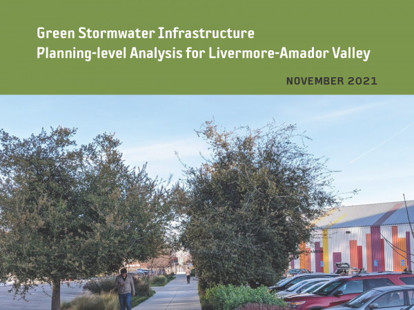 This effort is intended to provide planning-level regional guidance for placement of green stormwater infrastructure (GSI) in Livermore-Amador Valley. This work identifies potential GSI locations and quantifies contaminant load and stormwater runoff volume reduction benefits through the application of GreenPlan-IT, a planning tool developed by the San Francisco Estuary Institute and regional partners. Ultimately, the urban greening analysis presented in this report is intended to help enhance stream and watershed resilience, reduce peak flows, and improve water quality.
2021. Guidance for Restoration of Natural and Nature-Based Features in the Wetland-Upland Transition Zone. San Francisco Estuary Institute, California State Coastal Conservancy: Richmond, CA.
2021. Holistic Assessment of Microplastics and Other Anthropogenic Microdebris in an Urban Bay Sheds Light on Their Sources and Fate. Environmental Science and Technology Water . SFEI Contribution No. 1060.

The physical and chemical properties of microplastics and their environmental distributions may provide clues about their sources and inform their fate. We demonstrate the value of extensive monitoring of microplastics in an urban bay, San Francisco Bay. Surface water, fish, sediment, stormwater runoff, and treated wastewater were sampled across the bay and adjacent national marine sanctuaries (NMS). We found microplastics and other anthropogenic microdebris (“microdebris”) in all sample types. Concentrations were higher in the bay than in the NMS, and within the bay, concentrations were higher during the wet season than during the dry season. The fate of microdebris varied depending on their morphologies and densities: fibers were dominant in fish, black rubbery fragments were common in sediment, as were fibers, while buoyant fragments and fibers were widely observed in surface waters. Notably, we found large amounts of black rubbery fragments, an emerging contaminant, in stormwater. Moreover, stormwater was a significant pathway of microdebris, with concentrations roughly 140 times greater than those found in wastewater, which was dominated by fibers. Overall, we demonstrate the value of multimatrix regional monitoring to evaluate the sources and fate of microplastics, which can inform effective mitigation for other urban bays around the world.
2021. On the human appropriation of wetland primary production. Science of the Total Environment 785.
 Humans are changing the Earth's surface at an accelerating pace, with significant consequences for ecosystems and their biodiversity. Landscape transformation has far-reaching implications including reduced net primary production (NPP) available to support ecosystems, reduced energy supplies to consumers, and disruption of ecosystem services such as carbon storage. Anthropogenic activities have reduced global NPP available to terrestrial ecosystems by nearly 25%, but the loss of NPP from wetland ecosystems is unknown. We used a simple approach to estimate aquatic NPP from measured habitat areas and habitat-specific areal productivity in the largest wetland complex on the USA west coast, comparing historical and modern landscapes and a scenario of wetland restoration. Results show that a 77% loss of wetland habitats (primarily marshes) has reduced ecosystem NPP by 94%, C (energy) flow to herbivores by 89%, and detritus production by 94%. Our results also show that attainment of habitat restoration goals could recover 12% of lost NPP and measurably increase carbon flow to consumers, including at-risk species and their food resources. This case study illustrates how a simple approach for quantifying the loss of NPP from measured habitat losses can guide wetland conservation plans by establishing historical baselines, projecting functional outcomes of different restoration scenarios, and establishing performance metrics to gauge success.
2021. Hydrodynamic, sediment transport, and sediment flocculation data from south San Francisco Bay, California, summer 2020. United Sates Geological Survey.
The U.S. Geological Survey (USGS) Pacific Coastal and Marine Science Center collected hydrodynamic and suspended sediment flocculation data at channel and shallow water sites in south San Francisco Bay in July 2020. The data were used to determine water column stratification, turbulence profiles, and floc size evolution. The goal of this project was to bound the controls on floc size and floc settling velocity to improve estimates of sediment fluxes and consider error in numerical models of sediment transport in San Francisco Bay. This data release includes hydrodynamic, sediment concentration, and particle size timeseries during July 2020, as well as sediment bed properties, water column particle size distributions, and CTD profiles collected on four days in July 2020 at both sites. Details on station location, instrumentation, and measured variables are included on pages for each data type. These data were collected as part of a collaborative project with the USGS California Water Science Center. Funding was provided by the San Francisco Estuary Institute.
2021. Microplastics and other anthropogenic particles are prevalent in mussels from San Francisco Bay, and show no correlation with PAHs. Environmental Pollution 271.
Microplastics are an emerging contaminant of high environmental concern due to their widespread distribution and availability to aquatic organisms. Filter-feeding organisms like bivalves have been identified as particularly susceptible to microplastics, and because of this, it has been suggested bivalves could be useful bioindicators of microplastic pollution in ecosystems. We sampled resident mussels and clams from five sites within San Francisco Bay for microplastics and other anthropogenic microparticles. Cages of depurated mussels (denoted transplants) were also deployed at four sites in the Bay for 90 days to investigate temporal uptake of microplastics and microparticles. Because microplastics can sorb PAHs, and thus may act as a source of these chemicals upon ingestion, transplant mussels and resident clams were also analyzed for PAHs. We found anthropogenic microparticles in all samples at all sites, some of which were identified as microplastics. There was no statistical difference between the mean number of microparticles found in resident and transplant species. There were significant site-specific differences among microparticle abundances in the Bay, with the highest abundances observed in the South Bay. No correlation was found between the number of microparticles and the sum concentrations of PAHs, priority PAHs, or any individual PAH, suggesting the chemical concentrations observed reflect broader chemical trends in the Bay rather than direct exposure through microplastic ingestion. The pattern of spatial distribution of microparticles in transplanted mussels matched that of sediment samples from the Bay, suggesting bivalves could be a useful bioindicator of microplastic abundances in sediment, but not surface water.
2021. Nature inequity and higher COVID-19 case rates in less green neighbourhoods in the United States. Nature Sustainability 4 (10).
 Urban nature—such as greenness and parks—can alleviate distress and provide space for safe recreation during the COVID-19 pandemic. However, nature is often less available in low-income populations and communities of colour—the same communities hardest hit by COVID-19. In analyses of two datasets, we quantified inequity in greenness and park proximity across all urbanized areas in the United States and linked greenness and park access to COVID-19 case rates for ZIP codes in 17 states. Areas with majority persons of colour had both higher case rates and less greenness. Furthermore, when controlling for sociodemographic variables, an increase of 0.1 in the Normalized Difference Vegetation Index was associated with a 4.1% decrease in COVID-19 incidence rates (95% confidence interval: 0.9–6.8%). Across the United States, block groups with lower-income and majority persons of colour are less green and have fewer parks. Our results demonstrate that the communities most impacted by COVID-19 also have the least nature nearby. Given that urban nature is associated with both human health and biodiversity, these results have far-reaching implications both during and beyond the pandemic.
Related data: https://www.sfei.org/data/nature-equity-covid-2021
2021. OPC Coastal Wetlands, Beaches and Watersheds Inventory Factsheet, March 2021th ed.
2021. PCBs in Shiner Surfperch in Priority Margin Areas of San Francisco Bay. SFEI Contribution No. 1054.
Conceptual models developed for selected San Francisco Bay margin areas (referred to as priority margin units, or PMUs) have identified shiner surfperch as a crucial indicator of PCB impairment, due to their explicit inclusion as an indicator species in the PCBs TMDL, importance as a popular sport fish species, tendency to accumulate high PCB concentrations, site fidelity, and other factors. The conceptual models recommend periodic monitoring of shiner surfperch to track trends in the PMUs, and as the ultimate indicator of progress in reduction of impairment. The objectives of this study were to 1) establish baselines for long-term monitoring of PCB concentrations in shiner surfperch in four PMUs, and 2) understand local spatial variation in shiner PCB concentrations to support optimization of the long-term sampling design. This study also provided valuable information on the presence of shiner surfperch and other species in the PMUs.
2021. Peninsula Watershed Historical Ecology Study. SFEI Contribution No. 1029. San Francisco Estuary Institute: Richmond, Ca.
2021. Pollutants of Concern Reconnaissance Monitoring Progress Report, Water Years 2015-2020. SFEI Contribution No. 1061. San Francisco Estuary Institute: Richmond, CA.
The San Francisco Bay polychlorinated biphenyl (PCB) and mercury (Hg) total maximum daily loads (TMDLs) call for implementation of control measures to reduce PCB and Hg loads entering the Bay via stormwater. In 2009, the San Francisco Bay Regional Water Quality Control Board (Regional Water Board) issued the first Municipal Regional Stormwater Permit (MRP). This MRP contained a provision aimed at improving information on stormwater pollutant loads in selected watersheds (Provision C.8.) and piloted a number of management techniques to reduce PCB and Hg loading to the Bay from smaller urbanized tributaries (Provisions C.11. and C.12.). To address C8, a previously developed fixed station loads monitoring technique was refined that incorporated turbidity and stage sensors recording at 5-15 minute intervals with the collection of velocity and water samples using both manual and auto sampling techniques to compute loads. In 2015, the Regional Water Board issued the second iteration of the MRP. “MRP 2.0” placed an increased focus on identifying those watersheds, source areas, and source properties that are potentially the most polluted and are therefore most likely to be cost-effective areas for addressing load-reduction requirements.
2021. Remote Sensing Recommendations for Tidal Wetland Indicators. SFEI Contribution No. 1047. San Francisco Estuary Institute: Richmond. CA. p 31.
This document presents potential products and methods for monitoring a suite of tidal wetland habitat indicators designated for the Montezuma Wetlands Project using remote sensing technology. This document can also serve as a starting place for the Technical Advisory Committee of the San Francisco Estuary Regional Monitoring Program (WRMP) to develop a set of regional protocols for monitoring the same or similar habitat indicators.
2021. RMP Update 2021. SFEI Contribution No. 1057.
The overarching goal of the Regional Monitoring Program for Water Quality in San Francisco Bay (RMP) is to answer the highest priority scientific questions faced by managers of Bay water quality. The RMP is an innovative collaboration between the San Francisco Bay Regional Water Quality Control Board, the regulated discharger community, the San Francisco Estuary Institute, and many other scientists and interested parties. The purpose of this document is to provide a concise overview of recent RMP activities and findings, and a look ahead to significant products anticipated in the next two years. The report includes a description of the management context that guides the Program; a brief summary of some of the most noteworthy findings of this multifaceted Program; and a summary of progress to date and future plans for addressing priority water quality topics.
2021. San Francisco Bay North Bay Margins Sediment Report. Marine Pollution Studies Lab: Moss Landing, California.
This report contains information on the late summer/early fall field sampling efforts conducted
by the Marine Pollution Studies Lab at Moss Landing Marine Labs (MPSL-MLML) in support of
the San Francisco Bay Regional Monitoring Program (RMP) North Bay (San Pablo and Suisun
Bays) Margins study. The North Bay Margins is the third and final round of a larger San
Francisco Bay study collecting sediment and water in shallow margin areas of the bay. The first
round was conducted in Central Bay in 2015 and second round in South Bay in 2017. The work
was contracted through the San Francisco Estuary Institute (SFEI) to the San Jose State
University Research Foundation (SJSURF).
This report includes sample collections over a three week period (August 31st through September
16th) in 2020 encompassing two trips. A total of 40 sediment sites were sampled (Appendix A).
Duplicate sediment samples were collected at two sites (SPB039 and SUB25). Detailed sample
counts and protocols can be found in the 2020 RMP Bay Margins Sediment Cruise Plan prepared
by SFEI.
2021. San Francisco Bay Regional Watershed Modeling Progress Report, Phase 1. SFEI Contribution No. 1038. San Francisco Estuary Institute: Richmond, CA.
2021. The San Francisco Estuary Institute Collection at the NIST Biorepository. NIST Interagency/Internal Report (NISTIR) - 8370. SFEI Contribution No. 1039. National Institute of Standards and Technology: Gaithersburg, MD.
The National Institute of Standards and Technology (NIST) has been collaborating with the San Francisco Bay Estuary Institute (SFEI) since 2009, providing biobanking services at the NIST Biorepository in Charleston, South Carolina in support of their ongoing water quality monitoring program, the Regional Monitoring Program for Water Quality in the San Francisco Bay (RMP). Specimens (bivalve tissue, bird egg contents, fish tissue and sediment) are collected and processed by SFEI-partnering institutions according to their established protocols and shipped to the NIST Biorepository for archival. This report outlines NIST's role in the project, describes collection and processing protocols developed by SFEI and their collaborators, details shipping and archival procedures employed by biorepository staff and provides an inventory of the collection maintained by NIST from 2009 to 2020.
2021. Sediment for Survival: A Strategy for the Resilience of Bay Wetlands in the Lower San Francisco Estuary. SFEI Contribution No. 1015. San Francisco Estuary Institute: Richmond, CA.

This report analyses current data and climate projections to determine how much natural sediment may be available for tidal marshes and mudflats and how much supplemental sediment may be needed under different future scenarios. These sediment supply and demand estimates are combined with scientific knowledge of natural physical and biological processes to offer a strategy for sediment delivery that will allow these wetlands to survive a changing climate and provide benefits to people and nature for many decades to come. The approach developed in this report may also be useful beyond San Francisco Bay because shoreline protection, flood risk-management, and looming sediment deficits are common issues facing coastal communities around the world.
The resilience of San Francisco Bay shore habitats, such as tidal marshes and mudflats, is essential to all who live in the Bay Area. Tidal marshes and tidal flats (also known as mudflats) are key components of the shore habitats, collectively called baylands, which protect billions of dollars of bay-front housing and infrastructure (including neighborhoods, business parks, highways, sewage treatment plants, and landfills). They purify the Bay’s water, support endangered wildlife, nurture fisheries, and provide people access to nature within the urban environment. Bay Area residents showed their commitment to restoring these critical habitats when they voted for a property tax to pay for large-scale tidal marsh restoration. However, climate change poses a great threat, because there may not be enough natural sediment supply for tidal marshes and mudflats to gain elevation fast enough to keep pace with sea-level rise.
. 2021. Simulating Sediment Flux Through the Golden Gate. Prepared for Regional Monitoring Program for Water Quality in San Francisco Bay (RMP). SFEI Contribution No. 1033. San Francisco Estuary Institute: Richmond, CA.
2021. Study of Per- and Polyfluoroalkyl Substances in Bay Area POTWs: Phase 1, Sampling and Analysis Plan. SFEI Contribution No. 1020. San Francisco Estuary Institute: Richmond, CA.
2021. Summary for Managers: Non-targeted Analysis of Stormwater Runoff following the 2017 Northern San Francisco Bay Area Wildfires. SFEI Contribution No. 1045. San Francisco Estuary Institute: Richmond, CA.
Urban-wildland interfaces in the western US are increasingly threatened by the growing number and intensity of wildfires, potentially changing the type of contaminants released into the landscape as more urban structures are burned. In October 2017, the Tubbs, Nuns, and Atlas wildfires devastated communities in Northern California (Figure 1), burning over 8,500 buildings and 210,000 acres of land in the span of 24 days (California Department of Forestry and Fire Protection 2017). Together, these wildfires were the most destructive and costliest fires in the history of California at that time (California Department of Forestry and Fire Protection 2019).
Post-wildfire monitoring efforts in impacted watersheds typically focus on a few well-established water quality and chemistry concerns (McKee et al. 2018). Few studies go beyond these limited targeted analyses and attempt to identify the multitude of other fire-related compounds that are released from or form as the result of combustion of residential, commercial, and industrial structures in urban-wildland interfaces. Some of these unidentified compounds may be toxic to aquatic ecosystems or human health, and may pose risks to wildlife or in water bodies that act as drinking water supplies to nearby communities.
2021. A Synthesis of Microplastic Sources and Pathways to Urban Runoff. SFEI Contribution No. 1049. San Francisco Estuary Institute: Richmond, CA.
 California Senate Bill 1263 (2018) tasks the Ocean Protection Council (OPC) with leading statewide efforts to address microplastic pollution, and requires the OPC to adopt and implement a Statewide Microplastics Strategy related to microplastic materials that pose an emerging concern for ocean health. Key questions remain about the sources and pathways of microplastics, particularly to urban runoff, to inform an effective statewide microplastics management strategy. The OPC funded this work to inform these microplastics efforts. The purpose of this project was to build conceptual models that synthesize and integrate our current understanding of microplastic sources and pathways to urban runoff in order to provide future research priorities that will inform how best to mitigate microplastic pollution. Specifically, we developed conceptual models for cigarette butts and associated cellulose acetate fibers (Section 2), fibers other than cellulose acetate (Section 3), single-use plastic foodware and related microplastics (Section 4), and tire particles (Section 5), which were prioritized based on findings from the recent urban stormwater monitoring of microplastics in the San Francisco Bay region. Conceptual models specific to each of these particle types are valuable tools to refine source identification and elucidate potential source-specific data gaps and management options.
2021. Towards a Coarse Sediment Strategy for the Bay Area. SFEI Contribution No. 1032. San Francisco Estuary Institute: Richmond, CA.
Historic and current regional management of watersheds and channels for water supply and flood control across the San Francisco Bay Area has cut off much of the coarse sediment that was historically delivered to the Bay. Here we define coarse sediment as having grain sizes larger than 0.0625 mm, which includes sand, gravel and even cobble, as opposed to fine sediment that includes clay, mud and silt. Future projections indicate that sediment supply will not meet the demand from extant and restored tidal marshes to keep up with sea level rise.
The US EPA Water Quality Improvement Fund Preparing for the Storm grant has funded the Zone 7
Water Agency, the San Francisco Estuary Institute and the San Francisco Bay Joint Venture to support
the future development of a successful regional coarse sediment reuse strategy. Development of
such a strategy requires an understanding of logistical and regulatory hurdles and identification of key
strategies for breaking down barriers. One potential solution for meeting the sediment demand along
the Bay margin is to utilize coarse sediment that is removed from flood control channels by public
agencies. To-date, very little of this sediment that is removed is beneficially reused for restoration
along the Bay shoreline. The current economic and regulatory framework around sediment removal
presents many challenges, barriers and lack of incentives for agencies to reuse their sediment.
This document represents a step forward towards beneficially reusing coarse flood control channel sediment by outlining reuse challenges, and identifying incentives for participation and potential solutions.
2021. Trees and Hydrology in Urban Landscapes. SFEI Contribution No. 1034. San Francisco Estuary Institute: Richmond, CA.
 Effective implementation of urban greening strategies is needed to address legacies of landscape change and environmental degradation, ongoing development pressures, and the urgency of the climate crisis. With limited space and resources, these challenges will not be met through single-issue or individual-sector management and planning. Increasingly, local governments, regulatory agencies, and other urban planning organizations in the San Francisco Bay Area are expanding upon the holistic, portfolio-based, and multi-benefit approaches.
This effort, presented in the Trees and Hydrology in Urban Landscapes report, seeks to build links between stormwater management and urban ecological improvements by evaluating how complementary urban greening activities, including green stormwater infrastructure (GSI) and urban tree canopy, can be integrated and improved to reduce runoff and contaminant loads in stormwater systems. This work expands the capacity for evaluating engineered GSI and non-engineered urban greening within a modeling and analysis framework, with a primary focus on evaluating the hydrologic benefit of urban trees. Insights can inform stormwater management policy and planning.
2021. Urban Stormwater Runoff: A Major Pathway for Anthropogenic Particles, Black Rubbery Fragments, and Other Types of Microplastics to Urban Receiving Waters. Environmental Science and Technology Water . SFEI Contribution No. 1040.
Stormwater runoff has been suggested to be a significant pathway of microplastics to aquatic habitats; yet, few studies have quantified microplastics in stormwater. Here, we quantify and characterize urban stormwater runoff from 12 watersheds surrounding San Francisco Bay for anthropogenic debris, including microplastics. Depth-integrated samples were collected during wet weather events. All stormwater runoff contained anthropogenic microparticles, including microplastics, with concentrations ranging from 1.1 to 24.6 particles/L. These concentrations are much higher than those in wastewater treatment plant effluent, suggesting urban stormwater runoff is a major source of anthropogenic debris, including microplastics, to aquatic habitats. Fibers and black rubbery fragments (potentially tire and road wear particles) were the most frequently occurring morphologies, comprising ∼85% of all particles across all samples. This suggests that mitigation strategies for stormwater should be prioritized. As a case study, we sampled stormwater from the inlet and outlet of a rain garden during three storm events to measure how effectively rain gardens capture microplastics and prevent it from contaminating aquatic ecosystems. We found that the rain garden successfully removed 96% of anthropogenic debris on average and 100% of black rubbery fragments, suggesting rain gardens should be further explored as a mitigation strategy for microplastic pollution.
2021. What makes urban parks good for California quail? Evaluating park suitability, species persistence, and the potential for reintroduction into a large urban national park. Journal of Applied Ecology.
- Preserving and restoring wildlife in urban areas benefits both urban ecosystems and the well-being of urban residents. While urban wildlife conservation is a rapidly developing field, the majority of conservation research has been performed in wildland areas. Understanding the applicability of wildland science to urban populations and the relative importance of factors limiting species persistence are of critical importance to identifying prescriptive management strategies for restoring wildlife to urban parks.
- We evaluated how habitat fragmentation, habitat quality and mortality threats influence species occupancy and persistence in urban parks. We chose California quail Callipepla californica as a representative species with potential to respond to urban conservation. We used publicly available eBird data to construct occupancy models of quail in urban parks across their native range, and present an application using focal parks interested in exploring quail reintroduction.
- Urban parks had a 0.23 ± 0.02 probability of quail occupancy, with greater occupancy in larger parks that were less isolated from potential source populations, had higher shrub cover and had lower impervious cover. Less isolated parks had higher colonization rates, while larger parks had lower extinction rates. These results align with findings across urban ecology showing greater biodiversity in larger and more highly connected habitat patches.
- A case study highlighted that interventions to increase effective park size and improve connectivity would be most influential for two highly urban focal parks, while changes to internal land cover would have a relatively small impact. Low joint extinction probability in the parks (0.010 ± 0.013) indicated reintroduced populations could persist for some time.
- Synthesis and applications. We show how eBird data can be harnessed to evaluate the responsiveness of wildlife to urban parks of variable size, connectivity and habitat quality, highlighting what management actions are most needed. Using California quail as an example, we found park size, park isolation and presence of coyotes are all important drivers of whether quail can colonize and persist in parks. Our results suggest reintroducing quail to parks could be successful provided parks are large enough to support quail, and management actions are taken to enhance regional connectivity or periodic assisted colonization is used to supplement local populations.
. 2022. 2021 RMP Water Cruise Report. SFEI Contribution No. 1098. Applied Marine Sciences: Livermore, CA.
This report details activities associated with the biannual Regional Monitoring Program for Water Quality in the San Francisco Estuary (RMP) water cruise. The RMP water sampling program was redesigned in 2002 to adopt a randomized sampling design at thirty-one sites in place of the twenty-six “spine of the Estuary” stations sampled previously. In 2007, the number of sites was decreased to twenty-two stations, combined probabilistic and historic, and it remains as such for 2021.
2022. 2022 Pulse of the Bay. SFEI Contribution No. 1095. San Francisco Estuary Institute: Richmond, California.
 The theme of the 2022 Pulse is "50 Years After the Clean Water Act." Nine different individuals or groups have contributed perspectives on progress to date and challenges ahead. This Pulse also includes summaries, from a historical perspective, on the major water quality parameters of concern in the Bay.
2022. 2022 Pulse Resources.
2022. 2022 RMP Multi-Year Plan. SFEI Contribution No. 1058. San Francisco Estuary Institute: Richmond, California.
2022. 2023 Detailed Workplan and Budget. SFEI Contribution No. 1117. San Francisco Estuary Institute: Richmond, California.
2022. Adaptation Pathways: San Leandro Operational Landscape Unit. SFEI Contribution No. 1077. San Francisco Estuary Institute: Richmond, CA.
2022. Adaptation Planning for the Bay Point Operational Landscape Unit. SFEI Contribution No. 1078. San Francisco Estuary Institute: Richmond, CA.
2022. An assessment of future tidal marsh resilience in the San Francisco Estuary through modeling and quantifiable metrics of sustainability. Frontiers in Environmental Science 10.
Quantitative, broadly applicable metrics of resilience are needed to effectively manage tidal marshes into the future. Here we quantified three metrics of temporal marsh resilience: time to marsh drowning, time to marsh tipping point, and the probability of a regime shift, defined as the conditional probability of a transition to an alternative super-optimal, suboptimal, or drowned state. We used organic matter content (loss on ignition, LOI) and peat age combined with the Coastal Wetland Equilibrium Model (CWEM) to track wetland development and resilience under different sea-level rise scenarios in the Sacramento-San Joaquin Delta (Delta) of California. A 100-year hindcast of the model showed excellent agreement (R2 = 0.96) between observed (2.86 mm/year) and predicted vertical accretion rates (2.98 mm/year) and correctly predicted a recovery in LOI (R2 = 0.76) after the California Gold Rush. Vertical accretion in the tidal freshwater marshes of the Delta is dominated by organic production. The large elevation range of the vegetation combined with high relative marsh elevation provides Delta marshes with resilience and elevation capital sufficiently great to tolerate centenary sea-level rise (CLSR) as high as 200 cm. The initial relative elevation of a marsh was a strong determinant of marsh survival time and tipping point. For a Delta marsh of average elevation, the tipping point at which vertical accretion no longer keeps up with the rate of sea-level rise is 50 years or more. Simulated, triennial additions of 6 mm of sediment via episodic atmospheric rivers increased the proportion of marshes surviving from 51% to 72% and decreased the proportion drowning from 49% to 28%. Our temporal metrics provide critical time frames for adaptively managing marshes, restoring marshes with the best chance of survival, and seizing opportunities for establishing migration corridors, which are all essential for safeguarding future habitats for sensitive species.
2022. Bisphenols in San Francisco Bay: Wastewater, Stormwater, and Margin Sediment Monitoring. SFEI Contribution No. 1093. San Francisco Estuary Institute: Richmond, CA.
Bisphenols are a class of synthetic, mobile, endocrine-disrupting chemicals. Bisphenol A (BPA), the most well-studied bisphenol, is produced and used in vast quantities worldwide—especially in polycarbonate plastics and as a polymer additive. Recently, some manufacturers have begun using alternative bisphenol compounds, such as bisphenol F (BPF) and bisphenol S (BPS). These uses of bisphenols have led to widespread bisphenol detections in the environment and wildlife. The present study examined wastewater effluent in the San Francisco Bay Area and San Francisco Bay sediment samples for 17 bisphenols. The effluent samples were compared to available stormwater runoff data to better understand bisphenol transport, fate, and potential risks to wildlife.
2022. Building Capacity of the California Wetland Program Plan to Protect and Restore Vernal Pools. SFEI Contribution No. 1087. San Francisco Estuary Institute: Richmond. CA. p 30.
This report describes the updates to the vernal pool habitat map, the development of the ambient baseline ecological condition survey of vernal pool systems within the Central Valley, and the development and results of the habitat development curve. A fictional project example shows how CRAM and the vernal pool complex CDFs and HDCs can help project proponents and the regulatory agencies think critically about project designs (using CRAM Attributes and Metrics as a standard measure), evaluate project conditions within a regional landscape context, and monitor project performance over time to ensure that project goals are met.
Funding for this report was provided through an agreement with the U.S. Environmental Protection Agency (USEPA). This report does not necessarily reflect the views and policies of USEPA nor does the mention of trade names or commercial products within this report constitute endorsement or recommendation for use.
2022. CECs in California’s Ambient Aquatic Ecosystems: Occurrence and Risk Screening of Key Classes. . ASC Contribution. SFEI Contribution No. 1066. Aquatic Science Center: Richmond, CA.
2022. Charter: Regional Monitoring Program for Water Quality in San Francisco Bay. SFEI Contribution No. 1184. San Francisco Estuary Institute: Richmond, CA.
This Charter describes the purpose and function of the Regional Monitoring Program for Water
Quality in San Francisco Bay (RMP). Established in 1993, the RMP is a collaborative effort
between the San Francisco Estuary Institute, the California Regional Water Quality Control
Board, San Francisco Bay Region, and the regulated discharger community.
2022. Delta Wetland Futures: Blue Carbon and Elevation Change. SFEI Contribution No. 1105. San Francisco Estuary Institute: Richmond, CA.
2022. Delta Wetland Futures: Tidal Marsh Resilience to Sea Level Rise. SFEI Contribution No. 1106. San Francisco Estuary Institute: Richmond, CA.
2022. Ecological Horticulture at the Presidio. . SFEI Contribution No. 1080. San Francisco Estuary Institute: Richmond, Ca.
 The Presidio of San Francisco—the nation’s largest urban national park—is located in an area of exceptional ecological diversity. Historically, many different habitat types thrived in the mix of windswept dunes, riparian forests, and curious dwarf oak woodlands that characterized this landscape. Many of these habitat types are rare today (and some were even rare in the region historically), and together they harbor a host of unique plants and animals.
2022. ELEVATION AND OPPORTUNITY IN THE DELTA: Restoring the right thing in the right place. SFEI Contribution No. 1082. San Francisco Estuary Institute: Richmond, Ca.

A future Sacramento-San Joaquin Delta and Suisun Marsh (“Delta” herein) that supports healthy ecosystems and native species, while also meeting flood risk reduction, water supply, water quality, carbon sequestration, economic, and cultural objectives, requires that appropriate restoration and management actions be taken in the right place at the right time. Geographic setting affects the potential opportunities available—not all actions are suitable everywhere. Physical factors determining what types of activities are appropriate now and in the future include a site’s elevation, degree of tidal and fluvial influence, salinity, soil type, and local effects of climate change, which all vary spatially across the Delta. While there has been considerable progress over the last several decades, continued acceleration of the pace and scale of enhancement actions appropriate to landscape position is needed. Understanding the physical template is necessary for developing strategies that move beyond opportunistic restoration, support resilience over time, and have the potential to connect and magnify benefits across the larger landscape.
2022. Leveraging Wetlands for a Better Climate Future: Incorporating Blue Carbon into California's Climate Planning. SFEI Contribution No. 1084. San Francisco Estuary Institute: Richmond, CA. p 31.
 The 2022 update to California’s climate change Scoping Plan incorporates management actions in the state’s forests, shrublands/chaparral, grasslands, croplands, developed lands, deltaic wetlands, and sparsely vegetated lands. Missing from this list are the tidally-influenced coastal ecosystems outside the Sacramento-San Joaquin Delta. These blue carbon ecosystems support high rates of carbon storage and sequestration while providing many co-benefits that can enhance coastal climate change resilience. With sufficient data and robust modeling approaches, California has the opportunity to incorporate blue carbon in future Scoping Plan updates and set actionable targets for restoration, migration space conservation, and other management activities that promote long-term survival of the state’s coastal wetlands. To support this goal, this report offers a high-level overview of the state of the science for blue carbon quantification in California. This summary, which covers datasets and quantification approaches, key focus areas for additional science investment, and example scenarios for coastal wetland restoration, is intended to facilitate broader inclusion of blue carbon in future Scoping Plan updates and other state-level climate-planning documents.
2022. A living tool for the continued exploration of microplastic toxicity. Microplastics and Nanoplastics 2 (13).
Throughout the past decade, many studies have reported adverse effects in biota following microplastic exposure. Yet, the field is still emerging as the current understanding of microplastic toxicity is limited. At the same time, recent legislative mandates have required environmental regulators to devise strategies to mitigate microplastic pollution and develop health-based thresholds for the protection of human and ecosystem health. The current publication rate also presents a unique challenge as scientists, environmental managers, and other communities may find it difficult to keep up with microplastic research as it rapidly evolves. At present, there is no tool that compiles and synthesizes the data from these studies to allow for visualization, interpretation, or analysis. Here, we present the Toxicity of Microplastics Explorer (ToMEx), an open access database and open source accompanying R Shiny web application that enables users to upload, search, visualize, and analyze microplastic toxicity data. Though ToMEx was originally created to facilitate the development of health-based thresholds to support California legislations, maintaining the database by the greater scientific community will be invaluable to furthering research and informing policies globally. The database and web applications may be accessed at https://microplastics.sccwrp.org/.
2022. Microplastics from Tire Particles in San Francisco Bay Factsheet. SFEI Contribution No. 1074. San Francisco Estuary Institute: Richmond, CA.
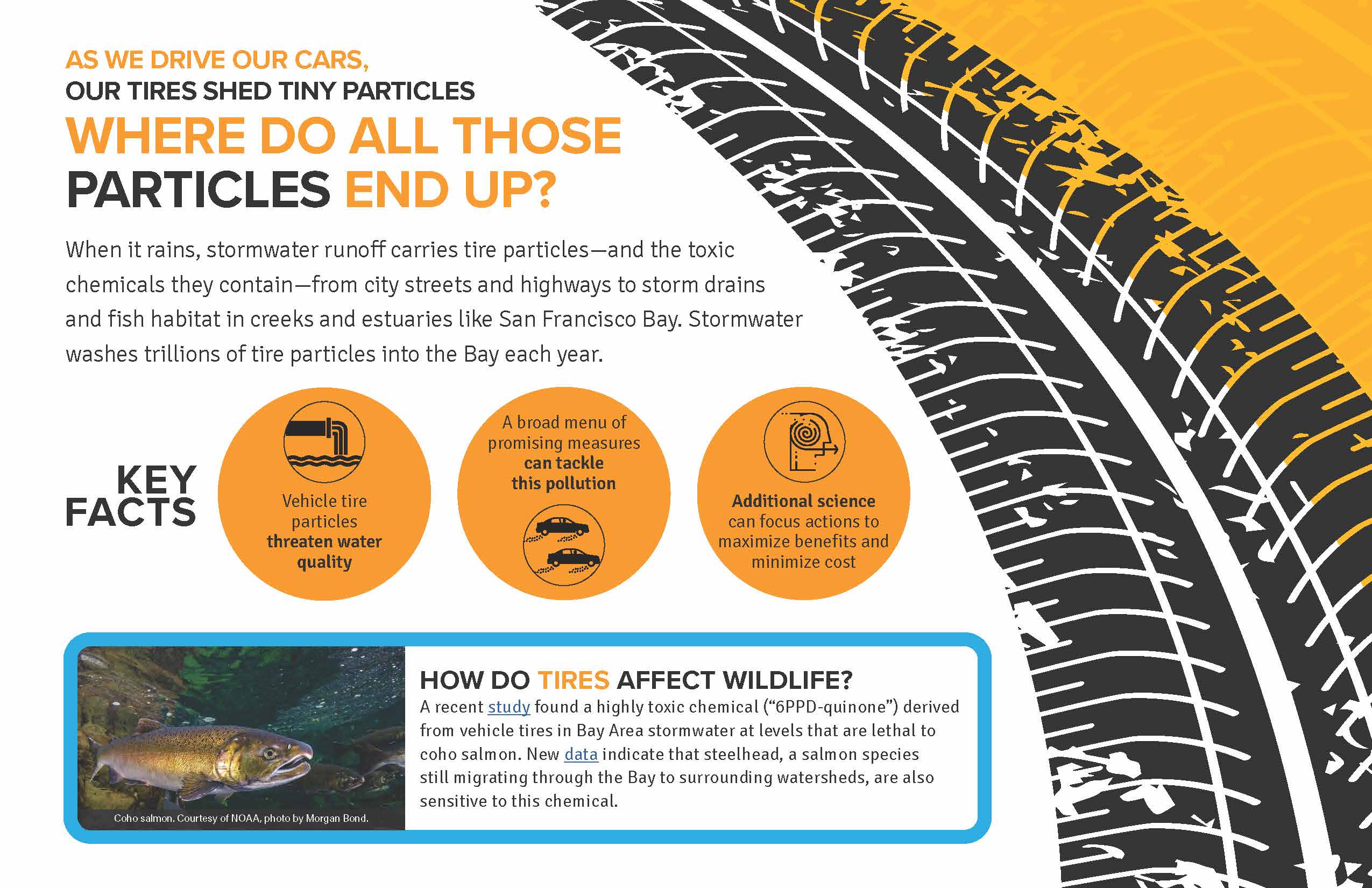 As we drive our cars, our tires shed tiny particles
When it rains, stormwater runoff carries tire particles—and the toxic chemicals they contain—from city streets and highways to storm drains and fish habitat in creeks and estuaries like San Francisco Bay. Stormwater washes trillions of tire particles into the Bay each year.
How do tires affect wildlife?
A recent study found a highly toxic chemical (“6PPD-quinone”) derived from vehicle tires in Bay Area stormwater at levels that are lethal to coho salmon. New data indicate that steelhead, a salmon species still migrating through the Bay to surrounding watersheds, are also sensitive to this chemical.
2022. Occurrence and risk assessment of organophosphate esters and bisphenols in San Francisco Bay, California, USA. Science of the Total Environment 813 . SFEI Contribution No. 982.
Organophosphate esters (OPEs) and bisphenols are two classes of industrial chemicals that are ubiquitously detected in environmental matrices due to high global production and widespread use, particularly in the manufacture of plastic products. In 2017, water samples collected throughout the highly urbanized San Francisco Bay were analyzed for 22 OPEs and 16 bisphenols using liquid chromatography-electrospray ionization-Q Trap-mass spectrometry. Fifteen of the 22 OPEs were detected, with highest median concentrations in the order TCPP (42 ng/L) > TPhP (9.5 ng/L) > TBOEP (7.6 ng/L) > TnBP (7.5 ng/L) > TEP (6.7 ng/L) > TDCIPP (6.2 ng/L). In contrast, only two of 16 bisphenols, BPA and BPS, were quantified, with concentrations ranging from <0.7–35 ng/L and <1–120 ng/L, respectively. BPA and a few OPEs (EHDPP and TEHP) were primarily present in the particulate phase, while BPS and all other observed OPEs were predominantly found in the dissolved phase. Pairwise correlation analysis revealed several strong, positive correlations among OPEs, and few weak, negative correlations between OPEs and BPA, suggesting differences between the two classes with respect to their sources, pathways, and/or fate in the environment. Concentrations of OPEs and bisphenols observed in this study were generally consistent with reported concentrations in other estuarine and marine settings globally. TDCIPP exceeded existing predicted no-effect concentrations (PNECs) at some sites, and six other compounds (TCrP, IDDPP, EHDPP, TPhP, TBOEP, and BPA) were observed at levels approaching individual compound PNECs (not considering mixture effects), indicating potential risks to Bay biota. These results emphasize the need to control releases of these contaminants in order to protect the ecosystem. Periodic monitoring can be used to maintain vigilance in the face of potential regrettable substitutions.