Library
Our library features many hundreds of entries.
To search among them, click "Search" below to pull down options, including filtering by document type, author, year, and keyword.
Find these options under "Show only items where." Or you can also sort by author, title, type, and year clicking the headings below.
1998. The exotic species threat to California's coastal resources. SFEI Contribution No. 386. American Society of Civil Engineers: Reston, VA. pp 1418-1426.
2020. Expert review of the sediment screening guidelines for the beneficial reuse of dredged material in San Francisco Bay. SFEI Contribution No. 978. San Francisco Estuary Institute: Richmond, CA.
The beneficial reuse of dredged sediment is one strategy in a broader portfolio that is being developed for San Francisco Bay to help marshes adapt to rising sea level. Dredged sediment is currently being used in restoration projects around the Bay, but additional sediment is needed to meet the demand. The guidelines for determining if sediment is appropriate for beneficial reuse were developed twenty years ago. As part of assessing the role of dredged sediment in Bay restoration and adaptation strategies, the Regional Monitoring Program for Water Quality (RMP) and stakeholders recognized the need to revisit the beneficial reuse guidelines for dredged sediment. In September 2019, the RMP convened a workshop that included four technical experts to review the beneficial reuse guidelines. The experts were asked to answer three questions: 1) Are the current screening guidelines appropriate for beneficial reuse? 2) Is the current screening process appropriate and adequate? If not, what are your recommendations for improving it? and 3) How should bioaccumulation potential be addressed for the beneficial reuse of sediment? Based on the discussion of these three questions, six recommendations emerged from the workshop.
2010. Exploratory categorization of watersheds for potential stormwater monitoring in San Francisco Bay. San Francisco Estuary Institute: Oakland, CA.
2013. Exploring the Traditional Use of Fire in the Coastal Mountains of Central California. Joint Fire Science Program.
1999. Extent and impacts of ballast water invasions. SFEI Contribution No. 326. West Coast Ballast Outreach Project: Davis, CA. Vol. 1, pp 2-3.
2014. External Nutrient Loads to San Francisco Bay. SFEI Contribution No. 704. San Francisco Estuary Institute: Richmond, CA. p 98.
2005. Fate of Contaminants in Sediment of San Francisco Estuary: A Review of Literature and Data - Final Report. SFEI Contribution No. 394. San Francisco Estuary Institute: Oakland.
. 2004. Field Evaluations of Alternative Pest Control Methods in California Waters. SFEI Contribution No. 95.
. 2004. Field Evaluations of Alternative Pest Control Methods in California Waters. . SFEI Contribution No. 105. p 110 pp.
2018. Field Operations Manual for the Regional Monitoring Program. SFEI Contribution No. 902. San Francisco Estuary Institute: Richmond, CA.
2001. Field Sampling Manual for the Regional Monitoring Program for Trace Substances. San Francisco Estuary Institute: Richmond, CA.
1999. Field Sampling Manual for the RMP for Trace Substances (version 1, January 1999). SFEI Contribution No. 324. San Francisco Estuary Institute: Richmond, CA.
2021. Field Testing Report: California Trash Monitoring Methods. SFEI Contribution No. 1026. San Francisco Estuary Institute: Richmond, Calif.
 Trash has received renewed focus in recent years as policy makers, public agencies, environmental organizations, and community groups have taken many steps towards trash quantification and management across California. The range of management actions is matched by the diversity of monitoring approaches, designed to determine key attributes associated with trash pollution on California’s lands and in its waterways.
This report describes the field testing associated with a project designed to validate the accuracy, precision, and practicality of several trash monitoring methods, practiced across the state. Additionally, the project measured the efficacy of a novel monitoring method designed to detect trash via remote sensing and machine learning. Readers will find details about each respective method -- the specific approach to
landscape characterization, the qualitative or quantitative measures undertaken, the team-based quality assurance for data collection -- as well as the approach that the testing team adopted to ensure efficient, accurate, and useful validation of the methods.
Because the validation efforts integrated multiple methods, using multiple teams at a selection of common sites, the field testing report yields useful statistical information not only about each method individually, but about the comparability of the results. The report illustrates the
correlation factor associated with different forms of trash metrics, associated with different methods practiced on the same assessment sites. The results illustrated a generally high degree of correlation among different methods, which promises opportunities to compare results meaningfully across methods.
Furthermore, this field testing report provides quantitative measures to illustrate the repeatability of each method, the differences and insights yielded by assessment site sizing criteria varying among methods, the transferability / teach-ability of each method among trash monitoring practitioners, and how the degrees of accuracy might aid programs in performing mass balance analysis of known sources
to trash detected in a given site.
Regarding innovation, the project team leveraged multiple on-the-ground methods and special testing scenarios to compare conventional and novel (aerial) assessments to measure the relative accuracy and precision of this emergent technology that might address some of the resource constraints that currently limit the broader or more frequent deployment of conventional trash assessment methods. The analyses captured in this field testing report offer specific quantitative measures of the accuracy (bias), precision (repeatability), practicality and cost associated with each method. This information is subsequently used to inform a companion summary analysis found in the Trash Monitoring Playbook, which is designed to evaluate the applicability of the monitoring methods to address classes of
monitoring questions.
2001. Final Draft Master List of NIS Plant Species. SFEI Contribution No. 366. San Francisco Estuary Institute.
2011. Final Project Report for the Demonstration Project in Three Critical Coastal Area Watersheds. San Francisco Estuary Institute: Richmond, CA.
2007. Final Project Report: Investigations of Sources and Effects of Pyrethroid Pesticides in Watersheds of the San Francisco Estuary. SFEI Contribution No. 523. San Francisco Estuary Institute: Oakland.
2004. First Annual Report of the Montezuma Wetlands Restoration Project Technical Review Team. SFEI Contribution No. 102. San Francisco Estuary Institute: Oakland, CA.
1996. Fishing for Food in the San Francisco Bay: An Environmental Health and Safety Report. Save San Francisco Bay Association: Oakland, CA.
2020. Flame retardants and plastic additives in San Francisco Bay: Targeted monitoring of organophosphate esters and bisphenols. SFEI Contribution No. 925. San Francisco Estuary Institute: Richmond, CA.
2021. Flood Control Channel Classification Scheme for the San Francisco Bay Region. . San Francisco Bay Region Flood Control Channel Classification . SFEI Contribution No. 1046. San Francisco Estuary Institute: Richmond, CA.
2004. Fluvial Geomorphology, Hydrology, and Riparian Habitat of La Honda Creek Along the Hwy 84 Transportation Corridor, San Mateo County, California. SFEI Contribution No. 78. San Francisco Estuary Institute /CA State Univ of Fresno.
2008. A Forecast Model of Long-Term PCB Fate in San Francisco Bay. SFEI: Oakland, CA. p 52.
2016. Framework to coordinate water quality improvement and wildlife habitat conservation to protect California streams, wetlands, and riparian areas.
Project funded by an USEPA Wetland Program Development Grant (Region 9) #99T05901: Framework for Coordinated Assessment of CA Wildlife Habitat and Aquatic Resource Areas
. SFEI Contribution No. 776. San Francisco Estuary Institute: Richmond, CA. p 89.The emergence of comparable landscape approaches to wildlife conservation and water quality improvement through federal and California state regulatory and management programs provides an opportunity for their coordination to better protect California’s aquatic resources, especially streams, wetlands, and riparian areas. Such coordination is patently desirable. A framework has been developed to help coordinate restoration and compensatory mitigation across policies governing wildlife conservation and water quality in the landscape context. The framework is based on the Wetland and Riparian Area Monitoring Plan (WRAMP) of the California Wetland Monitoring Workgroup (CWMW) of the Water Quality Monitoring Council. The framework presented in this memorandum is a version of the standard WRAMP framework. It only differs from the standard framework to better accommodate wildlife conservation planning, assessment and reporting. To distinguish this version from the standard version, it is termed the 'WRAMP for wildlife'.
2015. Fremont Tree Well Filters: LID Performance on a Redeveloped Urban Roadway (Case Study Site and Technical Reports). SFEI Contribution No. 772.
1996. Further Development of Chronic Ampelisca Abdita Bioassay as an Indicator of Sediment Toxicity. SFEI Contribution No. 17. San Francisco Estuary Institute: Richmond, CA.
1996. Gateway to the Inland Coast: The Story of the Carquinez Strait. California State Lands Commission: Sacramento CA.
2003. A Geographic History of the San Lorenzo Creek Watershed: Landscape Patterns Underlying Human Activities (w / 8.5x11 or 11 x 17 map). SFEI Contribution No. 85. San Francisco Estuary Institute: Oakland, CA.
2005. Global Spread of Marine Organisms in the Baitworm Trade. SFEI Contribution No. 455. San Francisco Estuary Institute: Oakland, CA.
2009. Going Organic Project. SFEI Contribution No. 588. San Francisco Estuary Institute: Oakland, Ca.
2023. Grain size, bulk density, and carbon content of sediment collected from Whale's Tail South marsh and adjacent bay floor, South San Francisco Bay, California, 2021-2022. U.S. Geological Survey.
Sediment samples were collected on and adjacent to the Whale’s Tail South marsh. Short push-cores of bed sediment were collected in South San Francisco Bay adjacent to Whales Tail South marsh on five days from June through August 2021 and 3 days from November 2021 to January 2022. Additional samples were taken from ceramic tiles placed on the marsh to measure sediment deposition and from rip-up clasts deposited on the marsh edge. Samples were analyzed for sediment properties including bulk density, particle size distribution, and percent carbon. These data were collected as part of a collaborative study with the USGS Western Ecological Research Center to quantify sediment fluxes, deposition on the marsh, and changes in marsh morphology at Whale's Tail marsh in southern San Francisco Bay.
. 2005. Grassland Bypass Project Report 2003.
. 2008. Grassland Bypass Project Report 2004-2005. SFEI Contribution No. 553.
. 2010. Grassland Bypass Project Report 2006-2007. San Francisco Estuary Institute: Oakland.
2018. Green Infrastructure Planning for North Richmond Pump Station Watershed with GreenPlan-IT. SFEI Contribution No. 882. San Francisco Estuary Institute: Richmond, CA.
2018. Green Infrastructure Planning for the City of Oakland with GreenPlan-IT. SFEI Contribution No. 884. San Francisco Estuary Institute : Richmond, CA.
2018. Green Infrastructure Planning for the City of Richmond with GreenPlan-IT. SFEI Contribution No. 883. San Francisco Estuary Institute: Richmond, CA.
2018. Green Infrastructure Planning for the City of Sunnyvale with GreenPlan-IT. SFEI Contribution No. 881. San Francisco Estuary Institute : Richmond, CA.
2018. Green Plan-IT Application Report for the East Bay Corridors Initiative. SFEI Contribution No. 887. San Francisco Estuary Institute: Richmond, CA.
2015. GreenPlan-IT Toolkit Demonstration Report. SFEI Contribution No. 958. San Francisco Estuary Institute: Richmond, CA.
GreenPlan-IT is a planning level tool that was developed by SFEP and SFEI with support and oversight from BASMAA to provide Bay Area municipalities with the ability to evaluate multiple management alternatives using green infrastructure for addressing stormwater issues in urban watersheds. GreenPlan-IT combines sound science and engineering principles with GIS analysis and optimization techniques to support the cost-effective selection and placement of Green Infrastructure (GI) at a watershed scale. Tool outputs can be used to develop quantitatively-derived watershed master plans to guide future GI implementation for improving water quality in the San Francisco Bay and its tributary watersheds.
This report provides an overview of the GreenPlan-IT Tool and demonstrates its utility and power through two pilot studies which is summarized in this report as a case study. The pilot studies with the City of San Mateo and the City of San Jose explored the use of GreenPlan-IT for identifying feasible and optimal GI locations for mitigation of stormwater runoff. They are provided here to give the reader an overview of the user application process from start to finish, including problem formulation, data collection, GIS analysis, establishing a baseline condition, GI representation, and the optimization process. Through the pilot study application process the general steps and recommendations for how GreenPlan-IT can be applied and interpreted are presented.
2015. GreenPlan-IT Toolkit User Guide. SFEI Contribution No. 958. San Francisco Estuary Institute: Richmond, CA.
Structurally, the GreenPlan-IT is comprised of three components: (a) a GIS-based Site Locator Tool to identify potential GI sites; (b) a Modeling Tool that quantifies anticipated watershed-scale runoff and pollutant load reduction from GI sites; and (c) an Optimization Tool that uses a cost-benefit analysis to identify the best combinations of GI types and number of sites within a watershed for achieving flow and/or load reduction goals. The three tool components were designed as standalone modules to provide flexibility and their interaction is either through data exchange, or serving as a subroutine to another tool. This user manual addresses each of the tools separately, though they are designed to complement each other.
2021. Green Stormwater Infrastructure Planning-level Analysis for Livermore-Amador Valley. SFEI Contribution No. 1063. San Francisco Estuary Institute: Richmond, Calif.
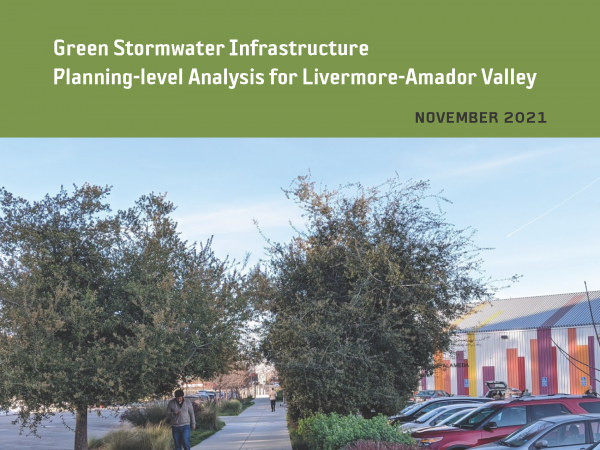 This effort is intended to provide planning-level regional guidance for placement of green stormwater infrastructure (GSI) in Livermore-Amador Valley. This work identifies potential GSI locations and quantifies contaminant load and stormwater runoff volume reduction benefits through the application of GreenPlan-IT, a planning tool developed by the San Francisco Estuary Institute and regional partners. Ultimately, the urban greening analysis presented in this report is intended to help enhance stream and watershed resilience, reduce peak flows, and improve water quality.
2023. Growing Resilience: Recommendations for Dune Management at North Ocean Beach. SFEI Contribution No. 1155. San Francisco Estuary Institute: Richmond, CA.
2018. Guadalupe River Mercury Concentrations and Loads During the Large Rare January 2017 Storm. SFEI Contribution No. 837. San Francisco Estuary Institute : Richmond, CA.
2011. Guadalupe River Watershed Loading HSPF Model: Year 3 final progress report. SFEI: Richmond, CA.
2009. Guadalupe Watershed Model Year 1 Report. Oakland, CA.
2021. Guidance for Restoration of Natural and Nature-Based Features in the Wetland-Upland Transition Zone. San Francisco Estuary Institute, California State Coastal Conservancy: Richmond, CA.
2018. Gut Contents Analysis of Four Fish Species Collected in the San Leandro Bay RMP PCB Study in August 2016. SFEI Contribution No. 900. San Francisco Estuary Institute: Richmond, CA.
2002. The highly invaded ecosystem of San Francisco Bay. Cawthron Institute, Nelson, New Zealand.
2014. Historical Changes in Channel Alignment along Lower Laguna de Santa Rosa and Mark West Creek. SFEI: Richmond, CA.
2017. Historical Ecology and Landscape Change in the Central Laguna de Santa Rosa. SFEI Contribution No. 820. San Francisco Estuary Institute - Aquatic Science Center: Richmond, CA.
This study synthesizes a diverse array of data to examine the ecological patterns, ecosystem functions, and hydrology that characterized a central portion of the Laguna de Santa Rosa during the mid-19th century, and to analyze landscape changes over the past 150 years. The primary purpose of this study was to help guide restoration actions and other measures aimed at reducing nutrient loads within this portion of the Laguna de Santa Rosa watershed.
2009. Historical Ecology of Lower San Francisquito Creek Phase 1. San Francisco Estuary Institute: Oakland, Ca.
2008. The Historical Ecology of Napa Valley: An Introduction. SFEI Contribution No. 557.
2007. Historical Ecology of South Santa Clara County: Preliminary Findings. A Technical Memorandum to the Santa Clara Valley Habitat Conservation Plan/Natural Community Conservation Plan. SFEI Contribution No. 527.
2011. Historical Ecology of the lower Santa Clara River, Ventura River, and Oxnard Plain: an analysis of terrestrial, riverine, and coastal habitats. SFEI Contribution No. 641. SFEI: Oakland.
. 2012. Historical Ecology of the McCormack-Williamson Tract: A Landscape Framework for Restoration. SFEI Contribution No. 674. Aquatic Science Center / San Francisco Estuary: Richmond, CA.
2009. Historical Ecology Reconnaissance for the Lower Salinas River. SFEI Contribution No. 581. San Francisco Estuary Institute: Richmond. p 32.
2002. The Historical Geography and Biogeography of Tidal Salt Marshes (Abstract). San Francisco Estuary Institute.
2005. Historical Landscape Analysis (full title to come from Robin). SFEI Contribution No. 396. San Francisco Estuary Institute.
2010. Historical Vegetation and Drainage Patterns of Western Santa Clara Valley: A technical memorandum describing landscape ecology in Lower Peninsula, West Valley, and Guadalupe Watershed Management Areas. SFEI Contribution No. 622. SFEI: Oakland.
2011. Historical Wetlands of the Southern California Coast: An Atlas of US Coast Survey T-sheets, 1851-1889. SFEI Contribution No. 586. SFEI: Oakland.
2005. Human influences on nitrogen and phosphorus concentrations in creek and river waters of the Napa and Sonoma watersheds, northern San Francisco Bay, California. SFEI Contribution No. 421. San Francisco Estuary Institute: Oakland.
2023. Hydrodynamic and sediment transport data from Whale's Tail marsh and adjacent waters in South San Francisco Bay, California 2021-2022. United States Geological Survey.
The U.S. Geological Survey Pacific Coastal and Marine Science Center collected hydrodynamic and sediment-transport data at shallow water sites in South San Francisco Bay and in the Whale's Tail South marsh in Eden Landing Ecological Reserve in Alameda County, CA in 2021 and 2022. This data release includes hydrodynamic and sediment transport time-series data spanning from June 2021 to January 2022, as well as sediment bed properties and water column suspended-sediment concentrations Details on station location, instrumentation, and measured variables are included in sections for each data type. The data were collected to determine sediment supply and sediment delivery to marshes, both in the bay and in tidal creeks as well as across the bay-marsh interface during varying tidal and wave conditions. The goal of the project was to more accurately predict the fate of marshes and to optimize management actions. They were collected as part of a collaborative study with the USGS Western Ecological Research Center. These data are intended for science researchers, students, policy makers, and the general public.
2018. Hydrodynamic and Water Quality Model Calibration and Application in San Francisco Bay. SFEI Contribution No. 913. San Francisco Estuary Institute : Richmond, CA.
2019. Hydrodynamic Model Development Report: Sacramento-San Joaquin River Delta and Suisun Bay (Water Year 2016). SFEI Contribution No. 964. San Francisco Estuary Institute: Richmond, CA.
2021. Hydrodynamic, sediment transport, and sediment flocculation data from south San Francisco Bay, California, summer 2020. United Sates Geological Survey.
The U.S. Geological Survey (USGS) Pacific Coastal and Marine Science Center collected hydrodynamic and suspended sediment flocculation data at channel and shallow water sites in south San Francisco Bay in July 2020. The data were used to determine water column stratification, turbulence profiles, and floc size evolution. The goal of this project was to bound the controls on floc size and floc settling velocity to improve estimates of sediment fluxes and consider error in numerical models of sediment transport in San Francisco Bay. This data release includes hydrodynamic, sediment concentration, and particle size timeseries during July 2020, as well as sediment bed properties, water column particle size distributions, and CTD profiles collected on four days in July 2020 at both sites. Details on station location, instrumentation, and measured variables are included on pages for each data type. These data were collected as part of a collaborative project with the USGS California Water Science Center. Funding was provided by the San Francisco Estuary Institute.
2003. Identification and evaluation of previously unknown organic contaminants in the San Francisco Estuary (1999-2001). SFEI Contribution No. 75. San Francisco Estuary Institute: Oakland, CA.
2002. Identification and evaluation of unidentified organic contaminants in the San Francisco Estuary. SFEI Contribution No. 45. San Francisco Estuary Institute: Oakland, CA.
1999. Impacts of Nonindigenous Species on Subtidal Benthic Assemblages in the San Francisco Estuary. SFEI Contribution No. 329. p 16.
1994. Implementation Manual for the San Leandro Creek Watershed Awareness Program, 1993-1994. SFEI Contribution No. 177. San Francisco Estuary Institute: Richmond, Ca. p 75.
2007. Indicator Development and Framework for Assessing Indirect Effects of Sediment Contaminants. SFEI Contribution No. 524. San Francisco Estuary Institute.
2010. Indicators and Performance Measures for North Bay Watersheds. San Francisco Estuary Institute: Oakland, Ca.
2008. The Influence of Chemical and Physical Factors on Macrobenthos in the San Francisco Estuary. SFEI Contribution No. 543.
2014. Initial Protocol to Identify and Delineate the Head of Tide Zone in San Francisco Bay Tributaries. SFEI Contribution No. 719. San Francisco Estuary Institute: Richmond, CA.
2006. Inspection for Live Marine Invertebrates in an Oyster Shell Pile at Drakes Bay Oyster Company. San Francisco Estuary Institute.
2020. Integrating Planning with Nature: Building climate resilience across the urban-to-rural gradient. SFEI Contribution No. 1013.
1995. Introduced Species. Prepared for: California's Ocean Resources: An Agenda for the Future, California Resources Agency: Sacramento, CA.
1998. Introduced Tidal Marsh Plants in the San Francisco Estuary: Regional Distribution and Priorities for Control. SFEI Contribution No. 321. San Francisco Estuary Institute: Richmond CA. p 42.
2016. An Introduction to EcoAtlas: Applied Aquatic Science. San Francisco Estuary Institute: Richmond, CA. p 16 pages.
This memo was developed by SFEI to introduce the EcoAtlas tools, their intended (target) user community, and the short- and long-term intended applications.
1990. An Introduction to the Ecology of the San Francisco Estuary, 1st Edition. Oakland, CA.
1991. An Introduction to the Ecology of the San Francisco Estuary, 2nd Edition. Oakland, CA.
2008. An Introduction to the Historical Ecology of the Sonoma Creek Watershed: a Tool for the Critical Coastal Area Action Plan. San Francisco Estuary Institute.
2008. An Introduction to the Historical Ecology of the Watsonville Sloughs: a Tool for the Critical Coastal Area Action Plan. San Francisco Estuary Institute.
2003. Introduction to the San Francisco Estuary. San Francisco Estuary Institute, Save the Bay and San Francisco Estuary Project: Oakland,CA.
2001. An Introduction to the San Francisco Estuary Third Edition. San Francisco Estuary Project, Oakland CA, Save The Bay, Oakland CA and San Francisco Estuary Institute, Richmond CA: Oakland, Ca. Vol. Third Edit.
2003. Invasions in Aquatic Ecosystems: Impacts on Restoration and Potential for Control. SFEI Contribution No. 512.
2004. Invasions in the sea. SFEI Contribution No. 312. Vol. 22, pp 37-41.
1989. Inventory of Current Monitoring Programs in the San Francisco Bay and Delta. SFEI Contribution No. 155. San Francisco Estuary Institute: Richmond, CA. p 39.
1989. Inventory of Monitoring Programs in the San Francisco Bay and Delta. SFEI Contribution No. 156. AHI: Richmond, CA. p 48.
1988. Inventory of Priority Datasets Relating to the San Francisco Estuary. SFEI Contribution No. 141. San Francisco Estuary Institute: Richmond, CA. p 51.
2001. Investigations into the Introduction of Non-indigenous Marine Organisms via the Cross-Continental Trade in Marine Baitworms. SFEI Contribution No. 357. San Francisco Estuary Institute: Richmond CA.
2000. Investigations of Sediment Elutriate Toxicity at Three Estuarine Stations in San Francisco Bay, California. SFEI Contribution No. 374. San Francisco Estuary Institue: Richmond, CA.
. 1993. Keynote Address for AHI Workshop on TIE's Status of TIE's as a Regulatory Tool in S.F. Bay Region. University of California at Berkeley Field Station. p 114.